Tombes impériales des dynasties Ming et Qing
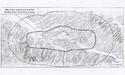
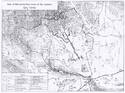
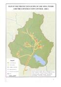
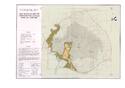
Situations géographiques multiples (14)
ID | Nom & Situation | État partie | Coordonnées | Bien | Zone tampon |
---|---|---|---|---|---|
1004-001 | Xianling Tomb | Chine |
N31 1 0.00 E112 39 0.00 |
87,6 ha | 226,4 ha |
1004-002 | Eastern Qing Tombs | Chine |
N41 10 60.00 E117 37 60.00 |
224 ha | 7 800 ha |
1004-003 | Western Qing Tombs | Chine |
N39 19 60.00 E115 13 0.00 |
1 842 ha | 4 758 ha |
1004-004 | Ming Tombs | Chine |
N40 16 10.40 E116 14 40.60 |
823 ha | 8 100 ha |
1004-005 | Xiaoling Tomb including area from Treasure Mound to Shenlieshan Stele, including Plum Blossom Hill, and Big Golden Gate | Chine |
N32 3 30.00 E118 51 7.00 |
116 ha | — |
1004-006 | Tomb of Chang Yuchun | Chine |
N32 3 44.00 E118 49 54.00 |
0,98 ha | — |
1004-007 | Tomb of Qiu Cheng | Chine |
N32 3 51.00 E118 49 59.00 |
0,55 ha | — |
1004-008 | Tomb of Wu Liang | Chine |
N32 4 0.00 E118 49 51.00 |
0,4 ha | — |
1004-009 | Tomb of Wu Zhen | Chine |
N32 4 5.00 E118 49 57.00 |
0,35 ha | — |
1004-010 | Tomb of Xu Da | Chine |
N32 4 30.00 E118 50 6.00 |
0,85 ha | — |
1004-011 | Tomb of Li Wenzhong | Chine |
N32 4 47.00 E118 50 23.00 |
0,87 ha | 180 ha |
1004-012 | Yongling Tomb of the Qing Dynasty | Chine |
N41 20 37.00 E124 49 18.00 |
236,59 ha | 1 343,9399 ha |
1004-013 | Fuling Tomb of the Qing Dynasty | Chine |
N41 49 34.00 E123 34 49.00 |
53,86 ha | 702,36 ha |
1004-014 | Zhaoling Tomb of the Qing Dynasty | Chine |
N41 50 29.00 E123 25 4.00 |
47,89 ha | 318,74 ha |
Cartes
Les dossiers de proposition d’inscription produits par les États parties sont publiés par le Centre du patrimoine mondial sur son site Internet et/ou dans des documents de travail afin de garantir la transparence, l’accès à l’information et de faciliter la préparation d’analyses comparatives par d’autres États parties soumissionnaires.
Le contenu de chaque dossier de proposition d’inscription relève de la responsabilité exclusive de l'État partie concerné. La publication d’un dossier de proposition d’inscription, y compris les cartes et les noms, ne saurait être interprétée comme exprimant une prise de position de la part du Comité du patrimoine mondial ou du Secrétariat de l'UNESCO à propos de l’histoire ou du statut juridique d'un pays, d'un territoire, d'une ville ou d'une zone, ou de ses frontières.