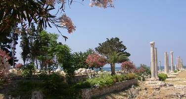
Tyre
Factors affecting the property in 2006*
- Ground transport infrastructure
- Housing
- Major visitor accommodation and associated infrastructure
- Management systems/ management plan
- Marine transport infrastructure
- Other Threats:
Insufficient maintenance
Factors* affecting the property identified in previous reports
- Need for an international safeguarding campaign (issue resolved)
- Construction of a tourist complex (land fill) (issue resolved)
- Construction project of a large fish market (issue resolved)
- Construction project of a coastal motorway (issue resolved)
- Uncontrolled construction (issue resolved)
- Project to build a new tourist marina (issue resolved)
- Road construction project (issue resolved)
- Need for a Urbain Master Plan for the city
- Lack of management mechanism (including legislation)
- Important and often uncontrolled urban development
- Public works, tourism developments
- Absence of a management and conservation plan
- Insufficient maintenance
UNESCO Extra-Budgetary Funds until 2006
Total amount provided to the property: USD 19,173 from 1997 to 2001 for the International Safeguarding Campaign.
International Assistance: requests for the property until 2006
Total amount approved : 29,000 USD
| 2001 | Installation of Plaques and Publication of Leaflets to ... (Approved) | 2,500 USD |
| 2001 | Geoarchaeological study for the ancient ports of Tyre (Approved) | 20,000 USD |
| 1999 | Photo Exhibition on Lebanese (Baalbeck and Tyre) and ... (Approved) | 2,500 USD |
| 1986 | Consultancy to evaluate damage to Tyre (Approved) | 4,000 USD |
Missions to the property until 2006**
2004: assessment mission by UNESCO Beirut office; 2006: for security reasons, the World Heritage Centre/ICOMOS mission was delayed.
Conservation issues presented to the World Heritage Committee in 2006
At its 29th session in 2005, the World Heritage Committee noted the information received by the World Heritage Centre concerning alleged threats to the archaeological remains of Tyre. Accordingly, it requested ICOMOS, in close consultation with the State Party and the World Heritage Centre, to undertake a reactive monitoring mission to the property in order to assess the impact of foreseen or on-going projects, to determine the overall state of conservation of the property, and to submit a report for examination by the Committee at its 30th session in 2006. For reasons of security, the mission could not take place.
The Committee further requested the State Party to provide, for examination at the same session, a report on the follow-up of the implementation of Decisions 28 COM 15B.48 and 29 COM 7B.102, notably regarding the impact of the proposed highway in the vicinity of Tyre, the establishment of the archaeological map, and the transformation of the commercial port.
A report prepared by the General Directorate of Antiquities of the Ministry of Culture was transmitted to the World Heritage Centre on 24 April 2006. This reported, inter alia, that the decree for the creation of a marine archaeological reserve, proposed in 2003, is still being studied by the Transport Ministry. The archaeological map of Tyre, considered as an emergency measure since many years, is finally being prepared as part of the World Bank project and should be completed in the course of 2006. It consists in the establishment of a DTM (Digital Terrain Model) and of a GIS (Geographic Information System) as well as geophysical prospecting. The General Directorate of Antiquities, is carrying out survey work in all State-owned land thanks notably to geophysical survey material provided by the Japanese Government and the support of UNESCO, in order to integrate archaeological data into the map. The impact study for the new highway would be based upon cross-checking with the archaeological survey project that is in progress. Indeed, the issue of the highway has been discussed a number of times between UNESCO and the Lebanese authorities, including in the framework of the Scientific Committee for the International Safeguarding Campaign for Tyre. UNESCO had in the past recommended that attention be paid, in choosing the route of the highway, to avoid any negative impact on the archaeological remains of the property. As a result, the initial project had been revised, the interchange was displaced and the route of the highway moved further west. The General Directorate of Antiquities confirmed that soundings carried out along the current projected route of the highway have not revealed any significant archaeological structure. Nevertheless, additional survey work is being undertaken on the whole alignment of the road in order to identify possible archaeological remains and reduce the impact of the highway.
In terms of site management, the State Party announced the assignment of three new staff to work on the property: one site manager, who will be in charge of establishing the management plan for the property, one archaeologist and one person responsible for the foreseen Underwater Archaeology Centre.
In July 2003, the Scientific Committee for the International Safeguarding Campaign of Tyre made a number of recommendations concerning the importance of developing specific detailed Urban Conservation Plans for the entire historic centre and a series of other specific issues regarding single buildings or areas within Tyre. According to the report provided by the State Party, the new building code in the historic sectors of the city is in its final promulgation stage, leading hopefully to a comprehensive Urban Conservation Plan.
Feasibility studies and impact assessment on the transformation of the commercial port into a tourist marina have been completed and would take the form of a definitive plan for the transformation of the port, in conjunction with the second phase of the World Bank project.
Summary of the interventions
Decisions adopted by the Committee in 2006
30 COM 7B.52
State of Conservation (Tyre)
The World Heritage Committee,
1. Having examined Document WHC-06/30.COM/7B,
2. Recalling Decision 29COM 7B.102, adopted at its 29th session (Durban, 2005),
3. Commends the State Party for the progress made in the establishment of the archaeological map of the property, the preparation of the decree for the new building code in the historic sectors of the city, the completion of the feasibility studies and impact assessment on the transformation of the commercial port into a tourist marina to be integrated within the second phase of the World Bank project;
4. Regrets however that the draft decree for the creation of an archaeological marine protection zone has not yet been approved by the Ministry of Transport;
5. Recommends the extension of the three-year moratorium on construction in the areas of potential archaeological interest, as well as the construction of the highway, until the survey and the map are completed;
6. Reiterates its request for a joint World Heritage Centre/ICOMOS reactive monitoring mission, in order to assess the impact of foreseen or on-going projects and to determine the overall state of conservation of the property and to consider the re-alignment of the proposed highway to avoid adverse impacts to the property;
7. Further requests the State Party to provide a detailed topographic map indicating the boundaries of the property possibly also defining a buffer zone for the protected area, and to submit a progress report on the above recommendations, and particularly on the archaeological map and possible further land use decisions, by 1 February 2007 for examination by the Committee at its 31st session in 2007.
Draft Decision: 30 COM 7B.52
The World Heritage Committee,
1. Having examined Document WHC-06/30.COM/7B,
2. Recalling Decision 29COM 7B.102, adopted at its 29th session (Durban, 2005),
3. Commends the State Party for the progress made in the establishment of the archaeological map of the property, the preparation of the decree for the new building code in the historic sectors of the city, the completion of the feasibility studies and impact assessment on the transformation of the commercial port into a tourist marina to be integrated within the second phase of the World Bank project;
4. Regrets however that the decree for the creation of an archaeological marine protection zone has not yet been approved by the Ministry of Transport;
5. Strongly recommends to the State Party to extend the ending three-year period of construction freezing in the areas of potential archaeological interest until the survey and the map are completed, as well as the construction of the highway;
6. Reiterates its request for a joint ICOMOS/World Heritage Centre reactive monitoring mission, in order to assess the impact of foreseen or on-going projects and to determine the overall state of conservation of the site;
7. Further requests the State Party to provide a detailed topographic map indicating the boundaries of the property possibly also defining a buffer zone for the protected area, and to submit a progress report on the above recommendations, and particularly on the archaeological map and possible further land use decisions, by 1 February 2007 for examination by the Committee at its 31st session in 2007.
 Lebanon
* :
The threats indicated are listed in alphabetical order; their order does not constitute a classification according to the importance of their impact on the property.
Furthermore, they are presented irrespective of the type of threat faced by the property, i.e. with specific and proven imminent danger (“ascertained danger”) or with threats which could have deleterious effects on the property’s Outstanding Universal Value (“potential danger”).
** : All mission reports are not always available electronically.

