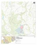
Région minière Erzgebirge/Krušnohoří
Situations géographiques multiples (22)
| ID | Nom & Situation | État partie | Coordonnées | Bien | Zone tampon |
|---|---|---|---|---|---|
| 1478-001 | Dippoldiswalde Medieval Silver Mines | Allemagne |
N50 53 48.13 E13 40 26.93 |
536,871 ha | — |
| 1478-002 | Altenberg-Zinnwald Mining Landscape | Allemagne |
N50 45 50.56 E13 46 13.69 |
269,367 ha | 1 716,705 ha |
| 1478-003 | Lauenstein Administrative Centre | Allemagne |
N50 47 1.96 E13 49 20.18 |
2,926 ha | 18,885 ha |
| 1478-004 | Freiberg Mining Landscape | Allemagne |
N50 55 5.96 E13 20 40.14 |
624,434 ha | 2 202,532 ha |
| 1478-005 | Hoher Forst Mining Landscape | Allemagne |
N50 37 10.63 E12 34 7.57 |
44,799 ha | 103,604 ha |
| 1478-006 | Schneeberg Mining Landscape | Allemagne |
N50 35 43.08 E12 38 28.82 |
218,15 ha | 670,351 ha |
| 1478-007 | Schindlers Werk Smalt Works | Allemagne |
N50 32 27.66 E12 39 26.5 |
2,659 ha | 2,7 ha |
| 1478-008 | Annaberg-Frohnau Mining Landscape | Allemagne |
N50 34 52.89 E12 59 33.5 |
191,994 ha | 926,131 ha |
| 1478-009 | Pöhlberg Mining Landscape | Allemagne |
N50 34 32.18 E13 2 43.98 |
118,94 ha | |
| 1478-010 | Buchholz Mining Landscape | Allemagne |
N50 33 47.3 E12 59 20.58 |
37,346 ha | |
| 1478-011 | Marienberg Mining Town | Allemagne |
N50 39 2.7 E13 9 47.58 |
25,306 ha | 44,603 ha |
| 1478-012 | Lauta Mining Landscape | Allemagne |
N50 39 47.94 E13 8 38.29 |
20,592 ha | |
| 1478-013 | Ehrenfriedersdorf Mining Landscape | Allemagne |
N50 38 35.23 E12 58 35.96 |
71,148 ha | 891,575 ha |
| 1478-014 | Grünthal Silver-Copper Liquation Works | Allemagne |
N50 39 1.19 E13 22 8.6 |
12,917 ha | 25,294 ha |
| 1478-015 | Eibenstock Mining Landscape | Allemagne |
N50 30 45.6 E12 35 57.18 |
100,656 ha | 248,312 ha |
| 1478-016 | Rother Berg Mining Landscape | Allemagne |
N50 31 8.62 E12 47 9.98 |
4,519 ha | 38,556 ha |
| 1478-017 | Uranium Mining Landscape | Allemagne |
N50 38 0.22 E12 41 8.34 |
811,213 ha | 746,263 ha |
| 1478-018 | Jáchymov Mining Landscape | Tchéquie |
N50 22 16.85 E12 54 47.53 |
738,266 ha | 637,737 ha |
| 1478-019 | Abertamy – Boží Dar – Horní Blatná – Mining Landscape | Tchéquie |
N50 24 23.5 E12 50 14.42 |
2 679,791 ha | 3 390,558 ha |
| 1478-020 | The Red Tower of Death | Tchéquie |
N50 19 44.24 E12 57 12.26 |
0,2 ha | 1,786 ha |
| 1478-021 | Krupka Mining Landscape | Tchéquie |
N50 41 6.74 E13 51 19.64 |
313,961 ha | 477,398 ha |
| 1478-022 | Mědník Hill Mining Landscape | Tchéquie |
N50 25 27.85 E13 6 41.63 |
7,721 ha | 1 254,989 ha |
Cartes
Les dossiers de proposition d’inscription produits par les États parties sont publiés par le Centre du patrimoine mondial sur son site Internet et/ou dans des documents de travail afin de garantir la transparence, l’accès à l’information et de faciliter la préparation d’analyses comparatives par d’autres États parties soumissionnaires.
Le contenu de chaque dossier de proposition d’inscription relève de la responsabilité exclusive de l'État partie concerné. La publication d’un dossier de proposition d’inscription ne saurait être interprétée comme exprimant une prise de position de la part du Comité du patrimoine mondial ou du Secrétariat de l'UNESCO à propos de l’histoire ou du statut juridique d'un pays, d'un territoire, d'une ville, d'une zone ou de ses frontières.