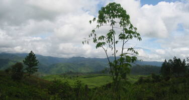
Río Plátano Biosphere Reserve
Factors affecting the property in 2015*
- Financial resources
- Human resources
- Identity, social cohesion, changes in local population and community
- Illegal activities
- Invasive/alien terrestrial species
- Land conversion
- Legal framework
- Livestock farming / grazing of domesticated animals
- Management systems/ management plan
- Water infrastructure
Factors* affecting the property identified in previous reports
- Illegal settlements
- Illegal livestock grazing and agricultural encroachment
- Illegal logging
- Illegal commercial fishing
- Poaching
- Alien invasive species
- Management deficiencies
- Potential impacts from hydroelectric development projects Patuca I,II and III
- Lawlessness
- Lack of law enforcement
- Lack of clarity regarding land tenure and access to natural resources
- Deforestation
Threats for which the property was inscribed on the List of World Heritage in Danger
- Illegal logging;
- Illegal occupation;
- Lack of clarity regarding land tenure
- Reduced capacity of the State Party;
- General deterioration of law and order and the security situation in the region.
Desired state of conservation for the removal of the property from the List of World Heritage in Danger
Drafted, proposed for adoption in the draft Decision below
Corrective Measures for the property
Adopted, see page https://whc.unesco.org/en/decisions/4439
Timeframe for the implementation of the corrective measures
UNESCO Extra-Budgetary Funds until 2015
Total amount granted: USD 80,000 (in addition to approximately USD 100,000 of in-kind technical assistance) under the management effectiveness assessment project “Enhancing our Heritage”.
International Assistance: requests for the property until 2015
Total amount approved : 223,628 USD
| 2015 | Studies in view of the redefinition of boundaries of ... (Approved) | 25,628 USD |
| 1996 | Conservation strategy and preparation of a management ... (Approved) | 30,000 USD |
| 1988 | Equipment for Rio Platano Biosphere Reserve (Approved) | 20,000 USD |
| 1987 | Consultant services, training and equipment for ... (Approved) | 30,000 USD |
| 1985 | Strengthen protection and management of Rio Platano ... (Approved) | 20,000 USD |
| 1983 | Implementation of protective measures, of training ... (Approved) | 26,000 USD |
| 1982 | Financial contribution towards ecodevelopment ... (Approved) | 67,025 USD |
| 1982 | Rio Platano Biosphere Reserve (Approved) | 4,975 USD |
Missions to the property until 2015**
2000: IUCN monitoring mission; 2003, 2006 and 2011: Joint World Heritage Centre / IUCN Reactive Monitoring missions
Conservation issues presented to the World Heritage Committee in 2015
On 4 February 2015, the State Party submitted a report on the state of conservation of the property, which is available at https://whc.unesco.org/en/list/196/documents.
Lead by the Honduran institution in charge of forests, protected areas and wildlife (ICF) and a technical ad hoc Committee bringing together a wide range of sectors, the State Party has conducted a number of activities, summarized hereafter:
- A draft Desired state of conservation for the removal of the property from the List of World Heritage in Danger (DSOCR) was submitted to the World Heritage Centre;
- The Retrospective Statement of Outstanding Universal Value for the property (RSOUV) has been finalized and it is submitted for approval by the Committee at its 39th session;
- Settlers in the property were evicted along with their livestock in August 2014;
- The longstanding efforts to clarify and formalize access to land and natural resources are ongoing in the cultural zone of the biosphere reserve;
- A time series of satellite images, used to detect changes in forest cover and land use, suggests the loss of more than 28,000 hectares of broad-leaved forest between 2010 and 2013 in the biosphere reserve;
- ICF, with external support, has consolidated the integrated monitoring system for the biosphere reserve (http://www.protep.org/simoni/);
- Patrolling, though limited due to security concerns, took place to complement remote sensing and to respond to illegal trade in timber and wildlife;
- To counter illegal logging, cooperatives are supported to engage in controlled logging and several licenses were granted to this effect. The efforts include attempts to establish mechanisms allowing for the tracking of wood (chain of custody). Non-commercial use licenses were likewise granted to cover local livelihood needs;
- A first construction phase of the Patuca III hydro power project appears to have started.
The ongoing lack of clarity in terms of which exact part of the vast biosphere reserve is formally recognized as the World Heritage property, is acknowledged. Furthermore, the State Party acknowledges limited human, financial and logistical capacity, partially compensated for by external support. The State Party has submitted an International Assistance Request focusing on this challenge. The request was approved by the Chairperson of the World Heritage Committee in January 2015. The clarification of boundaries is also expected to enable the finalization of the DSOCR.
Analysis and Conclusion by World Heritage Centre and the Advisory Bodies in 2015
Progress in addressing the many challenges the property is facing is noted. In particular, the improved availability of data on status and trends of deforestation and land use change and the further consolidation of an integrated monitoring system provide an encouraging foundation for future activities. Similarly, the ongoing efforts to further negotiate and clarify access to land and resources on the part of local and indigenous communities and the attempts to discourage illegal logging through the promotion of controlled forest management are plausible and promising.
The fundamental question mark remains about the exact extent and location of the formally recognized World Heritage property within the vast biosphere reserve exceeding 800,000 hectares. The forest loss reported by the State Party between 2010 and 2013 is alarming regardless of its location. Nevertheless, putting the figure formally in perspective of the World Heritage Convention requires the currently impossible determination of whether such loss has occurred outside or within the property.
It is worth recalling that the unchanged ambiguity of the boundaries and possible approaches to address it are described in detail in the 2011 mission report. The recently approved International Assistance Request focusing on this very issue is the adequate mechanism to move forward and clarity in terms of the exact boundaries and zonation of the property will also facilitate the ongoing efforts to define the draft DSCOR, which has been discussed and agreed with the State Party and will serve as a decisive structured framework to guide action towards the removal of the property from the List of World Heritage in Danger and to assess progress made according to measurable indicators. Ideally, the established monitoring system should be used in this regard. It is recommended that, following the clarification of the property’s boundaries, the DSOCR be revised and, if necessary, further complemented with additional indicators.
The eviction of settlers and livestock from the core zone of the property is sensitive and all care should be taken to ensure that this process is conducted in a peaceful manner. Such sensitive operations are likely to cast a shadow on the relationships between governmental actors and local communities. Further intrusions should be prevented so as to reduce the necessity of future operations.
The State Party provides no clear and updated information on the Patuca III project. Given the additional absence of clarity of the exact boundaries of the property, it is not possible to make a conclusive statement on the situation and its possible implications. It should be recalled that possible direct and indirect impacts were not adequately assessed in the original Environmental Impact Assessment (EIA) for the project. Once the boundaries have been clarified, it is recommended that the Committee request the State Party to assess potential impacts on the OUV of the property in line with IUCN’s World Heritage Advice Note on Environmental Assessment.
Given the ongoing lack of clarity of the boundaries, the limited overall progress in addressing the multiple challenges, the limited human, financial and logistical resources and consistent evidence of security challenges, including in the State Party report, it is recommended that the Committee retain Río Plátano Biosphere Reserve on the List of World Heritage in Danger.
The following DSOCR has been developed by the State Party, in consultation with the World Heritage Centre and IUCN, and is proposed for adoption by the World Heritage Committee:
Timeframe for implementation:
The implementation of the corrective measures outlined in this draft DSOCR will have to be able to achieve in a maximum period of 17 years, if the necessary administrative and political efforts are met, as well as if it is possible to count on the international bodies’ support.
It is suggested to adopt the integrity and management indicators proposed by the State Party as provisional as they apply to the wider Biosphere Reserve and potentially will need to be refined once the new boundaries of the property have been adopted in order to ensure that all indicators are specific to the World Heritage property (see below, indicators 5-9). Further two indicators are proposed to be considered as optional as they are setting broad management goals. Those were moved to the end of the draft DSOCR (see details below).
|
|
N° |
INDICATOR FOR THE REMOVAL OF THE PROPERTY FROM THE LIST OF WORLD HERITAGE IN DANGER |
REASONING
|
METHOD OF VERIFICATION |
|
|
ATTRIBUTES |
1 |
A proposal for boundary modification is submitted by 1 February 2016 and approved by the Committee at its 40th session in 2017
*The current draft DSOCR will need to be revised and, if necessary, completed with further indicators following the adoption of new boundaries |
Clarification of the property’s boundaries is a long-standing issue and needs to be resolved as a matter of priority in order to be able to develop precise measures aimed at preserving the Outstanding Universal Value of the property. The recently approved International Assistance Request will provide financial support to the State Party for the analysis of the current situation and development of a proposal for new boundaries of the property that would best represent and protect its Outstanding Universal Value. It also foresees provision of technical advice by IUCN. The main activities will take place during 2015 which should allow sufficient time for the preparation of the official proposal to be submitted by 1 February 2016. New design of the boundaries would provide a basis for refining the adopted indicators and, if considered necessary, the development of further indicators to be included in the draft DSOCR.
|
Submission and subsequent approval of the proposal for boundary modification
|
|
|
2 |
By year 2025, the actual percentage of the coverage of the broadleaf forest is maintained in the Rio Platano Biosphere Reserve (83%) |
The analysis for the Reserve made in 2012 showed that the state of conservation of the broadleaf forest is good regarding its viability and considering its key attributes, and showing that the percentage of the actual cover in relation to the historic one was 83%. It is essential that the actual forest cover is maintained.
|
Multi-temporal analysis of the broadleaf forest cover (use of satellite images) |
||
|
3 |
By Year 2025, 300 ha of degraded lands have been recovered in the core zone of the RHBRP |
300 ha of degraded lands have been identified in the core zone of the RHBRP, and their recovery is expected after the implementation of eviction and surveillance actions; the natural recuperation of those areas is considered feasible given that natural recuperation within 10 years has already been observed in other formerly occupied areas.
|
Satellite images and/or photographs obtained with overflights |
||
|
4 |
By Year 2025, the abundance indexes of the populations of jaguar (Panthera onca) and its prey species (Odocoileus virinianus, Tapirus bairdii) are maintained or have increased |
The jaguar has been identified as one of the key targets for conservation in the analysis made in 2012 and previous studies about ecological integrity since this species is the apex predator of the food chain in the tropical forests present in the reserve, its main function being the regulation of prey populations, which makes it an indicator species for the overall state of the ecosystems. This species is also included in Appendix 1 of the CITES Convention. |
Quinquennial monitoring studies of the relative abundance and distribution of the jaguar, its population composition and the structure of the prey species
Implementation of SIMONI |
||
|
The following indicators apply to the wider Río Plátano Biosphere Reserve and will need to be revised following the modification of the property boundaries as outlined in Indicator 1 |
|||||
|
5 |
By Year 2020 in the cultural zone and the buffer zone of the Río Plátano Biosphere Reserve, 101 719.22has of forest are sustainably managed through the assignment of forest community management contracts following processes which guarantee the legality of the forest products |
In the cultural and buffer zone of the Biosphere Reserve, sustainable use of the forest resources needs to directly involve local communities by assigning them responsibilities in conservation and protection of these resources. |
Approved Forest Management Plans Evaluations of achievement Monitoring and surveillance of use activities |
||
|
|
6 |
By Year 2017, the actual presence of populations and working areas in the core zone of the Rio Platano Biosphere Reserve are 100% eliminated |
The core zone is an area of special protection where human presence and any activities (except for research activities in accordance with a granted permit and the monitoring and investigation plan) are forbidden. Illegal occupation of lands in the core zone represent the main threat to natural resources of the area also given the fact that the inscription of the property as a natural World Heritage site was largely based on the existence of virgin forests (without intervention of men) contained in this zone. |
Eviction reports
Reports of control and monitoring (overflights and patrols) Satellite images |
|
|
7 |
In 2020, the indigenous peoples (Miskitos, Pech and afro-Honduran (Garífunas)) are integrated in the management of the Biosphere Reserve under a governance plan of the territory through the entitlement of 424 123.87 has (Community and Intercommunity titles for full possession) recognizing their ancestral rights in the Cultural Zone of the Rio Platano Biosphere Reserve |
The use of ancestral territories of the miskitos, pech and garífunas communities in the Cultural Zone will be regulated respecting their ancestral knowledge of the limits recognized by the territorial councils, and complying with the ILO- Convention 169 and the forest law that provides for participation and integration of the communities in the management of natural resources and protected areas.
|
Titles in favor of indigenous peoples and afro-Honduran peoples present in the reserve
|
||
|
8 |
By 2020, management responsibilities and rights of use are assigned to all the inhabitants in the buffer zone of the Biosphere Reserve, who comply with the established requirements in the law through the signature of familial usufruct contracts |
The forest law provides for a mechanism of allocation and assignment of use, conservation, management and usage of the lands meant for forest use in the national territory under a series of requirements of which the aim is to encourage the communities by making them participants of the management. Currently, there is a cadastral basis for lands in the buffer zone and in the latter, approximately 2 200 usufruct familial contracts and 2 community titles for indigenous communities Pech (Culuco and Jocomico) present in the buffer zone of the reserve, have been granted. These processes are being realized with the support of the German cooperation through the Project of Territorial Communal Management and Protection of the Environment in Rio Platano (PROTEP).
|
Contracts of assigned usufruct and monitoring of their implementation |
||
|
9 |
The ad hoc Committee has annually developed and implemented a Work Plan aimed at creating efforts of resource management and political impacts |
It is necessary to elaborate concrete work plans for the functioning of the ad hoc committee, by starting to manage and coordinate actions that contribute directly to the conservation of the Rio Platano Biosphere Reserve. |
Work plans and progress reports of activities and follow-up of realized actions |
||
|
10 |
At least until the year 2025, the level of acceptable management is maintained in the implementation of the Methodology for monitoring the management effectiveness in relation to the implementation of the Management Plan of the area
|
The Management Plan of a protected area is a technical administrative tool in which the actions are regulated, and strategic axis are established, which will help to reduce the threats on the objects of conservation identified for the area and simultaneously involve the communities in the effective management of the area, contributing to their sustainable development. The implementation of the Methodology for monitoring the management effectiveness allows to measure the degree of implementation of the planned actions within the stated timeframe. |
Biannual evaluations of Management effectiveness in the Rio Platano Biosphere Reserve |
||
|
11 |
By 2017, at least one co-management structure has been established in the Rio Platano Biosphere reserve |
Until now co-management has not been used in the reserve, however a strategy identifying the most appropriate co-management arrangements is needed in the area where various organizations and institutions are present which are interested in the realization of co-management. The report of the diagnosis of key actors identified 8 non-governmental organizations, 5 governmental organizations, 6 municipalities, 3 indigenous federations and 1 afro-Honduran, UNICAF, 2 inter-institutional tables, all of them being present and active in the reserve. By 2017 it is planned to sign at least one co-management agreement with one of these institutions. |
Established agreements Progress reports on the established co-management agreements |
||
Summary of the interventions
Decisions adopted by the Committee in 2015
39 COM 7A.20
Río Plátano Biosphere Reserve (Honduras) (N 196)
- Having examined Document WHC-15/39.COM/7A.Add,
- Recalling Decision 38 COM 7A.33, adopted at its 38th session (Doha, 2014),
- Commends the State Party and external supporters for the progress made in consolidating an integrated monitoring mechanism and the further clarification of access to land and natural resources, and encourages the State Party to continue these efforts;
- Adopts the Desired state of conservation for the removal of the property from the List of World Heritage in Danger (DSOCR) developed by the State Party in consultation with the World Heritage Centre and IUCN, as presented under Item 20 of Document WHC-15/39.COM/7A.Add, and considers that this DSOCR should be revised and, if necessary, further complemented with additional indicators following the clarification of the property’s boundaries;
- Notes the approval of the International Assistance Request to conclude the clarification of the boundaries of the property and urges the State Party to submit, as required, a boundary modification for consideration by the Committee, in conformity with the appropriate procedures laid out in the Operational Guidelines;
- Recalls the State Party’s intention to minimize the environmental and social impacts of the construction of dams in the Patuca watershed, and requests the State Party to report on the possible impacts of the Patuca III project once the boundaries of the property will be clarified;
- Reiterates its concern that no apparent progress has been made in terms of human, financial and logistical resources, and notes with concern that the security situation appears to impact on the State Party’s ability to operate in the property;
- Also reiterates its concern that illegal activities continue to impact on the property, and strongly urges the State Party to prevent new illegal settlements so as to avoid further evictions in the future;
- Also requests the State Party to submit to the World Heritage Centre, by 1 February 2016, an updated report, including a 1-page executive summary, on the state of conservation of the property and the implementation of the above, for examination by the World Heritage Committee at its 40th session in 2016;
- Decides to retain the Río Plátano Biosphere Reserve (Honduras) on the List of World Heritage in Danger.
39 COM 8C.2
Update of the List of the World Heritage in Danger
The World Heritage Committee,
- Having examined the state of conservation reports of properties inscribed on the List of World Heritage in Danger (WHC-15/39.COM/7A and WHC-15/39.COM/7A.Add),
- Decides to retain the following properties on the List of World Heritage in Danger:
- Afghanistan, Minaret and Archaeological Remains of Jam (Decision 39 COM 7A.38)
- Afghanistan, Cultural Landscape and Archaeological Remains of the Bamiyan Valley (Decision 39 COM 7A.39)
- Belize, Belize Barrier Reef Reserve System (Decision 39 COM 7A.18)
- Bolivia (Plurinational State of), City of Potosi (Decision 39 COM 7A.44)
- Central African Republic, Manovo-Gounda St Floris National Park (Decision 39 COM 7A.1)
- Chile, Humberstone and Santa Laura Saltpeter Works (Decision 39 COM 7A.45)
- Côte d'Ivoire, Comoé National Park (Decision 39 COM 7A.2)
- Côte d'Ivoire / Guinea, Mount Nimba Strict Nature Reserve (Decision 39 COM 7A.3)
- Democratic Republic of the Congo, Virunga National Park (Decision 39 COM 7A.4)
- Democratic Republic of the Congo, Kahuzi-Biega National Park (Decision 39 COM 7A.5)
- Democratic Republic of the Congo, Garamba National Park (Decision 39 COM 7A.6)
- Democratic Republic of the Congo, Salonga National Park (Decision 39 COM 7A.7)
- Democratic Republic of the Congo, Okapi Wildlife Reserve (Decision 39 COM 7A.8)
- Egypt, Abu Mena (Decision 39 COM 7A.24)
- Ethiopia, Simien National Park (Decision 39 COM 7A.10)
- Georgia, Bagrati Cathedral and Gelati Monastery (Decision 39 COM 7A.40)
- Georgia, Historical Monuments of Mtskheta (Decision 39 COM 7A.41)
- Honduras, Río Plátano Biosphere Reserve (Decision 39 COM 7A.20)
- Indonesia, Tropical Rainforest Heritage of Sumatra (Decision 39 COM 7A.15)
- Iraq, Ashur (Qal'at Sherqat) (Decision 39 COM 7A.25)
- Iraq, Samarra Archaeological City (Decision 39 COM 7A.26)
- Jerusalem, Old City of Jerusalem and its Walls (site proposed by Jordan) (Decision 39 COM 7A.27)
- Madagascar, Rainforests of the Atsinanana (Decision 39 COM 7A.11)
- Mali, Timbuktu (Decision 39 COM 7A.21)
- Mali, Tomb of Askia (Decision 39 COM 7A.22)
- Niger, Air and Ténéré Natural Reserves (Decision 39 COM 7A.12)
- Palestine, Birthplace of Jesus: Church of the Nativity and the Pilgrimage Route, Bethlehem (Decision 39 COM 7A.28)
- Palestine, Palestine: Land of Olives and Vines – Cultural Landscape of Southern Jerusalem, Battir (Decision 39 COM 7A.29)
- Panama, Fortifications on the Caribbean Side of Panama: Portobelo-San Lorenzo (Decision 39 COM 7A.46)
- Peru, Chan Chan Archaelogical Zone (Decision 39 COM 7A.47)
- Senegal, Niokolo-Koba National Park (Decision 39 COM 7A.13)
- Serbia, Medieval Monuments in Kosovo (Decision 39 COM 7A.42)
- Solomon Islands, East Rennell (Decision 39 COM 7A.16)
- Syrian Arab Republic, Ancient City of Damascus (Decision 39 COM 7A.30)
- Syrian Arab Republic, Ancient City of Bosra (Decision 39 COM 7A.31)
- Syrian Arab Republic, Site of Palmyra (Decision 39 COM 7A.32)
- Syrian Arab Republic, Ancient City of Aleppo (Decision 39 COM 7A.33)
- Syrian Arab Republic, Crac des Chevaliers and Qal’at Salah El-Din (Decision 39 COM 7A.34)
- Syrian Arab Republic, Ancient Villages of Northern Syria (Decision 39 COM 7A.35)
- Uganda, Tombs of Buganda Kings at Kasubi (Decision 39 COM 7A.23)
- United Kingdom of Great Britain and Northern Ireland, Liverpool – Maritime Mercantile City (Decision 39 COM 7A.43)
- United Republic of Tanzania, Selous Game Reserve (Decision 39 COM 7A.14)
- United States of America, Everglades National Park (Decision 39 COM 7A.17)
- Venezuela, Coro and its Port (Decision 39 COM 7A.48)
- Yemen, Historic Town of Zabid (Decision 39 COM 7A.37)
39 COM 8E
Adoption of Retrospective Statements of Outstanding Universal Value
The World Heritage Committee,- Having examined Document WHC-15/39.COM/8E.Rev,
- Congratulates the States Parties for the excellent work accomplished in the elaboration of retrospective Statements of Outstanding Universal Value for World Heritage properties located within their territories;
- Adopts the retrospective Statements of Outstanding Universal Value, as presented in the Annex of Document WHC-15/39.COM/8E.Rev, for the following World Heritage properties:
- Mozambique: Island of Mozambique;
- Senegal: Djoudj National Bird Sanctuary;
- United Republic of Tanzania: Stone Town of Zanzibar;
- Oman: Land of Frankincense;
ASIA AND THE PACIFIC
- India: Humayun’s Tomb, Delhi; Kaziranga National Park;
- Iran (Islamic Republic of): Bisotun; Meidan Emam, Esfahan; Persepolis; Soltaniyeh; Tchogha Zanbil;
- Belarus: Architectural, Residential and Cultural Complex of the Radziwill Family at Nesvizh;
- Belgium: Flemish Béguinages; Historic Centre of Brugge; The Four Lifts on the Canal du Centre and their Environs, La Louvière and Le Roeulx (Hainault);
- Canada / United States of America: Waterton Glacier International Peace Park;
- Canada: Dinosaur Provincial Park; Gros Morne National Park; Historic District of Old Québec; Miguasha National Park; Old Town Lunenburg; Sgang Gwaay; Wood Buffalo National Park;
- France / Spain : Pyrénées – Mont Perdu ;
- Greece: Acropolis, Athens; Archaeological Site of Olympia; Archaeological Sites of Mycenae and Tiryns; Delos; Sanctuary of Asklepios at Epidaurus;
- Italy: 18th-Century Royal Palace at Caserta with the Park, the Aqueduct of Vanvitelli, and the San Leucio Complex; Archaeological Area of Agrigento; Castel del Monte; Church and Dominican Convent of Santa Maria delle Grazie with “The Last Supper” by Leonardo da Vinci; Cilento and Vallo di Diano National Park with the Archeological sites of Paestum and Velia, and the Certosa di Padula; City of Verona; City of Vicenza and the Palladian Villas of the Veneto; Crespi d’Adda; Early Christian Monuments of Ravenna; Genoa: Le Strade Nuove and the system of the Palazzi dei Rolli; Historic Centre of San Gimignano; Historic Centre of Siena; Historic Centre of the City of Pienza; Late Baroque Towns of the Val di Noto (South-Eastern Sicily); Rock Drawings in Valcamonica; Sacri Monti of Piedmont and Lombardy; Syracuse and the Rocky Necropolis of Pantalica; The Sassi and the Park of the Rupestrian Churches of Matera;
- Montenegro: Durmitor National Park;
- Russian Federation: Architectural Ensemble of the Trinity Sergius Lavra in Sergiev Posad; Ensemble of the Ferapontov Monastery; Ensemble of the Novodevichy Convent; Historic Centre of Saint Petersburg and Related Groups of Monuments; Historic Monuments of Novgorod and Surroundings; Kremlin and Red Square, Moscow;
- Serbia: Stari Ras and Sopoćani; Studenica Monastery;
- Slovakia: Historic Town of Banská Štiavnica and the Technical Monuments in its Vicinity;
- Spain: Aranjuez Cultural Landscape; Archaeological Ensemble of Tárraco; Archaeological site of Atapuerca; Garajonay National Park; Rock Art of the Mediterranean Basin on the Iberian Peninsula;
- Sweden: Engelsberg Ironworks;
- The Former Yugoslav Republic of Macedonia: Natural and Cultural Heritage of the Ohrid region;
- Ukraine: L’viv – the Ensemble of the Historic Centre;
- United States of America: Pueblo de Taos;
LATIN AMERICA AND THE CARIBBEAN
- Brazil: Atlantic Forest South-East Reserves; Brazilian Atlantic Islands: Fernando de Noronha and Atol das Rocas Reserves; Central Amazon Conservation Complex; Cerrado Protected Areas: Chapada dos Veadeiros and Emas National Parks; Discovery Coast Atlantic Forest Reserves; Pantanal Conservation Area;
- Colombia: Malpelo Fauna and Flora Sanctuary;
- Haiti : National History Park – Citadel, Sans Souci, Ramiers ;
- Honduras: Río Plátano Biosphere Reserve;
- Peru: Historical Centre of the City of Arequipa; Huascarán National Park; Lines and Geoglyphs of Nasca and Pampas de Jumana; Manú National Park; Río Abiseo National Park;
- Saint Kitts and Nevis: Brimstone Hill Fortress National Park;
4. Decides that retrospective Statements of Outstanding Universal Value for World Heritage properties in Danger will be reviewed in priority by the Advisory Bodies;
5. Takes note that the World Heritage Centre, further to Decision 38 COM 8E, continues to harmonize all sub-headings in the adopted Statements of Outstanding Universal Value and updates names and sizes or buffer zones, as appropriate, following relevant Decisions of the Committee concerning changes of names and Minor Boundary Modifications;
6. Requests the States Parties to provide support to the World Heritage Centre for translation of the adopted Statements of Outstanding Universal Value into English or French respectively, and further requests the World Heritage Centre to upload the two language versions on its web site.
Draft Decision: 39 COM 7A.20
The World Heritage Committee,
- Having examined Document WHC-15/39.COM/7A.Add,
- Recalling Decision 38 COM 7A.33, adopted at its 38th session (Doha, 2014),
- Commends the State Party and external supporters for the progress made in consolidating an integrated monitoring mechanism and the further clarification of access to land and natural resources, and encourages the State Party to continue these efforts;
- Adopts the Desired state of conservation for the removal of the property from the List of World Heritage in Danger (DSOCR) developed by the State Party in consultation with the World Heritage Centre and IUCN, as presented under Item 20 of Document WHC-15/39.COM/7A.Add, and considers that this DSOCR should be revised and, if necessary, further complemented with additional indicators following the clarification of the property’s boundaries;
- Notes the approval of the International Assistance Request to conclude the clarification of the boundaries of the property and urges the State Party to submit, as required, a boundary modification for consideration by the Committee, in conformity with the appropriate procedures laid out in the Operational Guidelines;
- Recalls the State Party’s intention to minimize the environmental and social impacts of the construction of dams in the Patuca watershed, and requests the State Party to report on the possible impacts of the Patuca III project once the boundaries of the property will be clarified;
- Reiterates its concern that no apparent progress has been made in terms of human, financial and logistical resources, and notes with concern that the security situation appears to impact on the State Party’s ability to operate in the property;
- Also reiterates its concern that illegal activities continue to impact on the property, and strongly urges the State Party to prevent new illegal settlements so as to avoid further evictions in the future;
- Also requests the State Party to submit to the World Heritage Centre, by 1 February 2016, an updated report, including a 1-page executive summary, on the state of conservation of the property and the implementation of the above, for examination by the World Heritage Committee at its 40th session in 2016;
- Decides to retain the Río Plátano Biosphere Reserve (Honduras) on the List of World Heritage in Danger.
 Honduras
Documents examined by the Committee
39COM (2015)Exports
* :
The threats indicated are listed in alphabetical order; their order does not constitute a classification according to the importance of their impact on the property.
Furthermore, they are presented irrespective of the type of threat faced by the property, i.e. with specific and proven imminent danger (“ascertained danger”) or with threats which could have deleterious effects on the property’s Outstanding Universal Value (“potential danger”).
** : All mission reports are not always available electronically.

