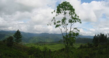
Río Plátano Biosphere Reserve
Factors affecting the property in 2011*
- Identity, social cohesion, changes in local population and community
- Illegal activities
- Invasive/alien terrestrial species
- Land conversion
- Legal framework
- Livestock farming / grazing of domesticated animals
- Management systems/ management plan
- Water infrastructure
Factors* affecting the property identified in previous reports
a) Illegal settlements;
b) Illegal livestock grazing and agricultural encroachment;
c) Illegal logging;
d) Illegal commercial fishing;
e) Poaching;
f) Alien Invasive Species;
g) Management deficiencies;
h) Potential impacts from hydroelectric development projects Patuca I,II and III;
i) Lack of law enforcement
j) Lack of clarity regarding land tenure and access to natural resources.
UNESCO Extra-Budgetary Funds until 2011
Total amount provided to the property: USD 80,000 (in addition to approximately USD 100,000 of in-kind technical assistance) under the management effectiveness assessment project “Enhancing our Heritage”.
International Assistance: requests for the property until 2011
Total amount approved : 198,000 USD
| 1996 | Conservation strategy and preparation of a management ... (Approved) | 30,000 USD |
| 1988 | Equipment for Rio Platano Biosphere Reserve (Approved) | 20,000 USD |
| 1987 | Consultant services, training and equipment for ... (Approved) | 30,000 USD |
| 1985 | Strengthen protection and management of Rio Platano ... (Approved) | 20,000 USD |
| 1983 | Implementation of protective measures, of training ... (Approved) | 26,000 USD |
| 1982 | Financial contribution towards ecodevelopment ... (Approved) | 67,025 USD |
| 1982 | Rio Platano Biosphere Reserve (Approved) | 4,975 USD |
Missions to the property until 2011**
1995 and 2000: IUCN monitoring missions; 2003 and 2006: World Heritage Centre/IUCN reactive monitoring missions; 2011: Joint World Heritage Centre/IUCN reactive monitoring mission.
Conservation issues presented to the World Heritage Committee in 2011
The State Party submitted a report on the property’s state of conservation on 8 February 2011. As requested in Committee Decision 34 COM 7B.34, a joint World Heritage Centre/IUCN reactive monitoring mission visited the property from 31 Januaryto 9 February 2011.
The mission report is available online at the following web address: http://whc.unesco.org/en/sessions/35COM.
a) Land tenure and illegal settlement of the property by squatters
Major illegal settlement was one of the main threats that led to the inscription of the property on the List of World Heritage in Danger in 1996, as a result of the region attracting poor settlers in search of cattle ranching lands, transforming forests into extensive pastures in an uncontrolled agricultural frontier. The mission recalls that extensive efforts to organize land tenure over more than 10 years, in large part with the support of German development cooperation, have yielded promising results. Most long standing settlers have obtained clear titles to their lands in areas surrounding the property, reducing the illegal land trading market. However, indigenous groups with traditional rights within the property are still in the process of negotiating land tenure and resource use access arrangements with the authorities that are adapted to their needs. Lack of clarity in terms of access to land and natural resources in these areas is aggravated by the general lack of planning and law enforcement, inviting unauthorized settlement by squatters seeking land for ranching. The mission notes that the property was removed from the Danger List in 2007 after important advances had been made in land titling and in removing illegal settlers from within its boundaries. Unfortunately, the State Party reports the presence of several dozen new squatters in this zone, but adds that all legal procedures are being implemented to ensure their removal by mid-2011. Though the State Party reports that it will be removing these squatters, the mission considers that they represent only a small proportion of illegal settlers currently located in the property.
b) Development of hydroelectric dams in nearby watershed (Patuca I, II and III)
The mission was informed that after several years seeking a development partner, the State Party finalized an agreement with Chinese company network Sinohydro, to build the first of possibly three dams on the Patuca river, Patuca III. This river’s watershed abuts part of the property, and even includes, to a small extent, portions of the property. Construction began in February 2011, with funding from the Chinese government. Though an Environmental Impact Assessment (EIA) was carried out in 2008, a copy of the EIA was first obtained during the 2011 mission. The EIA makes no reference of potential impacts on the property’s Outstanding Universal Value , leaving this question unanswered. Similarly, approvals to proceed with the other two Patuca dams have reportedly been granted, though no communication from the State Party to this effect has been received by the World Heritage Centre. The World Heritage Centre and IUCN consider that in line with Paragraph 172 of the Operational Guidelines, there is need for clear information on the precise location of the dams and the expected impacts on the Outstanding Universal Value, before construction on the dams is started.
c) Management and Institutional Capacity
The mission was informed that protected area management, formerly under the remit of the Forestry Development Corporation of Honduras, is now under the newly created National Institute for the Conservation and Development of Forests, Protected Areas and Wildlife (ICF) which reports directly to the President. There is also substantially revised new forest legislation, which contributes to removing the structural conflict in mandates that existed when the protected areas management agency had to cover the cost of its operations though logging concession revenues. The mission notes that the ICF remains a poorly resourced agency, relying in large part on extra-budgetary financing obtained from bi- and multi-lateral projects to carry out field activities. The ICF is in the process of producing a new management plan, though the mission considers that given that one of several projects (Proyecto Corazon) is taking the lead, there is a risk that not all initiatives and stakeholders are involved in producing the new plan in a coordinated fashion. The mission also considers that the confusion regarding the official property boundaries (the World Heritage property is effectively managed as if its boundaries were the same as the much larger Biosphere Reserve), poses the risk that World Heritage considerations are not fully considered nor reflected in the new management plan. Beyond the ICF, conservation of the property’s values, including its integrity, depends on the capacity of other government agencies, particularly those responsible for controlling illegal activities. The mission notes that the near absence of capacity to apprehend, to transport to holding areas, to hold in custody, and to prosecute people carrying out illegal activities, due to the remote nature of the site, results in an environment of impunity. The general atmosphere of intimidation, and potential and actual violence, are also disincentives for environmental prosecutors to venture into the zone.
d) Property boundary design
The State Party provided to the mission, as well as in its report, a sketch map of the current boundaries and zoning of the Rio Platano Biosphere Reserve, as legally recognized in national law. Though the area officially recognized by the World Heritage Committee in 1982 is still contained within the expanded boundaries of the Reserve, there is no coherence between management planning and the property boundaries recognized under the World Heritage Convention. Much of the inscribed property is included in the buffer zone of the Rio Plátano Biosphere Reserve, where significant agricultural activities occur, and a cultural zone, where human settlements, existing at the time of inscription, are located. The mission considers that there is a need to revisit the boundaries of the property to more accurately reflect the extent of the ecosystems for which it was initially inscribed, and to take into consideration the existing uses within the current boundaries. It notes that the key values of the area are the mosaic of ecosystems in the northern part of the Rio Platano watershed, which are now largely included in the cultural zone, and the exceptional protection of an entire watershed. The mission recommends that both these aspects be considered in the future boundary design.
e) Illegal logging and fishing, poaching
The mission concludes that despite visible efforts at controling illegal logging, the practice remains widespread. There is little or no management of fishing practices in the property. Though local and indigenous communities rely on fishing for subsistence, their practices are unsustainable, as they throw nets across the main canals separating the sea from the lagoons during tidal flows. Besides subsistence fishing, the seasonal migration upriver of one species triggers a human migration for commercial fishing. The mission also found evidence of poaching in the core zone, and it was informed that manatees, large marine mammals, are hunted for food in the lagoons
f) Increase in illegal drug transshipment activities in and near the property
The mission was informed that in the past 4-5 years the property has become a major transportation hub for moving narcotics from South America northwards. The State Party reports several illicit landing strips in the property, also observed by the mission during its helicopter overflight.
The State Party has recognized the severity of the situation. On 15 February 2011, it adopted a decree recognizing the property as a zone of special interest requiring priority on the part of the government and deciding the development and implementation of an inter-ministerial action plan to address the situation. Subsequently, the State Party proactively requested the World Heritage Committee, by a letter sent to the World Heritage Centre received 11 April 2011, to inscribe the property on the List of World Heritage in Danger, in response to concerns over increased incursions into the property by cattle ranchers, and to the growing inability to deal with the conservation challenges as a result of growing insecurity in the area.
Analysis and Conclusion by World Heritage Centre and the Advisory Bodies in 2011
The World Heritage Centre and IUCN note that although there has been significant progress in establishing and implementing a solid foundation over which to manage land occupation and land transactions, much work remains to be done, particularly in regards to finalizing the process within indigenous community lands. They note that despite these efforts, the number of squatters is again on the rise, and the State Party has demonstrated the ability to deal with only a fraction of these. The continuing absence of an effective response to squatters’ risks creating an irreversible situation leading to the loss of habitats and biodiversity, which are part of the property’s Outstanding Universal Value, as more land is cleared for cattle ranching within the property.
In addition, the World Heritage Centre and IUCN note that construction of hydroelectric dams on the nearby Patuca River, is taking place without first having clearly addressed potential environmental and social impacts. A clear pronouncement on such impacts must urgently be made before deciding if and how work should continue, and this information should be submitted to the World Heritage Centre, in line with Paragraph 172 of the Operational Guidelines. Though organizational restructuring has clarified conservation mandates, the World Heritage Centre and IUCN note that institutions responsible for carrying out conservation work, law enforcement and other roles remain poorly resourced, and in some cases, completely absent from the region. Until the State Party is able to establish a functional presence in the region, the integrity of the property will remain at serious risk. They recommend that the World Heritage Committee request the State Party to assess if and how the property’s boundaries should be modified to better capture and protect the values and reflect the zonation introduced after inscription. The World Heritage Centre and IUCN further point out the alarming increase in the use of the property as an illegal drugs transshipment area, which represents a very serious challenge to the State Party’s capacity to address all other matters relating to integrity. Until this situation is reversed, the prospect for effective management interventions is very limited.
The World Heritage Centre and IUCN note that the combination of threats from illegal logging, illegal occupation, the reduced capacity of the State Party and the general deterioration of law and order and the security situation in the region constitute a serious threat to its Outstanding Universal Value. Under these circumstances, they recommend that the World Heritage Committee support the request by the State Party to inscribe the property on the List of World Heritage in Danger. Corrective measures are proposed in the draft decision below.
Summary of the interventions
Decisions adopted by the Committee in 2011
35 COM 7B.31
Río Plátano Biosphere Reserve (Honduras) (N 196)
The World Heritage Committee,
1. Having examined Document WHC-11/35.COM/7B.Add,
2. Recalling Decision 34 COM 7B.34, adopted at its 34th session (Brasilia, 2010),
3. Takes note that the State Party has stabilized the illegal land market by advancing significantly in the land titling process in areas abutting the property, and restructured the administration of protected areas so as to clarify the mandate of pertinent governmental agencies;
4. Expresses its serious concern over the alarming trend in illegal drug trafficking carried out in and around the property, which is undermining conservation efforts, contributing to deforestation within the property, and creating an environment of insecurity;
5. Also takes note that the State Party has requested, by letter to the World Heritage Centre, that the property be inscribed on the List of World Heritage in Danger and further notes with appreciation that the State Party adopted a decree recognizing the property as a zone requiring priority action and has decided on the development and implementation of an inter-ministerial action plan to address the situation;
6. Considers that the combination of threats from illegal logging, illegal occupation, the reduced capacity of the State Party and the general deterioration of law and order and the security situation in the region constitute a serious threat to its Outstanding Universal Value;
7. Decides to inscribe Rio Plátano Biosphere Reserve (Honduras) on the List of World Heritage in Danger;
8. Urges the State Party to implement the following corrective measures:
a) Establish permanent and systematic monitoring to identify encroachment and land use changes of the entire protected area, and if possible the broader region, and relocate illegal occupants who have recently settled in the property, in particular in the core zone of the Rio Plátano Biosphere Reserve,
b) Continue efforts to negotiate and clarify access to land and natural resources while enforcing existing land tenure and access arrangements and explore opportunities for more meaningful co-management with a particular focus on the indigenous communities of the cultural zone,
c) In cooperation with the indigenous communities concerned, complete land tenure and resource access arrangements adapted to their historical and cultural contexts,
d) In coordination with the World Heritage Centre and IUCN, to review in a timely manner, any projects for the construction of hydroelectric dams on the Patuca River until it has been clearly demonstrated to the World Heritage Committee that they will not negatively impact the property's Outstanding Universal Value,
e) Provide the necessary human resources and logistical capacity to the agencies responsible for the protection and management of the property to enable them to regularly monitor and deal with illegal activities affecting the property,
f) Using the ongoing management planning process, seek to coordinate the many actors, various institutions and external supporters involved in Río Plátano in order to significantly improve coherence, effectiveness and efficiency of future management in addressing the issues affecting the property;
9. Also urges the State Party to take the necessary measures, in cooperation with other concerned States Parties, to prevent the use of the property, and surrounding lands, for drug trafficking;
10. Further urges the State Party to consider the various options to redefine the boundaries of the World Heritage property to reflect the increased size of the protected area, the new zonation, and the existing land uses, in order to ensure that the property's Outstanding Universal Value can be more effectively conserved;
11. Requests the State Party to translate the political recognition of the severity of the threats to the property into a coordinated, workable and budgeted long term Action Plan and encourages the State Party to consider a request for International Assistance in support of corresponding efforts;
12. Also requests the State Party to develop, in consultation with the World Heritage Centre and IUCN, a proposal for the Desired state of conservation for the removal of the property from the List of World Heritage in Danger, for examination by the World Heritage Committee at its 36th session in 2012;
13. Further requests the State Party to submit to the World Heritage Centre, by 1 February 2012, an updated report on the state of conservation of the property and the implementation of the above, for examination by the World Heritage Committee at its 36th session in 2012.
35 COM 8C.1
Establishment of the World Heritage List in Danger (Inscribed Properties)
The World Heritage Committee,
1. Following the examination of the state of conservation reports of properties inscribed on the World Heritage List (WHC-11/35.COM/7B, WHC-11/35.COM/7B.Add and WHC-11/35.COM/7B.Add.2) and of proposals for inscription of properties on the World Heritage List (WHC-11/35.COM/8B, WHC-11/35.COM/8B.Add),
2. Decides to inscribe the following properties on the List of World Heritage in Danger:
- Honduras, Río Plátano Biosphere Reserve (Decision 35 COM 7B.31)
- Indonesia, Tropical Rainforest Heritage of Sumatra (Decision 35 COM 7B.16)
Draft Decision: 35 COM 7B.31
The World Heritage Committee,
1. Having examined Document WHC-11/35.COM/7B.Add,
2. Recalling Decision 34 COM 7B.34, adopted at its 34th session (Brasilia, 2010),
3. Takes note that the State Party has stabilized the illegal land market by advancing significantly in the land titling process in areas abutting the property, and restructured the administration of protected areas so as to clarify the mandate of pertinent governmental agencies;
4. Expresses its serious concern over the alarming trend in illegal drug trafficking carried out in and around the property, which is undermining conservation efforts, contributing to deforestation within the property, and creating an environment of insecurity;
5. Also takes note that the State Party has requested, by letter to the World Heritage Centre, that the property be inscribed on the List of World Heritage in Danger and further notes with appreciation that the State Party adopted a decree recognizing the property as a zone requiring priority action and has decided on the development and implementation of an inter-ministerial action plan to address the situation;
6. Considers that the combination of threats from illegal logging, illegal occupation, the reduced capacity of the State Party and the general deterioration of law and order and the security situation in the region constitute a serious threat to its Outstanding Universal Value;
7. Decides to inscribe Rio Plátano Biosphere Reserve (Honduras) on the List of World Heritage in Danger;
8. Urges the State Party to implement the following corrective measures:
a) Establish permanent and systematic monitoring to identify encroachment and land use changes of the entire protected area, and if possible the broader region, and relocate illegal occupants who have recently settled in the property, in particular in the core zone of the Rio Plátano Biosphere Reserve,
b) Continue efforts to negotiate and clarify access to land and natural resources while enforcing existing land tenure and access arrangements and explore opportunities for more meaningful co-management with a particular focus on the indigenous communities of the cultural zone,
c) In cooperation with the indigenous communities concerned, complete land tenure and resource access arrangements adapted to their historical and cultural contexts,
d) Halt the construction of hydroelectric dams on the Patuca River until it has been clearly demonstrated to the World Heritage Committee that they will not negatively impact the property’s Outstanding Universal Value,
e) Provide the necessary human resources and logistical capacity to the agencies reponsible for the protection and management of the property to enable them to regularly monitor and deal with illegal activities affecting the property,
f) Using the ongoing management planning process, seek to coordinate the many actors, various institutions and external supporters involved in Río Plátano in order to significantly improve coherence, effectiveness and efficiency of future management in addressing the issues affecting the property;
9. Also urges the State Party to take the necessary measures, in cooperation with other concerned States Parties, to prevent the use of the property, and surrounding lands, for drug trafficking;
10. Further urges the State Party to consider the various options to redefine the boundaries of the World Heritage property to reflect the increased size of the protected area, the new zonation, and the existing land uses, in order to ensure that the property’s Outstanding Universal Value can be more effectively conserved;
11. Requests the State Party to translate the political recognition of the severity of the threats to the property into a coordinated, workable and budgeted long term Action Plan and encourages the State Party to consider a request for International Assistance in support of corresponding efforts;
12. Alsorequests the State Party to develop, in consultation with the World Heritage Centre and IUCN, a proposal for the Desired state of conservation for the removal of the property from the List of World Heritage in Danger, for examination by the World Heritage Committee at its 36th session in 2012;
13. Further requests the State Party to submit to the World Heritage Centre, by 1February 2012, an updated report on the state of conservation of the property and the implementation of the above, for examination by the World Heritage Committee at its 36th session in 2012.
 Honduras
Exports
* :
The threats indicated are listed in alphabetical order; their order does not constitute a classification according to the importance of their impact on the property.
Furthermore, they are presented irrespective of the type of threat faced by the property, i.e. with specific and proven imminent danger (“ascertained danger”) or with threats which could have deleterious effects on the property’s Outstanding Universal Value (“potential danger”).
** : All mission reports are not always available electronically.

