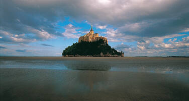
Mont-Saint-Michel and its Bay
Factors affecting the property in 2014*
- Earthquake
- Fishing/collecting aquatic resources
- Impacts of tourism / visitor / recreation
- Interpretative and visitation facilities
- Storms
Factors* affecting the property identified in previous reports
- Development pressures
- Environmental constraints
- Natural disasters (earthquakes, wind storms (1987 and 1999), earth slides)
- Tourism/visitor pressure (including the intensification of fish/shell industries and pasture in the bay)
- Problems related to the presentation of the property: car park at the foot of the Mount, sign posts
- Potential impact of wind turbines on the landscape setting of the property (issue resolved)
International Assistance: requests for the property until 2014
Total amount approved : 0 USD
Missions to the property until 2014**
November 2012: joint World Heritage Centre/ICOMOS Reactive Monitoring Mission.
Conservation issues presented to the World Heritage Committee in 2014
On 30 January 2014, The State Party submitted a detailed state of conservation report, available at: https://whc.unesco.org/en/list/80/documents. This report addresses the recommendations of the 2011 Reactive Monitoring Mission and current conservation issues.
- Wind turbine exclusion zone: This zone was acknowledged by the Committee at its last session. The terrain modelling procedures for assessing visual impact have been adopted in Brittany and Lower Normandy. Two additional measures have been initiated to improve protection:
- The Amended Protection Area (Périmètre de Protection Modifié or PPM), based on the principle of co-visibility, defines the area from which the Mount is seen and which is visible from the Mount.
- Consultations have started on a revised definition and delimitation of the protection area.
- Construction of the Ford (gué): It has been confirmed that the height of 7.30m advocated by the State Party in 2001 would ensure optimal safety of persons and property, and that it would not be possible to reduce this to 6.80m, as suggested by the 2011 Reactive Monitoring Mission in order to reduce visual impact. The main structure of the Pathway Bridge (pont-passerelle) has now been completed, and the connection to the historic Causeway (digue-route) is being reviewed.
- Integrated Management Plan : A concept for the Management Plan was submitted to ICOMOS for review in February 2013 and comments were provided. A management coordinator has been appointed to implement the approved Plan.
- Other recommendations of the 2011 Reactive Monitoring Mission:
- Reconsider pedestrian distances between the car park and shuttle access point: This has been revised.
- Prepare an urban plan for the Barracks area: A draft spatial planning charter will continue to be developed, subject to an agreement upon new submersion heights.
- Develop a planting plan for the Cloisters that evokes a medieval garden: Given the lack of records for the mediaeval garden, it has been decided to restore the "neo-medieval” garden designed by Yves-Marie Froidevaux in 1965.
- Raising Awareness of the Outstanding Universal Value (OUV): A symposium was held in April 2013 and an exhibition of photographs commissioned. A 3-year support post has also been created.
Other conservation issues:
- Weakening of the Ramparts: The ramparts have been the subject of a long-term conservation plan, which will soon be completed. Since 2011, sea erosion has increased at the foot of walls and this could affect the stability of the monument. An impact assessment is being carried out. Stabilising works would include protecting the base of the walls by surrounding them with sediment-covered rocks.
- Safety Pathway on the side of the rock: The State Party report responds to earlier inquiries by the World Heritage Centre regarding the ongoing excavation of an 18m by 1.4m passage in the rock face, part of an additional security pathway. The State Party report indicates that measures to mitigate the visual impacts of the passage are foreseen.
Analysis and Conclusion by World Heritage Centre and the Advisory Bodies in 2014
As the result of a multi-disciplinary approach involving additional protective measures and new tools, the recommendations of the mission relating to the visual protection of the immediate and wider setting of the property are being achieved, with the exception of the height of the Ford (gué), set at 7.30m for security reasons, against the recommendation of the 2011 Reactive Monitoring Mission. All the remaining recommendations of the mission relating to the Pathway Bridge (pont-passerelle), car park, the development plan for the Barracks, and the planting plans for the Cloisters have been addressed, although it was impossible to re-create a mediaeval garden in the Cloisters.
It should also be noted that the terrain modelling methods used for assessing visual impact of wind turbines have already been adopted in Brittany and Lower Normandy and could serve as an example of good practice for World Heritage properties facing similar issues.
In terms of improving management and promoting better awareness of the OUV of the property, it is noted that a Management Plan is being developed, and that extra staff resources have been allocated for the implementation of this Plan and to strengthen the dialogue with local prefects.
It is recommended that the Committee request further information to be provided by the State Party on ongoing projects, notably the construction of the Security Pathway, and to refrain from further alterations that may impact the property.
Finally, the increase in sea erosion since 2011 is a cause for concern, but it is noted that there has been an immediate response consisting of surveys as well as the development of a project to strengthen the foundations of the ramparts.
Summary of the interventions
Decisions adopted by the Committee in 2014
38 COM 7B.26
Mont-Saint-Michel and its Bay (France) (C 80bis)
The World Heritage Committee,
- Having examined Document WHC-14/38.COM/7B,
- Recalling Decisions 35 COM 7B.91 and 36 COM 7B.74, adopted at its 35th (UNESCO, 2011) and 36th (Saint-Petersburg, 2012) sessions respectively,
- Commends the State Party on the progress made in defining and strengthening the protection of the immediate and wider setting of the property, and, in particular, in developing specific visual modelling tools for addressing the impact of wind turbines, which could serve as an example of good practice for World Heritage properties facing similar issues;
- Notes with satisfaction that most recommendations of the 2011 joint World Heritage Centre/ICOMOS Reactive Monitoring Mission related to the Pathway Bridge (pont-passerelle), car park, urban plan for the Barracks, and planting plans for the Cloisters have now been addressed and modifications made to projects and schemes, where possible;
- Regrets however the decision to maintain the height of the Ford (gué) at 7.30m, instead of the 6.80m proposed by the 2011 Reactive Monitoring Mission;
- Also notes that a Management Plan for the property is being developed with input from ICOMOS, and that a Coordinator has been appointed for its implementation, which will include the establishment of a Coordinating Committee; and requests that the State Party submit the completed Management Plan to the World Heritage Centre for review by the Advisory Bodies;
- Urges the State Party to consider how the Security Pathway recently excavated in the rock face may have had an impact on the integrity of the property, and to implement the necessary mitigation measures.
Draft Decision: 38 COM 7B.26
The World Heritage Committee,
1. Having examined Document WHC-14/38.COM/7B,
2. Recalling Decisions 35 COM 7B.91 and 36 COM 7B.74, adopted at its 35th (UNESCO, 2011) and 36th (Saint-Petersburg, 2012) sessions respectively,
3. Commends the State Party on the progress made in defining and strengthening the protection of the immediate and wider setting of the property, and, in particular, in developing specific visual modelling tools for addressing the impact of wind turbines, which could serve as an example of good practice for World Heritage properties facing similar issues;
4. Notes with satisfaction that most recommendations of the 2011 joint World Heritage Centre/ICOMOS Reactive Monitoring Mission related to the Pathway Bridge (pont-passerelle), car park, urban plan for the Barracks, and planting plans for the Cloisters have now been addressed and modifications made to projects and schemes, where possible;
5. Regrets however the decision to maintain the height of the Ford (gué) at 7.30m, instead of the 6.80m proposed by the 2011 Reactive Monitoring Mission;
6. Also notes that a Management Plan for the property is being developed with input from ICOMOS, and that a Coordinator has been appointed for its implementation, which will include the establishment of a Coordinating Committee; and requests that the State Party submit the completed Management Plan to the World Heritage Centre for review by the Advisory Bodies;
7. Urges the State Party to consider how the Security Pathway recently excavated in the rock face may have had an impact on the integrity of the property, and to implement the necessary mitigation measures.
 France
Documents examined by the Committee
38COM (2014)Exports
* :
The threats indicated are listed in alphabetical order; their order does not constitute a classification according to the importance of their impact on the property.
Furthermore, they are presented irrespective of the type of threat faced by the property, i.e. with specific and proven imminent danger (“ascertained danger”) or with threats which could have deleterious effects on the property’s Outstanding Universal Value (“potential danger”).
** : All mission reports are not always available electronically.

