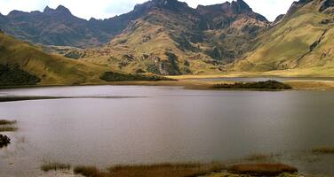
Sangay National Park
Factors affecting the property in 2008*
- Ground transport infrastructure
- Illegal activities
- Land conversion
- Livestock farming / grazing of domesticated animals
Factors* affecting the property identified in previous reports
UNESCO Extra-Budgetary Funds until 2008
Total amount provided to the property: USD 80,000
International Assistance: requests for the property until 2008
Total amount approved : 58,500 USD
| 1993 | Equipement for Sangay National Park (Approved) | 28,500 USD |
| 1985 | Public awareness programmes for local communities and ... (Approved) | 30,000 USD |
Missions to the property until 2008**
1999: IUCN mission; 2005: IUCN mission
Conservation issues presented to the World Heritage Committee in 2008
The State Party submitted on 26 March 2008 the requested report (in Spanish) together with a map to the World Heritage Centre.
The State Party provided an improved map, as requested by the World Heritage Committee (Decision 31 COM 7B.40); however according to the map minor discrepancies are evident between the boundaries of the northern part of the national park and the property.
The State Party notes that the 15,659.97 ha along the Highway of Guamote - Macas have been formally excluded from the National Park in 2004 to become a “special buffer zone” (zona especial de amortiguamiento) that lies within the extended southern zone of the National Park and not within the World Heritage property which is located north and west of this zone.
The second and updated report of “Enhancing our Heritage” (EoH) from August 2007 notes that the Highway crosses the National Park for about 39 km. Of this section, 7.85 km fall within the property and 31.23 km within the widened buffer zone. The EoH report notes that 1.11% or 3004.82 ha of the World Heritage zone lie within the 2km-radius of the road and that 712.92 ha or 0.26% of the natural vegetation in this area of the property has been modified to become pasture or cropland.
The State Party notes that 1,150 ha or 0.4% of the property is privately owned. The privately owned land represents mainly communal land with land titles pre-dating the inscription of the property, dating back to colonial times.
To address some of this agricultural encroachment, the park administration is negotiating with a family involved in pastoral and cultivation activities between the rivers Llushín Chico and Llushín Grande inside the property to facilitate their resettlement, and is also seeking financing for further resettlement activities.
An area of about 150 ha in the high altitudes (páramo ecosystems) in the northwest part of the property is ancient communal land which the park administration has recognized. A management plan has been developed for this area, and the community committed to not burn the páramo.
An additional 150 ha around Plazapamba has been given to communities for grazing of cattle and about 100 ha of the páramos in Culebrillas given to the Association of Autonomous Workers (Asociación de Trabajadores Autónomos Anga – Llacta de Alao San Antonio).
With regard to the area adjacent to the Highway of Guamote – Macas, the State Party report notes that on 12 March 2008 representatives of the Ministry of Environment met with representatives of the Ministry of Public Works to define actions to control activities with major impact on natural resources in the special buffer zone of the national park. However no management actions were reported for the 7.85 km of the road which are situated inside the property.
IUCN notes that while the updated “Enhancing our Heritage” report of 2007 shows overall progress and strengthened management effectiveness, there remain important threats from cattle herding and cultivation, uncontrolled tourism.
The EoH report further noted the positive intention to expand the analysis of management effectiveness to all protected areas in the country.
Summary of the interventions
Decisions adopted by the Committee in 2008
32 COM 7B.37
Sangay National Park (Ecuador) (N 250)
The World Heritage Committee,
1. Having examined Document WHC-08/32.COM/7B.Add,
2. Recalling Decision 31 COM 7B.40, adopted at its 31st session (Christchurch, 2007),
3. Regrets that the State Party did not submit its state of conservation report in one of the two languages of the Convention (French and English);
4. Commends the State Party for its implementation of the "Enhancing our Heritage" management effectiveness toolkit;
5. Urges the State Party to continue monitoring the impacts of the Highway of Guamote - Macas, particularly on the section within the property; in particular to monitor changes in vegetation, wildlife behaviour and any sign of ecoystem fragmentation and to develop and implement a recovery programme where vegetation has been affected;
6. Welcomes the clarification on boundaries, buffer zones and land tenure provided by the State Party; and notes that the area of the World Heritage property has not been reduced;
7. Requests the State Party to clarify the discrepancies in the maps provided between the boundaries of the World Heritage property and the northern part of the national park and to submit to the World Heritage Centre, by 1 December 2008, clear maps in this regard, for examination by the World Heritage Committee at its 33rd session in 2009.
Draft Decision: 32 COM 7B.37
The World Heritage Committee,
1. Having examined Document WHC-08/32.COM/7B.Add,
2. Recalling Decision 31 COM 7B.40, adopted at its 31st session (Christchurch, 2007),
3. Regrets that the State Party didn’t submit its state of conservation report in one of the two languages of the Convention (French and English);
4. Commends the State Party for its implementation of the “Enhancing our Heritage” management effectiveness toolkit;
5. Urges the State Party to continue monitoring the impacts of the Highway of Guamote – Macas, particularly on the section within the property; in particular to monitor changes in vegetation, wildlife behaviour and any sign of ecoystem fragmentation and to develop and implement an recovery programme where vegetation has been affected;
6. Welcomes the clarification on boundaries, buffer zones and land tenure provided by the State Party; and notes that the area of the World Heritage property has not been reduced;
7. Requests the State Party to clarify the discrepancies in the maps provided between the boundaries of the World Heritage property and the northern part of the national park and to submit to the World Heritage Centre, by 1 December 2008, clear maps in this regard, for examination by the World Heritage Committee at its 33rd session in 2009.
 Ecuador
Exports
* :
The threats indicated are listed in alphabetical order; their order does not constitute a classification according to the importance of their impact on the property.
Furthermore, they are presented irrespective of the type of threat faced by the property, i.e. with specific and proven imminent danger (“ascertained danger”) or with threats which could have deleterious effects on the property’s Outstanding Universal Value (“potential danger”).
** : All mission reports are not always available electronically.

