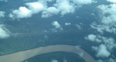
Canaima National Park
Factors affecting the property in 2021*
- Major linear utilities
- Management systems/ management plan
- Other Threats:
Conflicts between the Pemons communities and the National Guard; Need to finalize the boundaries of the area
Factors* affecting the property identified in previous reports
- Project to erect a series of power transmission lines
- Conflicts between the Pemons communities and the National Guard
- Need to finalize the boundaries of the area
International Assistance: requests for the property until 2021
Total amount approved : 43,777 USD
| 2007 | Workshop to Evaluate Management Effectiveness for ... (Not approved) | 0 USD |
| 2005 | Protected Areas Management Course in Canaima National ... (Approved) | 13,777 USD |
| 1999 | Awareness Building Workshop for Stakeholders concerned ... (Approved) | 30,000 USD |
Missions to the property until 2021**
1998: UNESCO / IUCN mission
Conservation issues presented to the World Heritage Committee in 2021
On 12 September 2018, the World Heritage Centre sent a letter to the State Party, noting third party information and media articles raising concerns about mining activities within and around the property and asking the State Party to provide clarifications on this matter.
On 19 October 2018 and later 28 February 2019, the State Party submitted a retrospective report for 2018-2019, as well as additional documents, and on 28 December 2020 a response regarding mining. These documents report the following:
- Mining is prohibited within national parks in Venezuela. In 2016, a National Strategic Development Zone “Arco Minero del Orinoco” (ZDENAMO, for its name in Spanish) was established for the purpose of development of activities related to mineral resources. A meeting was convened with the relevant organizations to clarify possible overlap of this zone with the Canaima National Park and other protected areas. Some discrepancies were observed between the boundaries based on the maps from the Geographic Institute of Venezuela from the 1970s, but, based on current technologies, it was concluded that there is no overlap between ZDENAMO and Canaima National Park. If such overlap could have been perceived, this was due to the use of maps of insufficient resolution and scale;
- Clarification of the property’s boundaries has been undertaken by INPARQUES (National Parks Institute). With the newly available geodesic technologies the total area of Canaima National Park is estimated at 2,816,015 ha (compared to 3,000,000 ha reported at the time of inscription in 1994), which, however, does not imply any changes to the property’s boundaries.
- Various management and conservation activities are reported;
On 8 March 2021, the State Party submitted a report on management and conservation of the property in 2020, providing an overview of different activities, which have continued despite the difficulties posed by the global COVID-19 pandemic.
On 24 March 2021, the World Heritage Centre sent another letter to the State Party, noting that it continued to receive third-party information regarding growing pressure from illegal mining activities on the property, including satellite images of areas affected by alleged illegal activities, and requesting the State Party to provide updated information on this matter. The State Party provided a preliminary response on 20 April 2021 and further information on 25 April, noting the following:
- In order to assess areas within the property potentially affected by any activities, different methods were used, including satellite images from 2020 and 2021, two overflights of the property undertaken in March and April 2021 and discussions with representatives of local authorities;
- It has been concluded that 99,97% of the territory of the property had not been affected by any negative factors;
- Occasional illegal mining activities might have occurred due to worsened economic situation in the broader region of the property. Some illegal mining activities, such as alluvial mining, had also occurred in the property at various points in the past and affected several areas where damage is still present, as evidenced by satellite images and also referred to in third parties reports. Various measures had been undertaken to fight illegal activities. In most cases, the surface of the areas affected by human activities is reported to have been decreasing. However, it is also noted that such an analysis based on satellite images does not always allow to identify the exact nature of human activities affecting the area and their current status;
- It is again reiterated that no area of the property overlaps with the ZDENAMO where legal mining activities are possible, even though some overlap initially existed at the time of the creation of the zone in 2016, but this has been subsequently corrected through adjustments to the boundaries of the zone and establishment of a 1-km buffer along the border of the property;
- Further information is provided on different national strategies and frameworks aimed at promoting mining as one of the key economic sectors in a responsible manner.
Analysis and Conclusion by World Heritage Centre and the Advisory Bodies in 2021
The information provided by the State Party regarding management of the property and different conservation activities, many of which continued despite the difficulties posed by the global COVID-19 pandemic, is welcomed.
Furthermore, the extensive clarifications regarding the recently established ZDENAMO, including the confirmation that it does not spatially overlap with the property, is noted. However, given well-known potentially wide-ranging impacts of gold mining, it is of concern that, despite the establishment of a 1-km buffer between ZDENAMO and the property, some areas already foreseen for mining activities are located in close vicinity to the northern border of the property. While the State Party notes that all mining activities in ZDENAMO need to undergo the necessary assessment and permits procedures, it is unclear whether a specific assessment of possible negative impacts on the Outstanding Universal Value (OUV) of the property has been undertaken or if undertaking of such an assessment is foreseen in the existing regulations.
The clarifications provided by the State Party regarding occasional illegal mining activities within the property that had been reported in the past and whose impacts can still be detected through analysis of satellite images is further noted. While it is welcomed that 99,97% of the property is reported to remain intact, according to the recent analysis and areal inspections, the fact that illegal mining had occurred in the past, including potentially quite recently, is of concern. Overall, while clarifications by the State Party are welcomed, it is difficult to conclude, based on the available information and as also noted by the State Party, what the current extent and status of such activities is and, more importantly, if any impacts on the OUV of the property might have occurred. Therefore it is recommended that the World Heritage Committee request the State Party to invite a joint World Heritage Centre/IUCN Reactive Monitoring mission to the property to assess, including through on-the-ground visits where feasible, the degree to which the property’s OUV, including its integrity, might be affected by illegal mining activities. Furthermore, it is recommended that the mission review the planned and ongoing legal mining activities in the parts of ZDENAMO located in the vicinity to the northern border of the property, assess whether they might result in any potential negative impacts on the OUV of the property and provide advice to the State Party in ensuring that assessment of possible impacts on the OUV of the property is integrated into existing national regulations for mining.
It is also noted that INPARQUES and the Ministerio del Poder Popular para el Ecosocialismo (MINEC) are studying the possibility to expand the park by adding two adjacent different areas located north of the property, of an area of approximately 212,268 ha, since they have the optimal characteristics to be conserved and not intervened, and because they do not have any other form of protection.
Finally, the clarifications provided by the State Party regarding the boundaries of Canaima National Park, which have been mapped more precisely using modern geospatial technologies are noted. While it might be the case that the maps and technologies used at the time of inscription were not precise, the difference between the area of the property recorded at the time of inscription and the newly estimated area of Canaima National Park is quite significant. It is therefore recommended that this matter is further clarified and that the Committee request the State Party to develop and submit an official proposal for clarification of the boundaries of the property through existing procedures under the Convention, in consultation with the World Heritage Centre.
Summary of the interventions
Decisions adopted by the Committee in 2021
44 COM 7B.199
Canaima National Park (Venezuela, Bolivarian Republic of) (N 701)
The World Heritage Committee,
- Having examined Document WHC/21/44.COM/7B.Add,
- Welcomes the information provided by the State Party regarding different conservation and management activities in the property, many of which continued despite the difficulties posed by the global COVID-19 pandemic;
- Notes the clarifications provided by the State Party regarding the recently established National Strategic Development Zone “Arco Minero del Orinoco” (ZDENAMO), including that it does not spatially overlap with the property, but expresses its concern that, despite the establishment of a 1-km buffer between ZDENAMO and the property, some areas foreseen for mining activities are located in close vicinity to the northern border of the property and that it remains unclear whether a specific assessment of possible negative impacts of mining activities on the Outstanding Universal Value (OUV) of the property has been undertaken;
- While welcoming the information that most of the property remains intact, notes with concern the confirmation by the State Party that some illegal mining activities occur in the property as concluded by the State Party based on its analysis of satellite images;
- Considering that, based on the available information and as also confirmed by the State Party, it is difficult to assess the current extent and status of such illegal activities in the property and to conclude whether any impacts on the OUV of the property might have occurred, requests the State Party to invite a joint World Heritage Centre/IUCN Reactive Monitoring mission to the property to:
- Assess, including through on-the-ground visits where feasible, the degree to which the property’s OUV, including its integrity, might have been affected by illegal mining activities,
- Review the planned and ongoing legal mining activities in the parts of ZDENAMO located in the vicinity to the northern border of the property and assess whether they might result in any potential negative impacts on the OUV of the property and provide advice to the State Party in ensuring that assessment of possible impacts on the OUV of the property is integrated into existing national regulations for mining;
- Also requests the State Party to submit an official proposal for clarification of boundaries of the property within the framework of the Retrospective Inventory, according to Paragraphs 163-165 of the Operational Guidelines concerning Minory Boundary Modifications and to provide further information on the proposals for futher expansion of the Canaima National Park;
- Finally requests the State Party to submit to the World Heritage Centre, by 1 December 2022, an updated report on the state of conservation of the property and the implementation of the above, for examination by the World Heritage Committee at its 46th session.
Draft Decision: 44 COM 7B.199
The World Heritage Committee,
- Having examined Document WHC/21/44.COM/7B.Add,
- Welcomes the information provided by the State Party regarding different conservation and management activities in the property, many of which continued despite the difficulties posed by the global COVID-19 pandemic;
- Notes the clarifications provided by the State Party regarding the recently established National Strategic Development Zone “Arco Minero del Orinoco” (ZDENAMO), including that it does not spatially overlap with the property, but expresses its concern that, despite the establishment of a 1-km buffer between ZDENAMO and the property, some areas foreseen for mining activities are located in close vicinity to the northern border of the property and that it remains unclear whether a specific assessment of possible negative impacts of mining activities on the Outstanding Universal Value (OUV) of the property has been undertaken;
- While welcoming the information that most of the property remains intact, notes with concern the confirmation by the State Party that some illegal mining activities occur in the property as concluded by the State Party based on its analysis of satellite images;
- Considering that, based on the available information and as also confirmed by the State Party, it is difficult to assess the current extent and status of such illegal activities in the property and to conclude whether any impacts on the OUV of the property might have occurred, requests the State Party to invite a joint World Heritage Centre/IUCN Reactive Monitoring mission to the property to:
- Assess, including through on-the-ground visits where feasible, the degree to which the property’s OUV, including its integrity, might have been affected by illegal mining activities,
- Review the planned and ongoing legal mining activities in the parts of ZDENAMO located in the vicinity to the northern border of the property and assess whether they might result in any potential negative impacts on the OUV of the property and provide advice to the State Party in ensuring that assessment of possible impacts on the OUV of the property is integrated into existing national regulations for mining;
- Also requests the State Party to submit an official proposal for clarification of boundaries of the property within the framework of the Retrospective Inventory, according to Paragraphs 163-165 of the Operational Guidelines concerning Minory Boundary Modifications and to provide further information on the proposals for futher expansion of the Canaima National Park;
- Finally requests the State Party to submit to the World Heritage Centre, by 1 December 2022, an updated report on the state of conservation of the property and the implementation of the above, for examination by the World Heritage Committee at its 46th session in 2023.
 Venezuela (Bolivarian Republic of)
Exports
* :
The threats indicated are listed in alphabetical order; their order does not constitute a classification according to the importance of their impact on the property.
Furthermore, they are presented irrespective of the type of threat faced by the property, i.e. with specific and proven imminent danger (“ascertained danger”) or with threats which could have deleterious effects on the property’s Outstanding Universal Value (“potential danger”).
** : All mission reports are not always available electronically.

