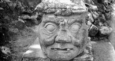
Maya Site of Copan
Factors affecting the property in 2012*
- Air transport infrastructure
- High impact research / monitoring activities
- Impacts of tourism / visitor / recreation
- Legal framework
- Management systems/ management plan
- Other Threats:
Deterioration of construction materials due to natural decay phenomena
Factors* affecting the property identified in previous reports
a) The foreseen construction of an airport in the vicinity of the World Heritage property in a national protected area;
b) Deterioration of construction materials due to natural decay phenomena;
c) Risk of structural failure of archaeological complexes resulting from tunnels excavated for archaeological purposes;
d) Deterioration derived from uncontrolled visitation and potential to exceed carrying capacity at specific time periods;
e) Legal issues concerning the ownership of the land in the property and its buffer zone and the delimitation of the property and its buffer zone.
International Assistance: requests for the property until 2012
Total amount approved : 226,513 USD
| 1999 | Emergency measures for the protection and ... (Approved) | 43,975 USD |
| 1998 | Replacement of a protective canopy of the Hieroglyphic ... (Approved) | 5,000 USD |
| 1997 | Preparation of a Replica of the Hieroglyphic Stairway ... (Approved) | 29,613 USD |
| 1997 | Scientific seminar on the preservation of the ... (Approved) | 8,800 USD |
| 1990 | Preservation of mural paintings recently discovered in ... (Approved) | 7,000 USD |
| 1983 | Equipment, consultant services and support to training ... (Approved) | 46,000 USD |
| 1982 | Technical mission and equipment for Copan Ruins (Approved) | 24,050 USD |
| 1982 | Training activities foreseen in the management plan for ... (Approved) | 28,950 USD |
| 1982 | Financial contribution to the preparation, publication ... (Approved) | 3,125 USD |
| 1982 | 2 specialists and equipment for Copan Ruins (Approved) | 20,000 USD |
| 1979 | Provision of one expert to prepare a technical ... (Approved) | 10,000 USD |
Missions to the property until 2012**
2003: World Heritage Centre / ICOMOS reactive monitoring mission; 2005: ICOMOS reactive monitoring mission; 2011: World Heritage Centre / ICOMOS reactive monitoring mission
Conservation issues presented to the World Heritage Committee in 2012
The State Party submitted a report on the state of conservation of the property on 1 February 2012. From 21 to 26 November, a joint World Heritage Centre/ICOMOS reactive monitoring mission was carried out to assess the state of conservation of the property. The mission report is available online at the following web address: https://whc.unesco.org/en/sessions/36COM/documents
a) Construction of an Aerodrome at Rio Amarillo
The mission reviewed the history of the airport project, which has been on-going since 2003, and noted that although the State Party had taken the decision to build the airport at Concepcion, the cost of constructing a road between this site and Copan has proved to be prohibitively expensive. The mission reviewed the new impact studies for the Rio Amarillo airport that had been produced following the 2005 mission. The mission considers that these demonstrate that there will be no direct impact on the Outstanding Universal Value of the property, although the wider cultural and natural setting of the inscribed site - from which it draws its significance and which is protected by national law - will be affected. In order to minimize the impact of the airport on the landscape and to fully understand the relationship of the property to its wider setting, the mission considered that a detailed archaeological study, and if necessary, the relevant rescue excavations will need to be undertaken on the airport site.
Furthermore, they considered that the construction would need to be as limited as possible and the runway limited to 1200 metres in order that the main archaeological site of Piedras Negras would not be affected. It would also need to comprehensively plan for potential indirect effects to the property, particularly in regard to increase in visitor numbers, the limits for tourism development and the strict enforcement of regulations. These aspects would need to be considered within the framework of a coherent territorial planning and management strategy which should have a clearly regional vision.
b) Boundaries and buffer zone
A revised map and buffer zone was included in the state of conservation report. This will be evaluated as part of the retrospective inventory process of the Periodic Reporting Exercise for Latin America and the Caribbean, and during the 2013 evaluations for minor boundary modifications. The Management Plan mentions that regulatory measures prescribed, formulated in 1982 and approved in 1998, will need to be updated and harmonized with new territorial planning laws, and that regulations established in 1997 need to be updated to include all areas that are part of the area declared as national monuments. The State Party mentions that enforcement of current measures is a challenge that has been addressed through the acquisition of private lands. However, this process has been halted since 2009. The mission was not presented with new or additional cartographic material for evaluation but noted the need to clarify zoning as part of the process for updating the Management Plan. It also underscored the need to work closely with the Local Government to ensure the protection of the property, given existing development pressures and to continue the process of acquisition of land in the proposed buffer zone to mitigate impacts from changes in land use. It recommended that a monitoring system be set up to map changes in land use and to integrate these results in decision making processes and for the enforcement of regulatory and protective measures. It also recommended that the feasibility of moving the main traffic, possible through Highway CA-11, away from the World Heritage property be evaluated.
c) Management Plan
The State Party reports that the Management Plan, published in 2005, is currently under review and will be updated through a participatory process. Risk management and public use plans will be revised and made explicit in the newer version which is expected to be concluded by February 2013. The Public Use Plan, which was to be drafted by September 2011 through funding by the Inter American Development Bank, was not developed. A new process has started with the Universidad Complutense de Madrid (Spain) to articulate its formulation with the updating of the Management Plan.
The mission noted that management issues have remained unaddressed or have had limited progress due to the political and financial situation in the country. The mission also reported that no clear indications were given how the Public Use Plan and the Risk Management Plan will be integrated into the general Management Plan and how this latter Plan will be updated. It highlighted the need to coordinate planning tools for the property with those at the local and regional levels. It also noted that carrying capacity for the property has to be established and used as a basis for the development of the Public Use Plan.
d) Conservation programme for the tunnels and conservation guidelines for the property
A project was implemented at Copan, through Inter American Development Bank funding, for the consolidation of external surfaces at sections of the Acropolis and some collapsed sections of the tunnels. The report on the interventions is included. The mission noted that the overall state of conservation of the property is good and underscored issues that required attention. Among these, there is a need to centrally collect monitoring data generated by diverse projects so as to inform management decisions. Also, criteria for potential transfer of sculptures from the site to the museum are needed, as well as for roofing of sculptures that will remain in situ. As for the tunnels, the mission reports there is no formal or documented monitoring being done, there is a potential threat derived from biological contaminants, there is water filtration that can damage stucco surfaces and potentially affect the stability of the tunnels. It mentioned that interventions to date have been carried out on an ad hoc basis. The mission considers that a comprehensive action plan for the conservation and maintenance of the tunnels needs to be developed.
e) Protective shelter for the hieroglyphic stairway and laboratory for sculpture conservation
A brief preliminary report on the prototype shelter installed on Structure 9B-83 at Las Sepulturas was included. A test year of one year is foreseen to assess its functionality and carry out environmental monitoring to assess its adequacy and efficacy as an alternative to the existing shelter. The mission noted that discussions are needed not only in terms of the effectiveness of the design but also in terms of how the “sails” will be fixed to the pre-hispanic building, considering the amount of perforations and the potential for severe damage in case of strong winds. As for the laboratory, the State Party informs it will be located within the existing Museum, in an area that functions as storage space. The mission verified that no new construction has been undertaken for this purpose.
Analysis and Conclusion by World Heritage Centre and the Advisory Bodies in 2012
The World Heritage Centre and the Advisory Bodies note the findings of the mission that the development of an airport at Rio Amarillo would not impact adversely the Outstanding Universal Value of the property. They also note that the mission recommended that the construction of the airport would need to be undertaken within clear constraints in order to not impact adversely the archaeology of the area which is part of the wider natural and cultural setting of the property protected by national law.
Although the general state of conservation of the property was found to be satisfactory, the World Heritage Centre and the Advisory Bodies note that there are still issues which have remained unaddressed for the past years, including the updating of the Management Plan, with provisions for risk management and public use based on updated studies, the development of a comprehensive conservation strategy for the tunnels and the updating of regulatory measures for the buffer zone to ensure the protection of the property in light of increasing development pressures.
Summary of the interventions
Decisions adopted by the Committee in 2012
36 COM 7B.100
Maya Site of Copan (Honduras) (C 129)
The World Heritage Committee,
1. Having examined Document WHC-12/36.COM/7B,
2. Recalling Decision 35 COM 7B.126, adopted at its 35th session (UNESCO, 2011),
3. Notes that no direct impact on the Outstanding Universal Value of the inscribed property is to be expected from the construction of the Rio Amarillo Aerodrome and requests the State Party, should a decision be made to proceed with its construction, to update the Environmental Impact Assessment and carry out a Heritage Impact Assessment to identify mitigation measures;
4. Acknowledges the information provided by the State Party regarding the implementation of conservation measures for the property and reiterates its request to fully develop a comprehensive strategy for the conservation of the tunnels and the establishment of conservation guidelines for interventions at the property;
5. Also requests the State Party to finalize the process for updating the Management Plan for the property, including provisions for risk management and a public use plan based on carrying capacities studies, and upon completion to provide three printed and electronic copies of the draft revised Management Plan for review by the World Heritage Centre and the Advisory Bodies;
6. Further requests the State Party to update, approve and enforce the regulatory measures for the management of different zones prescribed in the Plan and to work with the Local Government to ensure the protection of the property against development pressures;
7. Urges the State Party to integrate the updated Management Plan within local and regional planning instruments to develop a coherent territorial planning and management strategy with a regional vision;
8. Moreover requests the State Party to submit, in accordance to Paragraph 172 of the Operational Guidelines, the results from the prototype protective shelter for the Hieroglyphic Stairway as well as the technical specifications for the final design, for review prior to implementation;
9. Requests the State Party to submit to the World Heritage Centre, by 1 February 2013, an updated report on the state of conservation of the property and the implementation of the above, for examination by the World Heritage Committee at its 37th session in 2013.
Draft Decision: 36 COM 7B.100
The World Heritage Committee,
1. Having examined Document WHC-12/36.COM/7B,
2. Recalling Decision 35 COM 7B.126, adopted at its 35th session (UNESCO, 2011),
3. Notes that no direct impact on the Outstanding Universal Value of the inscribed property is to be expected from the construction of the Rio Amarillo Aerodrome and requests the State Party, should a decision be made to proceed with its construction, to update the Environmental Impact Assessment and carry out a Heritage Impact Assessment to identify mitigation measures;
4. Acknowledges the information provided by the State Party regarding the implementation of conservation measures for the property and reiterates its request to fully develop a comprehensive strategy for the conservation of the tunnels and the establishment of conservation guidelines for interventions at the property;
5. Also requests the State Party to finalise the process for updating the Management Plan for the property, including provisions for risk management and a public use plan based on carrying capacities studies, and upon completion to provide three printed and electronic copies of the draft revised Management Plan for review by the World Heritage Centre and the Advisory Bodies;
6. Further requests the State Party to update, approve and enforce the regulatory measures for the management of different zones prescribed in the Plan and to work with the Local Government to ensure the protection of the property against development pressures;
7. Urges the State Party to integrate the updated Management Plan within local and regional planning instruments to develop a coherent territorial planning and management strategy with a regional vision;
8. Moreover requests the State Party to submit, in accordance to Paragraph 172 of the Operational Guidelines, the results from the prototype protective shelter for the Hieroglyphic Stairway as well as the technical specifications for the final design, for review prior to implementation;
9. Requests the State Party to submit to the World Heritage Centre, by 1 February 2013, an updated report on the state of conservation of the property and the implementation of the above, for examination by the World Heritage Committee at its 37th session in 2013.
 Honduras
* :
The threats indicated are listed in alphabetical order; their order does not constitute a classification according to the importance of their impact on the property.
Furthermore, they are presented irrespective of the type of threat faced by the property, i.e. with specific and proven imminent danger (“ascertained danger”) or with threats which could have deleterious effects on the property’s Outstanding Universal Value (“potential danger”).
** : All mission reports are not always available electronically.

