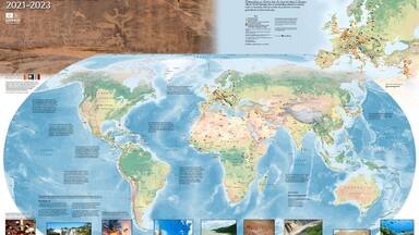
2006-2007 World Heritage Map Available
The 2006-2007 World Heritage map, the second to be produced in collaboration with National Geographic and Hewlett Packard, is now available.
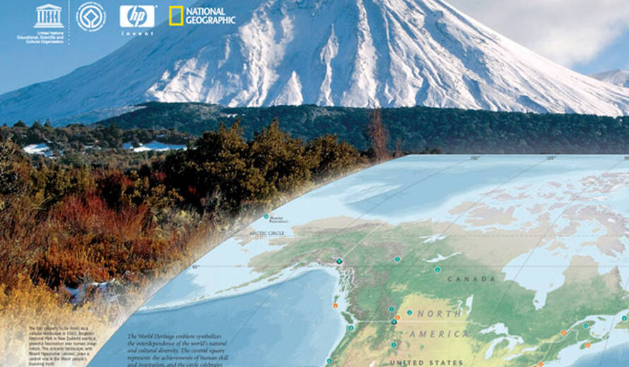
The goal of the partnership, signed at the end of 2005 for an initial period of three years, is to raise awareness of the World Heritage Convention, and the map is an essential tool for this purpose. The partnership combines National Geographic's unsurpassed cartography with HP's high technology printing to illustrate the location of World Heritage sites across the globe.
The World Heritage map is above all an educational visual tool, allowing UNESCO to communicate its work in this field on a large scale. It is especially important since print documents, accessible to everyone, are an essential communication tool.
HP's digital printing technology has now made it possible to print excellent quality A3 versions of the map, in addition to the classic large version. It is also possible to print tailor-made maps through a data selection process. With this version, distribution of maps will be tripled with a print run of 100,000 copies, thanks to the contribution of HP and Purdue University Printing Services.
The map features the 830 World Heritage properties, brief explanations of the World Heritage Convention and World Heritage conservation programmes, as well as superb photos of World Heritage sites with explanatory captions. The dimensions of the map are 78 cm by 50 cm (31 by 20 in.), and it can be downloaded free of charge from this website. It is available in English, French, and Spanish versions.
A copy of the map may be requested by registering on this website.