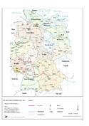
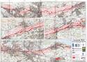
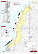
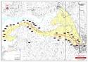
Frontiers of the Roman Empire
Multiple Locations (420)
| ID | Name & Location | State Party | Coordinates | Property | Buffer Zone |
|---|---|---|---|---|---|
| 430ter-001 | Hadrian's Wall in wall mile 5, sections of wall in playing field of Rutherford School | United Kingdom of Great Britain and Northern Ireland |
N54 58 37.12 W1 39 40.47 |
0.3021 ha | |
| 430ter-002 | Hadrian's Wall vallum in wall mile 6, Benwell length of vallum of Hadrian's Wall in grounds of St Cuthbert's School | United Kingdom of Great Britain and Northern Ireland |
N54 58 43.92 W1 40 29.01 |
0.3503 ha | |
| 430ter-003 | Hadrian's Wall in wall mile 6, Condercum Roman fort, Benwell | United Kingdom of Great Britain and Northern Ireland |
N54 58 38.02 W1 40 2.45 |
0.4864 ha | |
| 430ter-004 | Hadrian's Wall in wall mile 7, Benwell length of vallum of Hadrian's Wall in the grounds of Benwell Hill Cricket Club | United Kingdom of Great Britain and Northern Ireland |
N54 58 49.02 W1 40 50.45 |
0.3414 ha | |
| 430ter-005 | Hadrian's Wall in wall mile 7, Scotswood section of Hadrian's Wall in the grounds of Benwell Hill Cricket Club | United Kingdom of Great Britain and Northern Ireland |
N54 58 52.60 W1 40 48.06 |
0.1562 ha | |
| 430ter-006 | Hadrian's Wall and vallum in wall mile 7, Scotswood section from Denton Road to Denton Dene | United Kingdom of Great Britain and Northern Ireland |
N54 58 58.00 W1 41 9.39 |
0.0385 ha | |
| 430ter-007 | Hadrian's Wall and vallum in wall mile 7, Denton section of Hadrian's Wall, Denton Turret and Hadrian's Wall at West Denton | United Kingdom of Great Britain and Northern Ireland |
N54 59 7.70 W1 41 47.07 |
0.1306 ha | |
| 430ter-008 | Hadrian's Wall and vallum in wall mile 7, Scotswood section of vallum 75m long at Denton Dene | United Kingdom of Great Britain and Northern Ireland |
N54 58 54.68 W1 41 16.17 |
0.1724 ha | |
| 430ter-009 | Hadrian's Wall in wall mile 7, Scotswood section of Hadrian's Wall in garden of West Road Methodist Chapel | United Kingdom of Great Britain and Northern Ireland |
N54 58 55.87 W1 41 0.86 |
0.0121 ha | |
| 430ter-010 | Hadrian's Wall in wall mile 0, section between Eastfield Avenue and Tumulus Avenue | United Kingdom of Great Britain and Northern Ireland |
N54 59 8.93 W1 32 29.39 |
0.1604 ha | |
| 430ter-011 | Hadrian's Wall in wall mile 1, three sections between Stotts Road and Vauxhall Road | United Kingdom of Great Britain and Northern Ireland |
N54 59 5.08 W1 32 45.12 |
0.1436 ha | |
| 430ter-012 | Hadrian's Wall in wall mile 2, Byker section of Hadrian's Wall and presumed site of milecastle 3 at Shields Road West | United Kingdom of Great Britain and Northern Ireland |
N54 58 33.63 W1 35 18.80 |
0.1022 ha | |
| 430ter-013 | Hadrian's Wall in wall mile 2, Walker section of Hadrian's Wall under the forecourt of the Fosse public house | United Kingdom of Great Britain and Northern Ireland |
N54 58 50.10 W1 33 46.77 |
0.037 ha | |
| 430ter-014 | Hadrian's Wall in wall mile 2, Walker section of Hadrian's Wall 171m long across Millers Dene playing field | United Kingdom of Great Britain and Northern Ireland |
N54 59 1.67 W1 32 59.28 |
0.2382 ha | |
| 430ter-015 | Hadrian's Wall in wall mile 2, Walker section of Hadrian's Wall near the junction of Fossway and Shields Road | United Kingdom of Great Britain and Northern Ireland |
N54 58 41.55 W1 34 23.23 |
0.0837 ha | |
| 430ter-016 | Hadrian's Wall in wall mile 4, sections of wall between Crawhall Road and Jubilee Road | United Kingdom of Great Britain and Northern Ireland |
N54 58 20.23 W1 36 5.84 |
0.1155 ha | |
| 430ter-017 | Roman aqueduct to Great Chesters from the Cawburn | United Kingdom of Great Britain and Northern Ireland |
N55 0 32.26 W2 27 7.2 |
12.3527 ha | |
| 430ter-018 | Hadrian's Wall and vallum in wall mile 8 from Denton to Blucher | United Kingdom of Great Britain and Northern Ireland |
N54 59 26.35 W1 43 16.27 |
7.2201 ha | |
| 430ter-019 | Hadrian's Wall and vallum in wall mile 9, Blucher to Dene House | United Kingdom of Great Britain and Northern Ireland |
N54 59 38.09 W1 44 27.48 |
4.751 ha | |
| 430ter-020 | Hadrian's Wall and vallum in wall mile 10 from Dene House to Throckley Bank Top | United Kingdom of Great Britain and Northern Ireland |
N54 59 44.17 W1 45 44.87 |
3.0158 ha | |
| 430ter-021 | Roman fort, South Shields | United Kingdom of Great Britain and Northern Ireland |
N55 0 15.22 W1 25 52.01 |
3.5367 ha | |
| 430ter-022 | Hadrian's Wall in wall mile 0, Wallsend Roman fort, Segedunum | United Kingdom of Great Britain and Northern Ireland |
N54 59 17.87 W1 31 57.50 |
1.5713 ha | |
| 430ter-023 | Hadrian's Wall in wall mile 0, two sections of Hadrian's Wall between Sharpe Road and The Avenue | United Kingdom of Great Britain and Northern Ireland |
N54 59 12.50 W1 32 14.77 |
0.215 ha | |
| 430ter-024 | Red House Roman camp | United Kingdom of Great Britain and Northern Ireland |
N55 0 12.87 W2 11 28.27 |
1.8301 ha | |
| 430ter-025 | Roman camp, 290m north west of Seldom Seen | United Kingdom of Great Britain and Northern Ireland |
N55 0 14.51 W2 17 2.02 |
1.776 ha | |
| 430ter-026 | Corbridge (Corstopitum) Roman station | United Kingdom of Great Britain and Northern Ireland |
N54 58 47.60 W2 2 7.85 |
81.2125 ha | |
| 430ter-027 | Roman fort and watch tower, 800m SSW of Amberfield | United Kingdom of Great Britain and Northern Ireland |
N54 54 49.32 W3 3 19.22 |
7.9855 ha | |
| 430ter-028 | Cardurnock milefortlet (Mf 5) | United Kingdom of Great Britain and Northern Ireland |
N54 54 48.49 W3 17 43.60 |
0.7331 ha | |
| 430ter-029 | The Stangate at Crosby Lodge | United Kingdom of Great Britain and Northern Ireland |
N54 55 43.79 W2 51 15.60 |
0.393 ha | |
| 430ter-030 | Burrow Walls Roman fort | United Kingdom of Great Britain and Northern Ireland |
N54 39 21.25 W3 32 48.45 |
1.8502 ha | |
| 430ter-031 | Beckfoot Roman fort | United Kingdom of Great Britain and Northern Ireland |
N54 49 34.31 W3 25 6.22 |
1.5005 ha | |
| 430ter-032 | Roman fortlet 40m SSW of Castle Fields | United Kingdom of Great Britain and Northern Ireland |
N54 49 24.61 W3 25 19.44 |
0.6237 ha | |
| 430ter-033 | Parton Roman fort | United Kingdom of Great Britain and Northern Ireland |
N54 34 20.98 W3 34 32.02 |
9.3549 ha | |
| 430ter-034 | Cardurnock Marsh turret 4a | United Kingdom of Great Britain and Northern Ireland |
N54 55 21.37 W3 17 30.78 |
0.0349 ha | |
| 430ter-035 | Pasture House turret 3a | United Kingdom of Great Britain and Northern Ireland |
N54 55 53.24 W3 16 45.06 |
0.0636 ha | |
| 430ter-036 | Hadrian's Wall and vallum in wall mile 66, Stanwix Bank to Stainton | United Kingdom of Great Britain and Northern Ireland |
N54 53 59.69 W2 57 7.63 |
2.8723 ha | |
| 430ter-037 | Ravenglass Roman fort bath-house, also known as Walls Castle | United Kingdom of Great Britain and Northern Ireland |
N54 21 2.58 W3 24 14.89 |
0.0876 ha | |
| 430ter-038 | Willowford Roman temporary camp | United Kingdom of Great Britain and Northern Ireland |
N54 59 17.71 W2 35 12.28 |
1.295 ha | |
| 430ter-039 | Watchclose Roman temporary camp | United Kingdom of Great Britain and Northern Ireland |
N54 56 1.09 W2 49 10.67 |
1.2451 ha | |
| 430ter-040 | Throp Roman fortlet | United Kingdom of Great Britain and Northern Ireland |
N54 59 12.70 W2 34 39.30 |
0.6951 ha | |
| 430ter-041 | Nowtler Hill 1 Roman temporary camp | United Kingdom of Great Britain and Northern Ireland |
N54 54 13.15 W2 59 43.52 |
1.0328 ha | |
| 430ter-042 | Nowtler Hill 2 Roman temporary camp | United Kingdom of Great Britain and Northern Ireland |
N54 54 5.55 W2 59 59.05 |
0.953 ha | |
| 430ter-043 | Boomby Lane 1 and 2 Roman temporary camps | United Kingdom of Great Britain and Northern Ireland |
N54 54 25.82 W2 59 9.75 |
4.2416 ha | |
| 430ter-044 | Hadrian's Wall and vallum from Throckley to East Town House, Heddon-on-the-Wall in wall mile 11 | United Kingdom of Great Britain and Northern Ireland |
N54 59 45.44 W1 46 40.29 |
13.143 ha | |
| 430ter-045 | Hadrian's Wall and vallum from East Town House, Heddon-on-the-Wall to the A69 trunk road in wall mile 12 | United Kingdom of Great Britain and Northern Ireland |
N54 59 52.70 W1 48 0.77 |
9.8639 ha | |
| 430ter-046 | Hadrian's Wall and vallum between the March Burn and Oatens Bank, Harlow Hill in wall miles 13,14 and 15 | United Kingdom of Great Britain and Northern Ireland |
N55 0 16.89 W1 51 21.30 |
29.5807 ha | |
| 430ter-047 | Hadrian's Wall from Oatens Bank, Harlow Hill, to Whittle Dene Watercourse in wall mile 16 | United Kingdom of Great Britain and Northern Ireland |
N55 0 33.02 W1 53 20.24 |
3.3242 ha | |
| 430ter-048 | The vallum between Oatens Bank, Harlow Hill, and Whittle Dene Watercourse in wall mile 16 | United Kingdom of Great Britain and Northern Ireland |
N55 0 25.07 W1 53 19.47 |
5.0693 ha | |
| 430ter-049 | Hadrian's Wall and vallum between the B6309 and the B6321 in wall miles 16, 17 and 18 | United Kingdom of Great Britain and Northern Ireland |
N55 0 33.31 W1 55 19.69 |
29.4383 ha | |
| 430ter-050 | Hadrian's Wall and vallum between Sunnybrae at Halton Shields and Haltonchesters Roman fort in wall miles 20 and 21 | United Kingdom of Great Britain and Northern Ireland |
N55 0 42.36 W1 59 16.15 |
21.3807 ha | |
| 430ter-051 | Haltonchesters Roman fort, settlement & Hadrian's Wall & vallum between the field boundary east of Haltonchesters fort & the Fence Burn in wall mile 2 | United Kingdom of Great Britain and Northern Ireland |
N55 0 35.37 W2 0 23.53 |
12.5889 ha | |
| 430ter-052 | Hadrian's Wall and vallum between the Fence Burn and the track to Portgate Cottage in wall miles 21 and 22 | United Kingdom of Great Britain and Northern Ireland |
N55 0 38.54 W2 1 15.15 |
19.0349 ha | |
| 430ter-053 | Hadrian's Wall and vallum between the track to Portgate Cottage and the field boundary east of milecastle 24 in wall miles 22 and 23 | United Kingdom of Great Britain and Northern Ireland |
N55 0 56.98 W2 2 51.77 |
24.8667 ha | |
| 430ter-054 | Haltwhistle Burn 4 Roman temporary camp | United Kingdom of Great Britain and Northern Ireland |
N54 59 30.38 W2 26 55.25 |
0.2056 ha | |
| 430ter-055 | Milestone House Roman temporary camp and section of the Stanegate Roman road | United Kingdom of Great Britain and Northern Ireland |
N54 59 20.60 W2 26 12.72 |
21.2864 ha | |
| 430ter-056 | Markham Cottage Roman temporary camps 1 and 2, a section of the Stanegate Roman road, a length of Roman road and two Roman cemeteries | United Kingdom of Great Britain and Northern Ireland |
N54 59 17.56 W2 27 31.00 |
23.9733 ha | |
| 430ter-057 | Lees Hall Roman camp | United Kingdom of Great Britain and Northern Ireland |
N54 59 5.21 W2 27 46.84 |
3.1328 ha | |
| 430ter-058 | Walwick Fell Roman temporary camp | United Kingdom of Great Britain and Northern Ireland |
N55 1 54.22 W2 10 44.48 |
1.34 ha | |
| 430ter-059 | Brown Dikes Roman temporary camp | United Kingdom of Great Britain and Northern Ireland |
N55 1 37.10 W2 15 7.22 |
1.254 ha | |
| 430ter-060 | Coesike East Roman temporary camp | United Kingdom of Great Britain and Northern Ireland |
N55 1 34.35 W2 17 4.84 |
0.616 ha | |
| 430ter-061 | Coesike West Roman temporary camps 1 and 2 | United Kingdom of Great Britain and Northern Ireland |
N55 1 30.64 W2 17 10.73 |
0.89 ha | |
| 430ter-062 | Grindon School Roman temporary camp | United Kingdom of Great Britain and Northern Ireland |
N55 1 20.07 W2 17 33.46 |
0.6084 ha | |
| 430ter-063 | Seatsides 1 Roman temporary camp and section of the Stanegate Roman road from the west side of the road from Once Brewed to the south side of the B631 | United Kingdom of Great Britain and Northern Ireland |
N54 59 17.48 W2 24 24.44 |
15.985 ha | |
| 430ter-064 | Seatsides 2 Roman temporary camp | United Kingdom of Great Britain and Northern Ireland |
N54 59 31.97 W2 23 17.69 |
5.362 ha | |
| 430ter-065 | Bean Burn 1 Roman temporary camp | United Kingdom of Great Britain and Northern Ireland |
N54 59 17.49 W2 22 52.96 |
0.7327 ha | |
| 430ter-066 | Bean Burn 2 Roman temporary camp | United Kingdom of Great Britain and Northern Ireland |
N54 59 16.84 W2 23 2.30 |
0.1238 ha | |
| 430ter-067 | Chesters Pike Roman temporary camp | United Kingdom of Great Britain and Northern Ireland |
N54 59 53.81 W2 27 35.35 |
1.3675 ha | |
| 430ter-068 | Haltwhistle Burn 1 Roman temporary camp, fortlet and section of the Stanegate | United Kingdom of Great Britain and Northern Ireland |
N54 59 17.29 W2 26 58.53 |
6.8588 ha | |
| 430ter-069 | Haltwhistle Burn Roman temporary camps 2 and 3 and area of cord rig cultivation | United Kingdom of Great Britain and Northern Ireland |
N54 59 27.02 W2 26 42.78 |
2.0239 ha | |
| 430ter-070 | Sunny Rigg 1 Roman temporary camp | United Kingdom of Great Britain and Northern Ireland |
N54 59 4.03 W2 28 38.91 |
1.14 ha | |
| 430ter-071 | Sunny Rigg 2 Roman temporary camp | United Kingdom of Great Britain and Northern Ireland |
N54 59 6.47 W2 28 20.32 |
1.1307 ha | |
| 430ter-072 | Sunny Rigg 3 Roman temporary camp | United Kingdom of Great Britain and Northern Ireland |
N54 59 12.24 W2 28 10.10 |
0.2687 ha | |
| 430ter-073 | Fell End Roman temporary camp and section of the Stanegate Roman road | United Kingdom of Great Britain and Northern Ireland |
N54 59 2.20 W2 29 17.88 |
13.4628 ha | |
| 430ter-074 | Chapel Rigg Roman temporary camp | United Kingdom of Great Britain and Northern Ireland |
N54 58 55.64 W2 33 17.20 |
2.2644 ha | |
| 430ter-075 | Crooks Roman temporary camp | United Kingdom of Great Britain and Northern Ireland |
N54 59 1.79 W2 34 12.14 |
2.2145 ha | |
| 430ter-076 | The section of Stanegate Roman road from Fell End Roman temporary camp to the track to Old Shield, and the Roman cemetery adjacent to Carvoran Roman f | United Kingdom of Great Britain and Northern Ireland |
N54 58 59.06 W2 30 29.45 |
10.7089 ha | |
| 430ter-077 | Moss Side 1 and 2 Roman temporary camps | United Kingdom of Great Britain and Northern Ireland |
N54 56 5.04 W2 50 57.67 |
8.8785 ha | |
| 430ter-078 | Hadrian's Wall & vallum between field boundary east of milecastle 24 & field boundary west of the site of turret 25b in wall miles 24-25 | United Kingdom of Great Britain and Northern Ireland |
N55 1 8.53 W2 4 58.63 |
31.7564 ha | |
| 430ter-079 | The Roman fort, vicus, bridge abutments and associated remains of Hadrian's Wall at Chesters in wall mile 27 | United Kingdom of Great Britain and Northern Ireland |
N55 1 28.32 W2 8 34.12 |
27.5721 ha | |
| 430ter-080 | Hadrian's Wall and vallum between Chesters and the road to Simonburn in wall miles 27, 28 and 29 | United Kingdom of Great Britain and Northern Ireland |
N55 1 53.97 W2 9 52.83 |
29.2474 ha | |
| 430ter-081 | Hadrian's Wall and vallum between the road to Simonburn and the field boundary east of Carrawburgh car park in wall miles 29, 30 and 31 | United Kingdom of Great Britain and Northern Ireland |
N55 2 14.96 W2 12 5.46 |
25.8908 ha | |
| 430ter-082 | Hadrian's Wall and vallum between the field boundary west of Coventina's Well and the field boundary at Brown Dikes in wall miles 31 and 32 | United Kingdom of Great Britain and Northern Ireland |
N55 1 59.33 W2 14 32.67 |
16.8159 ha | |
| 430ter-083 | Hadrian's Wall and vallum between the field boundary at Brown Dikes and the field boundary east of turret 34a in wall miles 32, 33 and 34 | United Kingdom of Great Britain and Northern Ireland |
N55 1 47.01 W2 16 27.70 |
32.8533 ha | |
| 430ter-084 | Hadrian's Wall and associated features between the boundary east of turret 34a and the field boundary west of milecastle 36 in wall miles 34, 35 and 3 | United Kingdom of Great Britain and Northern Ireland |
N55 1 30.97 W2 18 26.97 |
25.6493 ha | |
| 430ter-085 | The vallum and early Roman road between the field boundary east of turret 34a and the field boundary west of milecastle 36 in wall miles 34, 35 and 36 | United Kingdom of Great Britain and Northern Ireland |
N55 1 14.49 W2 18 20.43 |
10.7577 ha | |
| 430ter-086 | Hadrian's Wall and associated features between the field boundary west of turret 37a and the road to Steel Rigg car park in wall miles 37, 38 and 39 | United Kingdom of Great Britain and Northern Ireland |
N55 0 16.76 W2 22 8.84 |
34.8705 ha | |
| 430ter-087 | The vallum and a British settlement between the field boundary west of turret 37a & the road to Steel Rigg car park, in wall miles 37, 38 & 39 | United Kingdom of Great Britain and Northern Ireland |
N54 59 59.23 W2 21 57.20 |
20.2929 ha | |
| 430ter-088 | Hadrian's Wall, associated features & a Romano-British settlement between the road to Steel Rigg car park & the road through Caw Gap in wall miles 39 | United Kingdom of Great Britain and Northern Ireland |
N55 0 3.96 W2 24 35.88 |
22.9729 ha | |
| 430ter-089 | The vallum between the road to Steel Rigg car park and the road in Caw Gap in wall miles 39, 40 and 41 | United Kingdom of Great Britain and Northern Ireland |
N54 59 41.50 W2 24 28.40 |
14.3442 ha | |
| 430ter-090 | Hadrian's Wall and vallum between the road to Caw Gap and the Caw Burn in wall miles 41 and 42 | United Kingdom of Great Britain and Northern Ireland |
N54 59 38.44 W2 26 25.74 |
31.4419 ha | |
| 430ter-091 | Great Chesters Roman fort and Hadrian's Wall between the Caw Burn and the track to Cockmount Hill farm in wall miles 42 and 43 | United Kingdom of Great Britain and Northern Ireland |
N54 59 36.78 W2 27 48.21 |
49.1692 ha | |
| 430ter-092 | Hadrian's Wall between Walltown Quarry East and Walltown Quarry West in wall mile 45 | United Kingdom of Great Britain and Northern Ireland |
N54 59 24.48 W2 30 45.53 |
4.0441 ha | |
| 430ter-093 | The vallum between Cockmount Hill and Walltown Quarry West in wall miles 43, 44 and 45 | United Kingdom of Great Britain and Northern Ireland |
N54 59 25.02 W2 29 39.93 |
12.6555 ha | |
| 430ter-094 | Hadrian's Wall and vallum between Baron's Dike and Birky Lane at Walby, in wall miles 60, 61 and 62. | United Kingdom of Great Britain and Northern Ireland |
N54 56 15.66 W2 51 38.64 |
38.2191 ha | |
| 430ter-095 | Hadrian's Wall and vallum between Birky Lane at Walby and the east side of the M6 in wall miles 62 and 63 | United Kingdom of Great Britain and Northern Ireland |
N54 55 31.70 W2 53 37.91 |
28.8219 ha | |
| 430ter-096 | Brown Moor Roman temporary camp | United Kingdom of Great Britain and Northern Ireland |
N55 1 43.32 W2 14 46.14 |
0.3598 ha | |
| 430ter-097 | Hadrian's Wall between the road to Garthside and The Centurion Inn, Walton, in wall miles 54 and 55 | United Kingdom of Great Britain and Northern Ireland |
N54 58 19.08 W2 43 53.93 |
8.413 ha | |
| 430ter-098 | The vallum between the road to Garthside and the track east of Castlesteads in wall miles 54, 55 and 56 | United Kingdom of Great Britain and Northern Ireland |
N54 58 13.12 W2 44 16.38 |
12.3498 ha | |
| 430ter-099 | Hadrian's Wall between Eden Vale house and the Cam Beck in wall mile 56 | United Kingdom of Great Britain and Northern Ireland |
N54 58 7.85 W2 45 28.88 |
3.6369 ha | |
| 430ter-100 | Castlesteads Roman fort and the vallum between the track to the east of Castlesteads fort and the Cam Beck in the west | United Kingdom of Great Britain and Northern Ireland |
N54 57 47.19 W2 45 47.66 |
10.9031 ha | |
| 430ter-101 | Hadrian's Wall between the Cam Beck and Newtown Farm in wall miles 56 and 57 | United Kingdom of Great Britain and Northern Ireland |
N54 57 49.10 W2 46 24.02 |
4.294 ha | |
| 430ter-102 | The vallum between the field boundary south east of Heads Wood and the A6071 road in wall mile 57 | United Kingdom of Great Britain and Northern Ireland |
N54 57 30.17 W2 46 40.02 |
1.7013 ha | |
| 430ter-103 | Hadrian's Wall & vallum from A6071 to The Cottage in the case of the Wall, & to the road to Oldwall, for the vallum, in wall miles 57, 58 & 59 | United Kingdom of Great Britain and Northern Ireland |
N54 56 57.15 W2 47 47.84 |
21.3771 ha | |
| 430ter-104 | Hadrian's Wall between the road to Laversdale at Oldwall and Baron's Dike in wall miles 59 and 60 | United Kingdom of Great Britain and Northern Ireland |
N54 56 38.57 W2 49 41.67 |
6.5344 ha | |
| 430ter-105 | The vallum between the road to Laversdale at Oldwall and Baron's Dike in wall miles 59 and 60 | United Kingdom of Great Britain and Northern Ireland |
N54 56 34.25 W2 49 39.28 |
7.2005 ha | |
| 430ter-106 | Carvoran Roman fort and Hadrian's Wall and vallum between the unclassified road to Old Shield & the field boundary west of the fort in wall miles 45 & | United Kingdom of Great Britain and Northern Ireland |
N54 59 7.92 W2 31 25.03 |
23.5777 ha | |
| 430ter-107 | Hadrian's Wall and vallum between the field boundary west of Carvoran Roman fort and the west side of the B6318 road in wall mile 46 | United Kingdom of Great Britain and Northern Ireland |
N54 59 14.36 W2 31 59.77 |
8.6597 ha | |
| 430ter-108 | Hadrian's Wall, vallum, section of the Stanegate Roman road and a Roman temporary camp between the B6318 road and Poltross Burn in wall miles 46 and 4 | United Kingdom of Great Britain and Northern Ireland |
N54 59 13.86 W2 33 17.01 |
58.1309 ha | |
| 430ter-109 | Birdoswald Roman fort and the section of Hadrian's Wall and vallum between the River Irthing and the field boundaries east of milecastle 50 | United Kingdom of Great Britain and Northern Ireland |
N54 59 22.03 W2 36 14.29 |
27.0122 ha | |
| 430ter-110 | Hadrian's Wall and vallum between the field boundaries east of milecastle 50 and the boundary west of Coombe Crag in wall miles 50 and 51 | United Kingdom of Great Britain and Northern Ireland |
N54 59 3.89 W2 37 36.04 |
48.7968 ha | |
| 430ter-111 | Hadrian's Wall and vallum between the field boundary west of Coombe Crag and Banks Green Cottage and the road to Lanercost at Banks in wall miles 51 & | United Kingdom of Great Britain and Northern Ireland |
N54 58 35.67 W2 39 35.17 |
26.9098 ha | |
| 430ter-112 | Hadrian's Wall and vallum between Banks Green Cottage and the road to Lanercost at Banks and the road to Garthside in wall miles 52, 53 and 54 | United Kingdom of Great Britain and Northern Ireland |
N54 58 20.40 W2 41 48.94 |
21.9431 ha | |
| 430ter-113 | Ravenglass Roman fort | United Kingdom of Great Britain and Northern Ireland |
N54 20 58.38 W3 24 20.34 |
2.2923 ha | |
| 430ter-114 | Beaumont motte castle and section of Hadrian's Wall in wall mile 70 including turret 70a | United Kingdom of Great Britain and Northern Ireland |
N54 55 26.32 W3 1 7.23 |
0.1655 ha | |
| 430ter-115 | Roman signal station on Mains Rigg | United Kingdom of Great Britain and Northern Ireland |
N54 58 46.84 W2 36 21.24 |
0.0901 ha | |
| 430ter-116 | Eight Roman inscriptions in the Roman quarry in Combcrag Wood, 350m south of Hadrian's Wall | United Kingdom of Great Britain and Northern Ireland |
N54 58 41.31 W2 38 26.76 |
0.0492 ha | |
| 430ter-117 | Written Rock of Gelt: Roman quarry inscriptions | United Kingdom of Great Britain and Northern Ireland |
N54 55 15.78 W2 44 26.16 |
0.036 ha | |
| 430ter-118 | Boothby Roman fort | United Kingdom of Great Britain and Northern Ireland |
N54 57 33.35 W2 42 46.03 |
1.0344 ha | |
| 430ter-119 | Brampton Old Church Roman fort and the medieval Church of St Martin | United Kingdom of Great Britain and Northern Ireland |
N54 56 44.48 W2 46 0.30 |
2.0475 ha | |
| 430ter-120 | Hadrian's Wall vallum between the dismantled railway north of Knockupworth Cottage and the dismantled railway south of Boomby Gill in wall mile 67 | United Kingdom of Great Britain and Northern Ireland |
N54 54 13.40 W2 59 1.47 |
1.5176 ha | |
| 430ter-121 | Hadrian's Wall vallum between the dismantled railway south of Boomby Gill and the field boundary south east of Mill Beck in wall mile 68 | United Kingdom of Great Britain and Northern Ireland |
N54 54 28.43 W2 59 31.43 |
5.3747 ha | |
| 430ter-122 | Hadrian's Wall between Grinsdale and the field boundary south of the site of St Andrew's Church, Kirkandrews on Eden in wall miles 68 and 69 | United Kingdom of Great Britain and Northern Ireland |
N54 54 48.49 W2 59 54.67 |
5.1726 ha | |
| 430ter-123 | Hadrian's Wall vallum between Mill Beck and the field boundary east of Kirkandrews Farm in wall mile 69 | United Kingdom of Great Britain and Northern Ireland |
N54 59 45.44 W1 46 40.29 |
3.307 ha | |
| 430ter-124 | Hadrian's Wall between the field boundary to the south of the site of St Andrew's Church and Eden Bank at Beaumont in wall miles 69 and 70 | United Kingdom of Great Britain and Northern Ireland |
N54 55 16.78 W3 0 47.89 |
2.7797 ha | |
| 430ter-125 | Hadrian's Wall vallum between the dismantled railway west of Kirkandrews Farm & the dismantled railway south east of Burgh by Sands in wall miles 70 & | United Kingdom of Great Britain and Northern Ireland |
N54 55 7.25 W3 1 47.41 |
9.5611 ha | |
| 430ter-126 | Hadrian's Wall between Fulwood House at Burgh by Sands and Burgh Marsh in wall miles 72 and 73 | United Kingdom of Great Britain and Northern Ireland |
N54 55 20.76 W3 4 4.31 |
6.955 ha | |
| 430ter-127 | Drumburgh Roman fort and Hadrian's Wall between Burgh Marsh and Westfield House in wall miles 76 and 77 | United Kingdom of Great Britain and Northern Ireland |
N54 55 46.46 W3 9 27.64 |
8.7607 ha | |
| 430ter-128 | Hadrian's Wall vallum between the watercourse 400m south east of Glasson and the access road to Glendale caravan park in wall miles 76 and 77 | United Kingdom of Great Britain and Northern Ireland |
N54 56 5.73 W3 10 9.21 |
6.631 ha | |
| 430ter-129 | Hadrian's Wall and vallum between the access road to Glendale caravan park and the track south of Kirkland House in wall miles 77 and 78 | United Kingdom of Great Britain and Northern Ireland |
N54 56 30.30 W3 10 51.28 |
4.7233 ha | |
| 430ter-130 | The Roman fort and associated civil settlement and a medieval tower house at Bowness on Solway at the west end of Hadrian's Wall in wall mile 80 | United Kingdom of Great Britain and Northern Ireland |
N54 57 7.79 W3 12 54.25 |
4.277 ha | |
| 430ter-131 | Silloth Golf Course tower 12a, 670m WNW of Blitterlees Farm, part of the Roman frontier defences along the Cumbrian coast | United Kingdom of Great Britain and Northern Ireland |
N54 51 21.00 W3 23 57.68 |
0.096 ha | |
| 430ter-132 | Silloth Golf Course tower 12b, 410m north west of Heatherbank, part of the Roman frontier defences along the Cumbrian coast | United Kingdom of Great Britain and Northern Ireland |
N54 51 4.75 W3 24 6.87 |
0.081 ha | |
| 430ter-133 | Rise How tower 25a, part of the Roman frontier defences along the Cumbrian coast including remains of prehistoric burial mound and early medieval kil | United Kingdom of Great Britain and Northern Ireland |
N54 42 2.72 W3 30 42.08 |
0.0402 ha | |
| 430ter-134 | Dubmill Point milefortlet 17, 560m WNW of Hill House, part of the Roman frontier defences along the Cumbrian coast | United Kingdom of Great Britain and Northern Ireland |
N54 47 49.38 W3 26 12.54 |
0.6 ha | |
| 430ter-135 | Brownrigg milefortlet 22, 800m north east of the Cemetery Chapel, part of the Roman frontier defences along the Cumbrian coast | United Kingdom of Great Britain and Northern Ireland |
N54 44 10.44 W3 27 57.69 |
0.4377 ha | |
| 430ter-136 | Wolsty North tower 13a, 500m south west of Wolsty Farm, part of the Roman frontier defences along the Cumbrian coast | United Kingdom of Great Britain and Northern Ireland |
N54 50 33.44 W3 24 20.36 |
0.0729 ha | |
| 430ter-137 | Wolsty South tower 13b, 200m WNW of New House, part of the Roman frontier defences along the Cumbrian coast | United Kingdom of Great Britain and Northern Ireland |
N54 50 16.92 W3 24 29.82 |
0.0852 ha | |
| 430ter-138 | Bank Mill tower 15a, 250m north west of Belmont House, part of the Roman frontier defences along the Cumbrian coast | United Kingdom of Great Britain and Northern Ireland |
N54 49 4.73 W3 25 31.63 |
0.0837 ha | |
| 430ter-139 | Mawbray Sandpit tower 16b, 680m WSW of Hailforth, part of the Roman frontier defences along the Cumbrian coast | United Kingdom of Great Britain and Northern Ireland |
N54 48 4.85 W3 26 6.82 |
0.0909 ha | |
| 430ter-140 | Swarthy Hill North tower 20b, 460m south west of Blue Dial, part of the Roman frontier defences along the Cumbrian coast | United Kingdom of Great Britain and Northern Ireland |
N54 44 59.32 W3 26 45.68 |
0.0625 ha | |
| 430ter-141 | Brownrigg North tower 21b, 830m north west of Canonby Hall, part of the Roman frontier defences along the Cumbrian coast | United Kingdom of Great Britain and Northern Ireland |
N54 44 20.10 W3 27 36.90 |
0.09 ha | |
| 430ter-142 | Maryport Golf Course tower 22a, 350m north of the Cemetery Chapel, part of the Roman frontier defences along the Cumbrian coast | United Kingdom of Great Britain and Northern Ireland |
N54 44 0.88 W3 28 20.15 |
0.0633 ha | |
| 430ter-143 | Vindolanda (Chesterholm) Roman forts, civil settlement and cemeteries, adjacent length of the Stanegate Roman road and two milestones | United Kingdom of Great Britain and Northern Ireland |
N54 59 29.83 W2 22 16.51 |
26.7775 ha | |
| 430ter-144 | Low Mire (milefortlet 20) 50m north of Heather Bank, part of the Roman frontier defences along the Cumbrian coast | United Kingdom of Great Britain and Northern Ireland |
N54 45 23.52 W3 26 10.17 |
0.2486 ha | |
| 430ter-145 | Sea Brows (milefortlet 23), 500m south west of Bank End part of the Roman frontier defences along the Cumbrian coast | United Kingdom of Great Britain and Northern Ireland |
N54 43 40.20 W3 29 5.58 |
0.3603 ha | |
| 430ter-146 | Blitterlees (milefortlet 12), part of the Roman frontier defences along the Cumbrian coast | United Kingdom of Great Britain and Northern Ireland |
N54 51 35.29 W3 23 49.65 |
0.372 ha | |
| 430ter-147 | Herd Hill North (tower 3b), 175m north east of the sheep wash, part of the Roman frontier defences along the Cumbrian coast | United Kingdom of Great Britain and Northern Ireland |
N54 55 50.62 W3 17 12.51 |
0.07 ha | |
| 430ter-148 | Pasture House (milefortlet 3), part of the Roman frontier defences along the Cumbrian coast | United Kingdom of Great Britain and Northern Ireland |
N54 55 57.79 W3 16 17.95 |
0.549 ha | |
| 430ter-149 | Herd Hill (milefortlet 4) and associated parallel banks and ditches, part of the Roman frontier defences along the Cumbrian coast | United Kingdom of Great Britain and Northern Ireland |
N54 55 34.50 W3 17 22.27 |
0.6749 ha | |
| 430ter-150 | Campfield (tower 2b) & associated parallel ditches & Roman road, 350m south west of Campfield Farm part of Roman frontier defences along Cumbrian coas | United Kingdom of Great Britain and Northern Ireland |
N54 56 6.51 W3 15 54.91 |
1.2416 ha | |
| 430ter-151 | Biglands House (milefortlet 1) and associated parallel ditches, part of the Roman frontier defences along the Cumbrian coast | United Kingdom of Great Britain and Northern Ireland |
N54 56 45.77 W3 14 9.92 |
1.7157 ha | |
| 430ter-152 | Palisade ditches, part of Roman frontier defences along Cumbrian coast, Roman camp & road & part of Romano-British field system,250m north of Silloth | United Kingdom of Great Britain and Northern Ireland |
N54 52 25.36 W3 23 0.10 |
2.5277 ha | |
| 430ter-153 | Swarthy Hill milefortlet 21, 80m south of the Saltpans, part of the Roman frontier defences along the Cumbrian coast | United Kingdom of Great Britain and Northern Ireland |
N54 44 48.05 W3 27 1.84 |
0.4117 ha | |
| 430ter-154 | Skinburness (milefortlet 9), part of the Roman frontier defences along the Cumbrian coast, and earlier Roman camp | United Kingdom of Great Britain and Northern Ireland |
N54 53 32.54 W3 21 33.15 |
1.0661 ha | |
| 430ter-155 | Maryport (Alavna) Roman fort, part of the Roman frontier defences along the Cumbrian coast, its associated vicus and a length of Roman road | United Kingdom of Great Britain and Northern Ireland |
N54 43 23.03 W3 29 28.20 |
20.7631 ha | |
| 430ter-156 | Bewcastle Roman fort, high cross shaft in St Cuthbert's churchyard, and Bew Castle medieval shell keep castle | United Kingdom of Great Britain and Northern Ireland |
N55 3 50.23 W2 40 55.37 |
3.9073 ha | |
| 430ter-157 | Hadrian's Wall between Apple Garth, Westfield, and the dismantled railway in wall mile 77 | United Kingdom of Great Britain and Northern Ireland |
N54 56 24.63 W3 10 25.27 |
0.3102 ha | |
| 430ter-158 | Hadrian's Wall between the dismantled railway and the access road to Glendale caravan park in wall mile 77 | United Kingdom of Great Britain and Northern Ireland |
N54 56 25.44 W3 10 35.35 |
0.3897 ha | |
| 430ter-159 | Burnhead Roman temporary camp | United Kingdom of Great Britain and Northern Ireland |
N54 59 46.56 W2 27 18.05 |
5.2597 ha | |
| 430ter-160 | Twice Brewed Roman temporary camp | United Kingdom of Great Britain and Northern Ireland |
N54 59 40.80 W2 23 26.89 |
2.1683 ha | |
| 430ter-161 | Carrawburgh Roman fort & Hadrian's Wall & vallum between the field boundary east of the fort & the field boundary west of Coventina's Well in wall mil | United Kingdom of Great Britain and Northern Ireland |
N55 2 5.40 W2 13 28.38 |
12.5301 ha | |
| 430ter-162 | Hadrian's Wall and vallum and their associated features between Poltross Burn and the River Irthing in wall mile 48 | United Kingdom of Great Britain and Northern Ireland |
N54 59 25.83 W2 34 59.63 |
11.4996 ha | |
| 430ter-163 | The Roman bath house to the north east of Castlesteads Roman fort in wall mile 56 | United Kingdom of Great Britain and Northern Ireland |
N54 57 56.22 W2 45 41.70 |
0.1102 ha | |
| 430ter-164 | Hadrian's Wall between Port Carlisle and Bowness-on-Solway in wall miles 78 & 79 | United Kingdom of Great Britain and Northern Ireland |
N54 56 57.77 W3 12 0.78 |
5.4556 ha | |
| 430ter-165 | Hadrian's Wall vallum between the track south of Kirkland House and Bowness-on-Solway in wall miles 78 & 79 | United Kingdom of Great Britain and Northern Ireland |
N54 56 49.25 W3 11 39.05 |
7.7869 ha | |
| 430ter-166 | Cardurnock (tower 4b) and earlier ditch system and patrol road, part of the Roman frontier defences along the Cumbrian coast | United Kingdom of Great Britain and Northern Ireland |
N54 55 2.11 W3 17 40.56 |
0.5259 ha | |
| 430ter-167 | Hadrian's Wall north of Kirkland House, Port Carlisle in wall mile 78 | United Kingdom of Great Britain and Northern Ireland |
N54 56 40.68 W3 10 59.01 |
0.102 ha | |
| 430ter-168 | Knockcross Roman temporary camp at Grey Havens | United Kingdom of Great Britain and Northern Ireland |
N54 57 10.86 W3 12 12.24 |
0.7739 ha | |
| 430ter-169 | Rudchester Roman fort, associated civil settlement and a section of Hadrian's Wall and vallum from the A69 to the March Burn in wall mile 13 | United Kingdom of Great Britain and Northern Ireland |
N55 0 4.40 W1 49 16.19 |
24.4455 ha | |
| 430ter-170 | Hadrian's Wall and vallum between the B6321 and Sunnybrae at Halton Shields, in wall miles 18 and 19 | United Kingdom of Great Britain and Northern Ireland |
N55 0 42.17 W1 57 28.97 |
20.4451 ha | |
| 430ter-171 | Hadrian's Wall between the track to Cockmount Hill and Walltown Quarry East in wall miles 43, 44 and 45 | United Kingdom of Great Britain and Northern Ireland |
N54 59 45.26 W2 29 25.83 |
32.7695 ha | |
| 430ter-172 | Limestone Corner Roman temporary camp | United Kingdom of Great Britain and Northern Ireland |
N55 2 11.90 W2 11 39.81 |
0.8463 ha | |
| 430ter-173 | Cawfields Roman temporary camp | United Kingdom of Great Britain and Northern Ireland |
N54 59 46.23 W2 26 55.43 |
1.4961 ha | |
| 430ter-174 | Hadrian's Wall between the M6 motorway and the property boundaries to the east of Houghton Road in wall mile 64 | United Kingdom of Great Britain and Northern Ireland |
N54 55 8.32 W2 54 46.03 |
1.7751 ha | |
| 430ter-175 | Hadrian's Wall vallum between the M6 motorway and Drawdykes Castle in wall mile 64 | United Kingdom of Great Britain and Northern Ireland |
N54 55 7.60 W2 54 26.41 |
0.1735 ha | |
| 430ter-176 | Hadrian's Wall vallum between Drawdykes Castle and Whiteclosegate in wall mile 64 | United Kingdom of Great Britain and Northern Ireland |
N54 54 57.38 W2 54 47.02 |
3.4714 ha | |
| 430ter-177 | Hadrian's Wall between Houghton Road and Tarraby in wall mile 64 | United Kingdom of Great Britain and Northern Ireland |
N54 54 55.54 W2 55 11.85 |
0.9426 ha | |
| 430ter-178 | Hadrian's Wall between Tarraby and Beech Grove, Knowefield in wall miles 64 and 65 | United Kingdom of Great Britain and Northern Ireland |
N54 54 38.91 W2 55 38.09 |
3.6571 ha | |
| 430ter-179 | Hadrian's Wall vallum between the boundaries north of the properties on Whiteclosegate and the field boundary west of Wall Knowe in wall miles 64 and | United Kingdom of Great Britain and Northern Ireland |
N54 54 36.98 W2 55 27.60 |
2.6779 ha | |
| 430ter-180 | Hadrian's Wall and vallum between the field boundary west of Wall Knowe and Scotland Road including the Roman fort at Stanwix in wall mile 65 | United Kingdom of Great Britain and Northern Ireland |
N54 54 15.98 W2 55 57.38 |
14.0799 ha | |
| 430ter-181 | Roman quarry inscription on Queen's Crags, 680m south east of East Hotbank | United Kingdom of Great Britain and Northern Ireland |
N55 1 45.29 W2 19 22.56 |
0.0109 ha | |
| 430ter-182 | Stone circle, defended settlement, Romano-British farmstead & field system, Roman camp & group of shielings immediately south of Greenlee Lough | United Kingdom of Great Britain and Northern Ireland |
N55 1 11.34 W2 21 10.33 |
8.1461 ha | |
| 430ter-183 | Maiden Way Roman road from B6318 to 450m SW of High House, Gillalees Beacon signal station and Beacon Pasture early post-medieval dispersed settlement | United Kingdom of Great Britain and Northern Ireland |
N55 1 12.27 W2 38 17.51 |
14.5196 ha | |
| 430ter-184 | Hadrian's Wall vallum between West End, Burgh By Sands and the track to Dykesfield in wall miles 72 and 73 | United Kingdom of Great Britain and Northern Ireland |
N54 55 19.85 W3 4 15.63 |
4.4011 ha | |
| 430ter-185 | Hadrian's Wall between the east end of Davidson's Banks & road to Grinsdale & vallum between Davidson's Banks & dismantled railway in wall miles 67 & | United Kingdom of Great Britain and Northern Ireland |
N54 54 3.72 W2 58 39.12 |
13.2272 ha | |
| 430ter-186 | Burgh by Sands Roman fort, Beaumont camp, Burgh Castle & Hadrian's Wall from boundary west of churchyard, Beaumont to Burgh Head in wall miles 70 and | United Kingdom of Great Britain and Northern Ireland |
N54 55 23.56 W3 2 6.25 |
12.8937 ha | |
| 430ter-187 | Hadrian's Wall vallum between east side of road at Burgh Head, & boundary south of Ash Tree Square, Burgh-by-Sands in wall miles 71 & 72 | United Kingdom of Great Britain and Northern Ireland |
N54 55 16.82 W3 3 15.17 |
1.5765 ha | |
| 430ter-188 | Nether Denton Roman fort, associated vicus and length of Stanegate Roman road | United Kingdom of Great Britain and Northern Ireland |
N54 58 24.30 W2 38 5.28 |
9.1515 ha | |
| 430ter-189 | Defended settlement and Roman signal station 410m south of West Crindledikes | United Kingdom of Great Britain and Northern Ireland |
N54 59 43.54 W2 20 26.96 |
1.0384 ha | |
| 430ter-190 | Hadrian's Wall and vallum between St Oswald's Cottages, east of Brunton Gate and the North Tyne in wall miles 25, 26 and 27 | United Kingdom of Great Britain and Northern Ireland |
N55 1 18.25 W2 7 8.22 |
23.2358 ha | |
| 430ter-191 | Housesteads fort, section of Wall & vallum between the field boundary west of milecastle 36 & the field boundary west of turret 37a in wall miles 36 & | United Kingdom of Great Britain and Northern Ireland |
N55 0 37.81 W2 19 56.75 |
117.8758 ha | |
| 430ter-192 | Kirkbride Roman fort, part of associated vicus and length of Roman road around, 370m south east of Whitrigg Bridge | United Kingdom of Great Britain and Northern Ireland |
N54 54 17.05 W3 12 3.57 |
4.4659 ha | |
| 430ter-193 | Roman fort, Anglo-Saxon cemetery, motte and bailey castle and tower keep castle | United Kingdom of Great Britain and Northern Ireland |
N54 58 6.09 W1 36 35.72 |
1.0116 ha | |
| 430ter-194 | Fortlet Rheinbohl | Germany |
N50 30 13.18 E7 19 8.42 |
0.3011 ha | |
| 430ter-195 | Watchtowers WP 1/1 to 1/2 | Germany |
N50 30 33.72 E7 19 26.80 |
1.2171 ha | 6.2176 ha |
| 430ter-196 | Limessection between watchtowers WP 1/2 and 1/3 | Germany |
N50 30 35.38 E7 19 34.93 |
0.6417 ha | 0.6813 ha |
| 430ter-197 | Watchtowers WP 1/3 to 1/10 | Germany |
N50 30 49.91 E7 21 22.08 |
24.0653 ha | 137.3199 ha |
| 430ter-198 | Watchtowers WP 1/11 to 1/20 including the fortlet Am Forsthausweg | Germany |
N50 29 40.05 E7 23 35.09 |
34.2834 ha | 274.8354 ha |
| 430ter-199 | Watchtowers WP 1/21 to 1/22 | Germany |
N50 28 2.65 E7 25 6.55 |
3.2969 ha | 16.4653 ha |
| 430ter-200 | Watchtowers WP 1/23 to 1/24 | Germany |
N50 27 57.74 E7 25 31.99 |
1.4511 ha | 9.8289 ha |
| 430ter-201 | Watchtowers WP 1/24 to 1/26 | Germany |
N50 27 52.69 E7 26 58.64 |
1.0553 ha | 6.4407 ha |
| 430ter-202 | Watchtowers WP 1/27 to 1/29 | Germany |
N50 27 52.08 E7 26 57.93 |
2.3952 ha | 9.2016 ha |
| 430ter-203 | Watchtowers WP 1/30 | Germany |
N50 28 3.51 E7 27 53.34 |
0.8196 ha | 4.1348 ha |
| 430ter-204 | Fort site and civil settlement of Heddesdorf | Germany |
N50 26 11.52 E7 28 9.11 |
4.8888 ha | 18.9806 ha |
| 430ter-205 | Fort site and civil settlement of Niederbieber | Germany |
N50 28 1.48 E7 28 19.06 |
6.667 ha | 15.2161 ha |
| 430ter-206 | Limessection between watchtowzers WP 1/30 and 1/31 | Germany |
N50 28 14.49 E7 28 21.28 |
0.2461 ha | 2.0579 ha |
| 430ter-207 | Watchtower WP 1/31 | Germany |
N50 28 19.21 E7 28 33.05 |
1.4151 ha | 2.0492 ha |
| 430ter-208 | Watchtowers WP 1/32 to 1/34 | Germany |
N50 28 43.92 E7 29 0.78 |
5.7445 ha | 17.8527 ha |
| 430ter-209 | Limessection between watchtowers WP/ 1/34 and 1/35 | Germany |
N50 28 39.99 E7 29 34.27 |
0.9153 ha | 2.306 ha |
| 430ter-210 | Watchtowers WP 1/35 and 1/35a | Germany |
N50 28 36.17 E7 29 54.11 |
0.0425 ha | 1.8796 ha |
| 430ter-211 | Watchtowers WP 1/36* | Germany |
N50 28 36.26 E7 30 8.43 |
0.4022 ha | 1.9109 ha |
| 430ter-212 | Watchtowers WP 1/37 to 1/38 | Germany |
N50 28 41.22 E7 30 48.52 |
5.2835 ha | 28.3257 ha |
| 430ter-213 | Watchtower WP 1/39 | Germany |
N50 28 46.12 E7 31 22.54 |
2.6913 ha | 24.4788 ha |
| 430ter-214 | Limessection between watchtowers WP 1/39 and 1/40 | Germany |
N50 28 50.35 E7 31 39.60 |
1.6873 ha | 5.4856 ha |
| 430ter-215 | Watchtowers WP 1/41 to 1/50 including the fortlet Anhausen | Germany |
N50 28 5.46 E7 33 53.90 |
39.3149 ha | 362.5933 ha |
| 430ter-216 | Watchtower WP 1/51 | Germany |
N50 26 44.30 E7 34 53.28 |
2.0506 ha | 9.7791 ha |
| 430ter-217 | Watchtower WP 1/52 | Germany |
N50 26 34.57 E7 35 11.15 |
4.0903 ha | 23.6776 ha |
| 430ter-218 | Watchtowers WP 1/53 to 1/57 | Germany |
N50 26 33.49 E7 36 15.33 |
11.9934 ha | 73.607 ha |
| 430ter-219 | Watchtowers WP 1/58 to 1/59 | Germany |
N50 26 16.50 E7 37 36.85 |
9.1258 ha | 66.9679 ha |
| 430ter-220 | Watchtower WP 1/60 | Germany |
N50 26 14.41 E7 38 25.21 |
1.3611 ha | 5.3365 ha |
| 430ter-221 | Limessection between watchtowers WP 1/60 and 1/61 | Germany |
N50 26 9.65 E7 38 35.25 |
0.4306 ha | 2.9426 ha |
| 430ter-222 | Watchtower WP 1/61 | Germany |
N50 26 6.03 E7 38 39.17 |
0.1923 ha | 4.2206 ha |
| 430ter-223 | Watchtower WP 1/62 | Germany |
N50 25 58.56 E7 38 56.06 |
3.0025 ha | 25.7233 ha |
| 430ter-224 | Fortlet Ferbach | Germany |
N50 25 49.04 E7 39 8.15 |
0.5726 ha | 2.0985 ha |
| 430ter-225 | Watchtower WP 1/64 | Germany |
N50 25 43.83 E7 39 23.97 |
2.927 ha | 13.9784 ha |
| 430ter-226 | Watchtower WP 1/65 | Germany |
N50 25 23.90 E7 40 3.80 |
5.0766 ha | 33.2094 ha |
| 430ter-227 | Watchtowers WP 1/67 to 1/66 | Germany |
N50 25 8.49 E7 40 47.00 |
6.3735 ha | 27.1477 ha |
| 430ter-228 | Limessection between watchtowers WP 1/67 and 1/69 | Germany |
N50 24 46.97 E7 41 43.36 |
0.6974 ha | 20.1426 ha |
| 430ter-229 | Watchtowers WP 1/69 to 1/72 including the fortlet Hillscheid | Germany |
N50 24 39.03 E7 42 38.65 |
11.7136 ha | 82.4961 ha |
| 430ter-230 | Watchtower WP 1/73 | Germany |
N50 24 9.80 E7 43 1.23 |
1.611 ha | 15.9041 ha |
| 430ter-231 | Watchtowers WP 1/74 to 1/76 | Germany |
N50 23 51.22 E7 43 24.52 |
5.523 ha | 82.9905 ha |
| 430ter-232 | Watchtower WP 1/77 | Germany |
N50 23 50.08 E7 44 10.75 |
2.6049 ha | 40.0119 ha |
| 430ter-233 | Watchtowers WP 1/78 to 1/81 | Germany |
N50 23 20.61 E7 44 31.02 |
14.4079 ha | 79.8987 ha |
| 430ter-234 | Limessection north of Arzbach | Germany |
N50 22 35.72 E7 44 42.04 |
0.402 ha | 2.4726 ha |
| 430ter-235 | Fort site and civil settlement of Arzbach | Germany |
N50 22 30.27 E7 44 45.24 |
2.1574 ha | 10.2431 ha |
| 430ter-236 | Watchtower WP 1/84 | Germany |
N50 22 11.00 E7 45 23.02 |
0.3603 ha | 7.1456 ha |
| 430ter-237 | Watchtowers WP 1/83 to 1/86 | Germany |
N50 22 16.04 E7 45 36.89 |
13.4598 ha | 74.2083 ha |
| 430ter-238 | Fort site and civil settlement of Niederberg | Germany |
N50 22 3.76 E7 37 40.51 |
15.9443 ha | 16.9731 ha |
| 430ter-239 | Watchtower WP 1/87 | Germany |
N50 21 47.24 E7 46 8.00 |
3.8684 ha | 21.4778 ha |
| 430ter-240 | Limessection between watchtower WP 1/87 and 1/88 | Germany |
N50 21 34.99 E7 45 49.87 |
2.21 ha | 10.5091 ha |
| 430ter-241 | Watchtower WP 1/88 | Germany |
N50 21 28.41 E7 45 36.36 |
1.2044 ha | 9.6462 ha |
| 430ter-242 | Limessection between watchtowers WP 1/88 and 1/89 | Germany |
N50 21 20.70 E7 45 24.98 |
1.5712 ha | 6.4485 ha |
| 430ter-243 | Watchtowers WP 1/89 to 1/92 | Germany |
N50 20 48.25 E7 44 45.51 |
14.6978 ha | 135.8487 ha |
| 430ter-244 | Watchtower WP 1/93 | Germany |
N50 20 6.49 E7 44 6.04 |
4.098 ha | 34.1791 ha |
| 430ter-245 | Fort site and civil settlement of Bad Ems northern part | Germany |
N50 20 10.35 E7 42 47.19 |
0.5882 ha | 7.8706 ha |
| 430ter-246 | Limessection between watchtowers WP 1/93 and 2/13 including fort site and civil settlement of Bad Ems southern part | Germany |
N50 20 8.20 E7 42 48.96 |
0.1711 ha | 41.9474 ha |
| 430ter-247 | Watchtower WP 2/1 including fortlet Bad Ems Auf der Schanz | Germany |
N50 19 25.29 E7 43 39.99 |
0.7127 ha | 7.4643 ha |
| 430ter-248 | Watchtowers WP 2/2 to 2/4 | Germany |
N50 18 34.60 E7 43 5.50 |
19.641 ha | 115.2602 ha |
| 430ter-249 | Watchtowers WP 2/5 to 2/6 | Germany |
N50 17 40.32 E7 43 25.41 |
4.2615 ha | 44.5816 ha |
| 430ter-250 | Watchtowers WP 2/7 and 2/13 including fortlet Becheln | Germany |
N50 17 11.90 E7 44 21.59 |
32.4545 ha | 217.4311 ha |
| 430ter-251 | Limessection between watchtowers WP 2/13 and 2/14 | Germany |
N50 15 53.53 E7 47 17.09 |
3.5631 ha | 38.9768 ha |
| 430ter-252 | Watchtowers WP 2/14 to 2/16 | Germany |
N50 15 26.57 E7 47 50.68 |
10.634 ha | 54.3017 ha |
| 430ter-253 | Fort site and civil settlement of Marienfels | Germany |
N50 14 27.56 E7 48 38.70 |
17.8012 ha | 76.1637 ha |
| 430ter-254 | Watchtowers WP 2/17 to 2/19 including fort and civil settlement of Hunzel | Germany |
N50 14 51.11 E7 49 43.75 |
21.0719 ha | 82.4269 ha |
| 430ter-255 | Watchtowers WP 2/20 to 2/22 | Germany |
N50 15 1.01 E7 51 25.09 |
12.0116 ha | 64.7669 ha |
| 430ter-256 | Watchtowers WP WP 2/23 to 2/26 including fortlet Pohl | Germany |
N50 14 42.94 E7 52 29.64 |
11.6114 ha | 59.2721 ha |
| 430ter-257 | Fortlet of Pfarrhofen | Germany |
N50 13 35.36 E7 53 26.16 |
0.9687 ha | 25.5087 ha |
| 430ter-258 | Watchtoers WP 2/26 to 2/30 | Germany |
N50 14 6.35 E7 53 20.07 |
16.6584 ha | 53.8371 ha |
| 430ter-259 | Watchtower WP 2/31 | Germany |
N50 12 47.27 E7 54 55.26 |
3.18 ha | 8.8072 ha |
| 430ter-260 | Fortsite of Holzhausen and civil settlement western part including watchtowers WP 2/31a to 2/34 | Germany |
N50 12 49.64 E7 56 44.59 |
33.8586 ha | 103.0276 ha |
| 430ter-261 | Watchtowers WP 2/35 to 2/48 including the fortlet Dörstenberg and the civil settlement of Holzhausen eastern part | Germany |
N50 12 56.64 E7 57 9.13 |
43.9714 ha | 913.5817 ha |
| 430ter-262 | Fortlets and site of the fort and civil settlement of Kemel | Germany |
N50 10 2.36 E8 1 2.15 |
2.5987 ha | 29.4714 ha |
| 430ter-263 | Watchtowers WP 2/50 to 2/55 including Justinius Rock | Germany |
N50 9 44.94 E8 2 49.56 |
14.8118 ha | 238.2884 ha |
| 430ter-264 | Fortlet Adolfseck | Germany |
N50 9 52.75 E8 4 38.56 |
1.8479 ha | 8.268 ha |
| 430ter-265 | Watchtower WP 3/4* | Germany |
N50 9 56.47 E8 6 15.47 |
0.5299 ha | 25.6342 ha |
| 430ter-266 | Watchtower SP 3/5* | Germany |
N50 11 29.65 E8 12 3.65 |
40.2646 ha | 0.5829 ha |
| 430ter-267 | Watchtower WP 3/1 to 3/14 including the civil settlement of Zugmantel western part | Germany |
N50 10 46.81 E8 8 28.83 |
34.828 ha | 771.2502 ha |
| 430ter-268 | Watchtowers WP 3/15 to 3/19 including the fort site of Zugmantel and civil settlement eastern part | Germany |
N50 11 23.12 E8 12 24.96 |
72.307 ha | 262.1363 ha |
| 430ter-269 | Watchtower WP 3/19* to 3/21* | Germany |
N50 11 23.51 E8 15 10.10 |
5.5345 ha | 148.3752 ha |
| 430ter-270 | Watchtowers WP 3/20 to 3/22 | Germany |
N50 11 37.72 E8 15 1.72 |
3.8261 ha | 125.2677 ha |
| 430ter-271 | Watchtower WP 3/23* | Germany |
N50 11 22.35 E8 15 59.47 |
0.7124 ha | 21.134 ha |
| 430ter-272 | Watchtowers WP 3/23 | Germany |
N50 11 42.52 E8 15 44.17 |
1.4432 ha | 21.5854 ha |
| 430ter-273 | Watchtower WP 3/38* | Germany |
N50 12 43.11 E8 23 0.86 |
0.3507 ha | 30.3403 ha |
| 430ter-274 | Watchtowers WP 3/24 to 3/40Watchtowers WP 3/24 to 3/40 including the fortlet Maisel, fort and civil settlement Alteburg-Heftrich, fortlet Eichelgarten | Germany |
N50 12 31.59 E8 20 9.54 |
108.9519 ha | 1,299.1455 ha |
| 430ter-275 | Watchtower WP 3/42* | Germany |
N50 13 16.31 E8 24 53.23 |
0.6228 ha | 9.2512 ha |
| 430ter-276 | Watchtowers WP 3/41 to 3/44 | Germany |
N50 13 20.93 E8 24 40.47 |
8.1423 ha | 291.8473 ha |
| 430ter-277 | Watchtower WP 3/49* | Germany |
N50 14 9.31 E8 27 29.61 |
0.3595 ha | 35.8513 ha |
| 430ter-278 | Watchtowers WP 3/45 to 3/52 including the fort site and civil settlement of Feldberg | Germany |
N50 13 36.88 E8 26 45.31 |
55.1021 ha | 473.0211 ha |
| 430ter-279 | Building remains southwest of Saalburg | Germany |
N50 15 44.54 E8 33 17.73 |
2.4979 ha | 44.8413 ha |
| 430ter-280 | Fort site and civil settlement of Saalburg west of B 456 including watchtowers WP 3/56, 3/66, fortlets Heidenstock and Altes Jagdhaus | Germany |
N50 15 12.28 E8 30 47.81 |
91.2392 ha | 908.381 ha |
| 430ter-281 | Civil settlement of Saalburg east of B 456 including watchtowers WP 3/67 to 3/69 | Germany |
N50 16 24.18 E8 34 22.94 |
29.7472 ha | 182.5561 ha |
| 430ter-282 | Fortlet Lochmühle | Germany |
N50 16 55.88 E8 35 13.34 |
1.9045 ha | 21.2336 ha |
| 430ter-283 | Fort site and civil settlement of Friedberg | Germany |
N50 20 28.74 E8 45 9.79 |
0.0286 ha | 142.1287 ha |
| 430ter-284 | Watchtower WP 4/17* | Germany |
N50 20 36.37 E8 38 40.31 |
0.635 ha | 50.1146 ha |
| 430ter-285 | Fortlet Eichkopf | Germany |
N50 21 21.82 E8 38 26.30 |
2.0178 ha | 24.6912 ha |
| 430ter-286 | Watchtowers WP 4/1 to 4/19a including fortlets Kaisergrube, Ockstadter Wald, Kapersburg, Rittergraber | Germany |
N50 18 43.49 E8 38 15.90 |
82.2611 ha | 1,689.965 ha |
| 430ter-287 | Signaltower Johannisberg | Germany |
N50 21 54.73 E8 43 36.33 |
0.351 ha | 15.4578 ha |
| 430ter-288 | Fort site and civil settlement of Langenhain | Germany |
N50 21 56.26 E8 38 55.91 |
42.3794 ha | 72.9849 ha |
| 430ter-289 | Fort Schrenzer | Germany |
N50 25 58.12 E8 39 0.11 |
1.6088 ha | 12.3893 ha |
| 430ter-290 | Fort site and civil settlement of Butzbach western part | Germany |
N50 26 22.59 E8 39 53.91 |
8.4136 ha | 35.6198 ha |
| 430ter-291 | Fort site and civil settlement of Butzbach eastern part | Germany |
N50 26 26.66 E8 39 59.91 |
0.3687 ha | 20.5719 ha |
| 430ter-292 | Civil settlement of Butzbach | Germany |
N50 26 31.25 E8 40 23.12 |
5.6391 ha | 40.8864 ha |
| 430ter-293 | Watchtowers WP 4/20 to 4/36 including the fortlets Hunnenkirchhof 1 and Hunnenkirchhof 2 | Germany |
N50 24 53.32 E8 37 45.60 |
39.4405 ha | 942.3284 ha |
| 430ter-294 | Limessection between WP 4/36 and 4/37 | Germany |
N50 26 57.55 E8 39 35.41 |
0.217 ha | 9.7689 ha |
| 430ter-295 | Watchtower WP 4/37* | Germany |
N50 27 13.72 E8 40 6.82 |
0.3656 ha | 31.2444 ha |
| 430ter-296 | Limessection between WP 4/37 and 4/39 | Germany |
N50 27 31.55 E8 40 1.41 |
7.0454 ha | 259.1951 ha |
| 430ter-297 | Watchtower WP 4/39* | Germany |
N50 27 49.63 E8 40 24.02 |
0.7313 ha | 22.6845 ha |
| 430ter-298 | Fortlet Dicker Wald 1 | Germany |
N50 27 58.16 E8 40 42.22 |
1.8335 ha | 33.2679 ha |
| 430ter-299 | Watchtowers WP 4/40 to 4/44 including the fortlet Dicker Wald 2 | Germany |
N50 28 12.93 E8 40 35.42 |
10.6442 ha | 252.9186 ha |
| 430ter-300 | Watchtowers WP 4/45 to 4/52 including the fortlets Hainhaus and Holzheimer Unterwald | Germany |
N50 31 11.58 E8 43 33.23 |
41.1493 ha | 665.2282 ha |
| 430ter-301 | Watchtowers WP 4/53 to 4/57 | Germany |
N50 30 15.61 E8 47 15.25 |
14.9383 ha | 380.6733 ha |
| 430ter-302 | Fort site and civil settlement of Arnsburg | Germany |
N50 29 5.63 E8 47 8.85 |
110.4329 ha | 376.1304 ha |
| 430ter-303 | Watchtowers WP 4/59 to 4/71 including the fortlets Feldheimer Wald and Langsdorf | Germany |
N50 28 54.68 E8 51 16.07 |
53.7674 ha | 1,031.5701 ha |
| 430ter-304 | Watchtowers WP 4/72 to 4/73 | Germany |
N50 28 4.78 E8 54 6.49 |
4.8683 ha | 60.8737 ha |
| 430ter-305 | Fort site of Hungen-Inheiden | Germany |
N50 27 36.77 E8 54 23.69 |
34.0273 ha | 131.9481 ha |
| 430ter-306 | Fortlet Wingertsberg | Germany |
N50 26 58.31 E8 54 57.29 |
2.5514 ha | 148.7702 ha |
| 430ter-307 | Signaltower Wölferheimer Wald | Germany |
N50 25 43.93 E8 47 48.44 |
0.4964 ha | 30.7269 ha |
| 430ter-308 | Watchtowers WP 4/76 to 4/80 including the fortlets Unterwiddersheim and Masohi | Germany |
N50 25 21.50 E8 54 30.10 |
22.9187 ha | 353.7718 ha |
| 430ter-309 | Watchtower WP 4/81 | Germany |
N50 24 41.98 E8 54 26.49 |
2.0147 ha | 48.1563 ha |
| 430ter-310 | Limessection between WP 4/81 and 4/82 | Germany |
N50 24 25.41 E8 54 24.09 |
1.129 ha | 35.718 ha |
| 430ter-311 | Fortsite and civil settlement of Echzell | Germany |
N50 23 40.52 E8 52 50.88 |
87.6196 ha | 403.0401 ha |
| 430ter-312 | Fortsite and civil settlement of Ober-Florstadt | Germany |
N50 19 24.92 E8 52 51.89 |
63.3346 ha | 224.7753 ha |
| 430ter-313 | Fort site and civil settlement of Marköbel | Germany |
N50 13 20.86 E8 59 7.21 |
1.6307 ha | 270.5515 ha |
| 430ter-314 | Watchtowers WP 4/82 to 5/8 including fortlets Langendiebach, Buchkopf, Stammheim, Staden, Lochberg, Haselheck, Altenstadt | Germany |
N50 15 36.71 E8 57 40.71 |
117.1359 ha | 3,711.6059 ha |
| 430ter-315 | Fort site and civil settlement of Rückingen, western part | Germany |
N50 9 9.72 E8 58 30.71 |
1.4611 ha | 11.9067 ha |
| 430ter-316 | Fort site and civil settlement of Rückingen central part | Germany |
N50 9 12.99 E8 58 41.81 |
0.7097 ha | 15.906 ha |
| 430ter-317 | Fort site and civil settlement of Rückingen eastern part | Germany |
N50 9 12.80 E8 58 54.51 |
0.2041 ha | 13.4291 ha |
| 430ter-318 | Watchtowers WP 5/9 to 5/10 | Germany |
N50 8 49.86 E8 59 11.51 |
5.1659 ha | 239.2714 ha |
| 430ter-319 | Watchtowers WP 5/11 to 5/12 | Germany |
N50 7 29.92 E8 59 7.01 |
13.1535 ha | 360,216,345 ha |
| 430ter-320 | Watchtowers WP 5/13 to 5/14 including the fortlet Neuwirtshaus | Germany |
N50 6 38.62 E8 59 0.21 |
7.6166 ha | 105.365 ha |
| 430ter-321 | Watchtowers WP 5/15 to 5/16 | Germany |
N50 5 41.66 E8 58 57.01 |
12.3727 ha | 266.0015 ha |
| 430ter-322 | Fort site and civil settlement of Grosskrotzenburg | Germany |
N50 4 48.00 E8 58 50.59 |
15.6692 ha | 41.5947 ha |
| 430ter-323 | Fort site and civil settlement of Seligenstadt | Germany |
N50 2 32.82 E8 58 37.99 |
59.2665 ha | |
| 430ter-324 | Civil settlement of Niedernberg northern part | Germany |
N49 55 11.21 E9 8 26.81 |
0.7281 ha | 11.8923 ha |
| 430ter-325 | Fort site and civil settlement of Niedernberg | Germany |
N49 54 50.33 E9 8 26.38 |
5.0062 ha | 23.8041 ha |
| 430ter-326 | Fort site and civil settlement of Obernburg | Germany |
N49 50 26.70 E9 8 49.78 |
6.7785 ha | 35.4736 ha |
| 430ter-327 | Fort site and civil settlement of Wörth | Germany |
N49 48 5.99 E9 8 36.77 |
7.3269 ha | 15.544 ha |
| 430ter-328 | Fort site and civil settlement of Trennfurt | Germany |
N49 46 39.33 E9 10 40.36 |
1.3455 ha | 0.473 ha |
| 430ter-329 | Fort site and civil settlement of Miltenberg-Altstadt western part | Germany |
N49 42 28.51 E9 13 45.08 |
1.4996 ha | 10.6137 ha |
| 430ter-330 | Fort site and civil settlement of Miltenberg-Altstadt southern part | Germany |
N49 42 21.96 E9 13 57.25 |
2.0401 ha | 17.843 ha |
| 430ter-331 | Fort site and civil settlement of Miltenberg-Altstadt north-eastern part | Germany |
N49 42 31.57 E9 13 53.87 |
6.5714 ha | 23.1586 ha |
| 430ter-332 | Watchtowers WP 7/1 to 7/36 including fortlets Haselburg,Buergstadt and fort site and civil settlement of Miltenberg-Ost | Germany |
N49 42 19.76 E9 15 43.92 |
61.2422 ha | 90.2612 ha |
| 430ter-333 | Watchtower WP 7/37 | Germany |
N49 35 14.80 E9 23 10.12 |
1.3868 ha | 0.0672 ha |
| 430ter-334 | Fort site and civil settlement of Walldürn | Germany |
N49 34 40.77 E9 23 14.34 |
12.9075 ha | 42.8255 ha |
| 430ter-335 | Fort Altheimer Strasse | Germany |
N49 32 42.00 E9 23 4.38 |
0.6271 ha | — |
| 430ter-336 | Fortlet Holderbusch | Germany |
N49 30 53.97 E9 23 43.18 |
1.4023 ha | — |
| 430ter-337 | Watchtowers WP 7/38 to 8/10 including fortlet Rehberg | Germany |
N49 30 25.70 E9 24 8.37 |
36.1439 ha | 35.5384 ha |
| 430ter-338 | Building remains north of Götzingen | Germany |
N49 30 2.02 E9 23 22.80 |
1.5714 ha | — |
| 430ter-339 | Building remains south of Götzingen | Germany |
N49 28 54.59 E9 24 16.20 |
3.8718 ha | — |
| 430ter-340 | Watchtowers WP 8/11 to 8/28 including fortlet Hintere Kalbe | Germany |
N49 27 34.99 E9 25 12.40 |
33.0301 ha | 78.3581 ha |
| 430ter-341 | Fort site and civil settlement of Osterburken | Germany |
N49 25 44.04 E9 25 31.15 |
12.6044 ha | — |
| 430ter-342 | Watchtowers WP 8/29 to 8/30 | Germany |
N49 25 42.06 E9 25 53.94 |
4.9602 ha | 0.0818 ha |
| 430ter-343 | Watchtowers WP 8/31 to 8/41 | Germany |
N49 23 48.12 E9 26 36.96 |
30.8352 ha | 51.9419 ha |
| 430ter-344 | Fortlet Lehnenwiesen | Germany |
N49 21 2.45 E9 27 26.58 |
0.3925 ha | — |
| 430ter-345 | Watchtowers WP 8/44 to 9/2 | Germany |
N49 20 30.54 E9 27 50.12 |
35.2434 ha | 18.3746 ha |
| 430ter-346 | Fort site and civil settlement of Jagsthausen western part | Germany |
N49 18 37.71 E9 27 58.62 |
1.887 ha | 18.0998 ha |
| 430ter-347 | Fort site and civil settlement of Jagsthausen south-western part | Germany |
N49 18 29.36 E9 27 52.21 |
0.599 ha | 5.3088 ha |
| 430ter-348 | Fort site and civil settlement of Jagsthausen northern and eastern part | Germany |
N49 18 42.98 E9 28 8.35 |
6.3089 ha | 6.3136 ha |
| 430ter-349 | Fort site and civil settlement of Jagsthausen central and eastern part | Germany |
N49 18 33.07 E9 28 12.14 |
0.1439 ha | 5.3244 ha |
| 430ter-350 | Fort site and civil settlement of Jagsthausen eastern part | Germany |
N49 18 32.76 E9 28 14.76 |
0.0688 ha | 1.2426 ha |
| 430ter-351 | Fort site and civil settlement of Jagsthausen | Germany |
N49 18 29.67 E9 28 11.55 |
1.2379 ha | 6.242 ha |
| 430ter-352 | Watchtowers WP 9/2* to 9/13 | Germany |
N49 17 35.82 E9 28 56.88 |
15.0474 ha | 0.0628 ha |
| 430ter-353 | Watchtowers WP 9/14 to 9/32 including the fort site of Westernbach | Germany |
N49 13 52.79 E9 30 18.50 |
30.6612 ha | 27.7909 ha |
| 430ter-354 | Watchtowers WP 9/33 to 9/35 | Germany |
N49 12 39.16 E9 30 48.90 |
0.6895 ha | 28.2664 ha |
| 430ter-355 | Watchtowers WP 9/36 to 9/68 | Germany |
N49 8 20.47 E9 32 5.63 |
50.0242 ha | 72.5969 ha |
| 430ter-356 | Building remains south of the watchtower WP 9/67 | Germany |
N49 5 7.74 E9 33 31.39 |
0.2997 ha | — |
| 430ter-357 | Fort site and civil settlement of Mainhardt | Germany |
N49 4 50.79 E9 33 20.71 |
5.1603 ha | 15.6752 ha |
| 430ter-358 | Fortlet Mainhardt-Herrenwiesen | Germany |
N49 4 50.79 E9 33 38.27 |
1.0243 ha | 5.3147 ha |
| 430ter-359 | Limessection between watchtowers WP 9/68 and 9/70 | Germany |
N49 4 40.69 E9 33 48.47 |
0.8014 ha | 1.9624 ha |
| 430ter-360 | Murrhardt civil settlement northern part | Germany |
N48 58 44.58 E9 34 46.15 |
6.9882 ha | — |
| 430ter-361 | Fort site and civil settlement of Murrhardt | Germany |
N48 58 36.79 E9 34 57.30 |
4.2075 ha | 2.4318 ha |
| 430ter-362 | Watchtowers WP 9/70 to 9/99a including the fortlet Hankertsmühle | Germany |
N49 3 9.80 E9 34 21.23 |
42.0121 ha | 259.6716 ha |
| 430ter-363 | Watchtowers WP 9/100 | Germany |
N48 58 31.18 E9 36 5.89 |
0.5904 ha | 0.4205 ha |
| 430ter-364 | Watchtowers WP 9/101 to 9/131 including the fortlets of Rötelsee and Ebnisee | Germany |
N48 55 32.41 E9 37 10.20 |
39.4494 ha | 289.1798 ha |
| 430ter-365 | Fort site and civil settlement of Welheim-West | Germany |
N48 52 18.41 E9 38 7.52 |
0.8509 ha | 37.1825 ha |
| 430ter-366 | Welzheim-Ost civil settlement northern part | Germany |
N48 52 22.94 E9 38 32.79 |
0.2246 ha | 6.9353 ha |
| 430ter-367 | Fort site and civil settlement of Welzheim-Ost | Germany |
N48 52 17.40 E9 38 34.69 |
2.5702 ha | 7.354 ha |
| 430ter-368 | Fort site and civil settlement of Lorsch | Germany |
N48 47 53.51 E9 41 19.04 |
4.4547 ha | 14.1181 ha |
| 430ter-369 | Fortlet of Freimühle | Germany |
N48 47 26.31 E9 45 49.23 |
6.2376 ha | — |
| 430ter-370 | Fort site and civil settlement of Schirenhof | Germany |
N48 47 11.06 E9 46 42.99 |
16.3663 ha | 20.8031 ha |
| 430ter-371 | Watchtowers WP 9/132 to 12/38 including fortlet Klein-Deinbach | Germany |
N48 47 58.44 E9 42 17.77 |
83.0771 ha | 147.9762 ha |
| 430ter-372 | Watchtowers WP 12/39 | Germany |
N48 49 16.27 E9 53 22.93 |
2.5738 ha | 1.2223 ha |
| 430ter-373 | Fort site and civil settlement of Unterböbingen | Germany |
N48 49 11.58 E9 55 33.23 |
0.1958 ha | 18.8463 ha |
| 430ter-374 | Fort site and civil settlement of Aalen | Germany |
N48 50 9.23 E10 5 8.86 |
9.501 ha | 22.2199 ha |
| 430ter-375 | Watchtowers WP 12/40 to 12/59 | Germany |
N48 50 16.73 E9 56 57.24 |
48.1708 ha | 96.5334 ha |
| 430ter-376 | Watchtowers WP 12/60 to 12/68 | Germany |
N48 52 20.87 E10 3 36.66 |
18.1449 ha | 18.6286 ha |
| 430ter-377 | Fort site and civil settlement of Reinau-Buch | Germany |
N48 54 31.47 E10 8 45.83 |
21.7609 ha | — |
| 430ter-378 | Watchtowers WP 12/69 to 12/85 | Germany |
N48 55 34.76 E10 9 20.36 |
32.2266 ha | 197.5993 ha |
| 430ter-379 | Building remains of south of Pfahlheim | Germany |
N48 57 36.81 E10 15 27.12 |
0.1835 ha | — |
| 430ter-380 | Watchtowers WP 12/86 to 13/5 including fort site and civil settlement of Halheim | Germany |
N48 58 57.08 E10 17 8.66 |
75.5228 ha | 112.943 ha |
| 430ter-381 | Limessection between Watchtowers WP 13/5 and 13/6 | Germany |
N49 1 19.13 E10 23 41.94 |
0.1502 ha | 0.0613 ha |
| 430ter-382 | Watchtowers WP 13/6 to 13/12 | Germany |
N49 2 5.87 E10 26 24.27 |
21.7264 ha | 52.0385 ha |
| 430ter-383 | Fort site and civil settlement of Ruffenhofen | Germany |
N49 2 40.52 E10 28 56.72 |
83.3939 ha | — |
| 430ter-384 | Watchtowers WP 13/13 to 13/15 | Germany |
N49 3 3.64 E10 27 8.32 |
7.9408 ha | 28.7207 ha |
| 430ter-385 | Watchtowers WP 13/16 to 13/36 including fort site and civil setllement of Dambach | Germany |
N49 6 4.82 E10 34 56.64 |
113.586 ha | 146.4076 ha |
| 430ter-386 | Fort site and civil settlement of Unterschwaningen | Germany |
N49 4 10.81 E10 37 20.78 |
21.5119 ha | 37.0096 ha |
| 430ter-387 | Watchtowers WP 13/37 to 13/40 | Germany |
N49 6 27.54 E10 36 30.60 |
10.1821 ha | 25.9897 ha |
| 430ter-388 | Watchtowers WP 13/40 | Germany |
N49 6 36.72 E10 38 2.37 |
0.2696 ha | 2.4651 ha |
| 430ter-389 | Watchtower WP 13/40 | Germany |
N49 6 35.32 E10 38 4.04 |
0.4982 ha | 3.3122 ha |
| 430ter-390 | Limessection between watchtowers WP 13/40 and 13/41 | Germany |
N49 6 36.20 E10 38 17.25 |
0.5916 ha | 0.5898 ha |
| 430ter-391 | Limessection between watchtowers WP 13/40 and 13/41 | Germany |
N49 6 37.45 E10 38 26.56 |
0.0219 ha | 0.0449 ha |
| 430ter-392 | Watchtowers WP 13/41 to 13/45 | Germany |
N49 6 43.93 E10 40 39.39 |
13.9585 ha | 37.2044 ha |
| 430ter-393 | Fort site and civil settlement of Gnotzheim | Germany |
N49 3 24.35 E10 42 12.66 |
41.6104 ha | 53.96 ha |
| 430ter-394 | Watchtowers WP 13/46 to 13/49 | Germany |
N49 6 49.52 E10 42 40.43 |
11.5075 ha | 30.3857 ha |
| 430ter-395 | Watchtower WP 13/50 | Germany |
N49 6 53.83 E10 43 19.59 |
0.037 ha | 0.2961 ha |
| 430ter-396 | Watchtowers WP 13/51 to 13/53 | Germany |
N49 6 53.49 E10 43 46.82 |
7.5856 ha | 25.6685 ha |
| 430ter-397 | Watchtower WP 13/54 | Germany |
N49 6 57.10 E10 45 0.51 |
1.2755 ha | 0.4993 ha |
| 430ter-398 | fort site and civil settlement of Theilenhofen | Germany |
N49 5 19.57 E10 50 57.37 |
54.6183 ha | 53.3551 ha |
| 430ter-399 | Watchtowers WP 14/1 to 14/27 including the fortlets of Gündersbach and Hinterer Schlossberg | Germany |
N49 6 38.81 E10 50 1.86 |
77.0525 ha | 131.1818 ha |
| 430ter-400 | Watchtower WP 14/28 | Germany |
N49 5 4.16 E10 58 15.24 |
4.6657 ha | 3.7259 ha |
| 430ter-401 | Fort site and civil settlement of Ellingen north of Road 2389 | Germany |
N49 3 52.81 E10 59 27.89 |
40.5069 ha | 15.4112 ha |
| 430ter-402 | Fort site and civil settlement of Ellingen south of Road 2389 | Germany |
N49 3 40.68 E10 59 21.48 |
3.6025 ha | 0.3463 ha |
| 430ter-403 | Fort site and civil settlement of Weissenburg eastern part | Germany |
N49 1 51.13 E10 57 46.41 |
4.5076 ha | 24.4646 ha |
| 430ter-404 | Fort site and civil setllement of Weissenburg eastern part | Germany |
N49 1 49.38 E10 57 31.28 |
1.2539 ha | 25.6947 ha |
| 430ter-405 | Fort site of Oberhochstatt | Germany |
N49 2 0.71 E11 3 13.93 |
11.7129 ha | 15.2223 ha |
| 430ter-406 | Fort site of Burgsalach | Germany |
N49 1 2.82 E11 4 36.52 |
21.4582 ha | 14.7245 ha |
| 430ter-407 | Watchtowers WP 14/29 to 14/62 including fortlets Kaldorf and Raitenbuch | Germany |
N49 1 54.62 E11 4 53.62 |
98.5812 ha | 233.539 ha |
| 430ter-408 | Fort site and civil settlement of Pfünz | Germany |
N48 52 55.24 E11 15 53.42 |
44.1088 ha | — |
| 430ter-409 | Fort site and civil settlement of Boehming | Germany |
N48 56 47.33 E11 21 38.74 |
22.5416 ha | 28.322 ha |
| 430ter-410 | Watchtowers WP 14/63 to 14/78 including fortlets Hegelohe and Biebig | Germany |
N48 58 31.12 E11 15 59.11 |
50.6539 ha | 99.3413 ha |
| 430ter-411 | Watchtowers WP 15/1 to 15/7 | Germany |
N48 56 42.65 E11 24 52.38 |
15.7117 ha | 6.938 ha |
| 430ter-412 | Watchtowers WP 15/8 to 15/10 | Germany |
N48 56 11.67 E11 26 56.45 |
8.4547 ha | 20.4512 ha |
| 430ter-413 | Fort site and civil settlement of Kösching | Germany |
N48 48 37.33 E11 30 2.81 |
12.9328 ha | |
| 430ter-414 | Watchtowers WP 15/11 to 15/26 and fortlets Hinterer Seegraben and Güssgraben | Germany |
N48 54 18.79 E11 34 23.38 |
53.6553 ha | 12.9328 ha |
| 430ter-415 | Watchtowers WP 15/27 to 15/47 | Germany |
N48 53 27.84 E11 38 45.68 |
68.1947 ha | 134.2866 ha |
| 430ter-416 | Fort site and civil settlement of Pfoerring west of road B 299 | Germany |
N48 49 7.13 E11 40 42.86 |
11.8835 ha | 0.8898 ha |
| 430ter-417 | Fort site and civil settlement of Pfoerring north of road B 299 | Germany |
N48 49 11.87 E11 41 3.63 |
59.5013 ha | 1.0157 ha |
| 430ter-418 | Fort site and civil settlement of Pfoerring south of road B 299 | Germany |
N48 48 56.58 E11 41 9.88 |
2.2031 ha | 0.3255 ha |
| 430ter-419 | Fort site of Eining-Unterfeld | Germany |
N48 51 34.63 E11 46 36.58 |
15.9311 ha | 33.5854 ha |
| 430ter-420 | Fort site and civil settlement of Eining | Germany |
N48 50 46.82 E11 46 27.54 |
76.4962 ha |
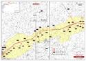
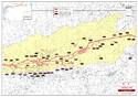
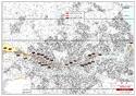
Maps
Disclaimer
The Nomination files produced by the States Parties are published by the World Heritage Centre at its website and/or in working documents in order to ensure transparency, access to information and to facilitate the preparations of comparative analysis by other nominating States Parties.
The sole responsibility for the content of each Nomination file lies with the State Party concerned. The publication of the Nomination file, including the maps and names, does not imply the expression of any opinion whatsoever of the World Heritage Committee or of the Secretariat of UNESCO concerning the history or legal status of any country, territory, city or area or of its boundaries.