Amami-Oshima Island, Tokunoshima Island, Northern part of Okinawa Island, and Iriomote Island
Multiple Locations (5)
| ID | Name & Location | State Party | Coordinates | Property | Buffer Zone |
|---|---|---|---|---|---|
| 1574-001 | Amami-Oshima Island | Japan |
N28 16 44.96 E129 22 41.87 |
11,640 ha | 14,663 ha |
| 1574-002 | Tokunoshima Island (a) | Japan |
N27 45 48.12 E128 58 1.95 |
1,724 ha | 1,813 ha |
| 1574-003 | Tokunoshima Island (b) | Japan |
N27 51 48.39 E128 55 46.19 |
791 ha | 999 ha |
| 1574-004 | Northern part of Okinawa Island | Japan |
N26 43 29.21 E128 13 12.38 |
7,721 ha | 3,398 ha |
| 1574-005 | Iriomote Island | Japan |
N24 19 34.25 E123 48 31.47 |
20,822 ha | 3,594 ha |
Maps
| Date | Title | |
|---|---|---|
|
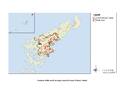
2021 | Amami-Oshima Island, Tokunoshima Island, Northern part of Okinawa Island, and Iriomote Island - maps of the inscribed property |
Disclaimer
The Nomination files produced by the States Parties are published by the World Heritage Centre at its website and/or in working documents in order to ensure transparency, access to information and to facilitate the preparations of comparative analysis by other nominating States Parties.
The sole responsibility for the content of each Nomination file lies with the State Party concerned. The publication of the Nomination file, including the maps and names, does not imply the expression of any opinion whatsoever of the World Heritage Committee or of the Secretariat of UNESCO concerning the history or legal status of any country, territory, city or area or of its boundaries.