Wadi Rum Protected Area
Wadi Rum Protected Area
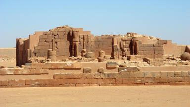
The 74,000-hectare property, inscribed as a mixed natural and cultural site, is situated in southern Jordan, near the border with Saudi Arabia. It features a varied desert landscape consisting of a range of narrow gorges, natural arches, towering cliffs, ramps, massive landslides and caverns. Petroglyphs, inscriptions and archaeological remains in the site testify to 12,000 years of human occupation and interaction with the natural environment. The combination of 25,000 rock carvings with 20,000 inscriptions trace the evolution of human thought and the early development of the alphabet. The site illustrates the evolution of pastoral, agricultural and urban activity in the region.
Description is available under license CC-BY-SA IGO 3.0
Zone protégée du Wadi Rum
Ce bien couvrant 74 000 hectares, inscrit comme site mixte naturel et culturel, se trouve au sud de la Jordanie, près de la frontière avec l'Arabie saoudite. Il s'agit d'un paysage désertique très spectaculaire, avec des canyons, des arches naturelles, des falaises, des rampes et des grottes. La présence de pétroglyphes, d'inscriptions gravées et de vestiges archéologiques témoigne de 12 000 ans d'occupation humaine et d'interaction avec l'environnement naturel. La combinaison de 25 000 pétroglyphes et de 20 000 inscriptions retrace l'évolution de la pensée humaine et les débuts de l'écriture alphabétique. Le site illustre l'évolution des activités pastorales, agricoles et urbaines dans la région.
Description is available under license CC-BY-SA IGO 3.0
محمية وادي رم
موقع مختلط، طبيعي وثقافي في آن، تبلغ مساحته 000 74 هكتار. وتقع منطقة وادي رم جنوب الأردن بالقرب من الحدود الأردنية السعودية وهي عبارة عن صحراء متنوعة التضاريس تشمل مجموعة من الأودية الضيقة والأقواس الطبيعية والمنحدرات الشاهقة والطرق المنحدرة، فضلاً عن أكوام كبيرة من الصخور المنهارة وعدد من الكهوف. وتشهد النقوش والرسوم على الصخور والبقايا الأثرية الموجودة في الموقع على ما عرفته منطقة وادي رم من مستوطنات بشرية وتفاعل بين الإنسان والبيئة الطبيعية على مدى 000 12 سنة. وعُثر في الموقع على 000 25 منحوتة صخرية و000 20 نقش على الصخور تقف شاهداً على تطوُّر الفكر البشري والمراحل الأولى لتطوير الأبجدية. ويجسد هذا الموقع تطوُّر الفلاحة والزراعة والحياة الحضرية في المنطقة.
source: UNESCO/CPE
Description is available under license CC-BY-SA IGO 3.0
瓦迪拉姆保护区
作为自然与文化混合遗产列入名录,位于约旦南部,靠近沙特阿拉伯边界,占地74000公顷。瓦迪拉姆保护区一系列形态各异的沙漠景观由狭窄的峡谷、天然拱门、高耸的峭壁、坡道、巨型滑坡和洞穴所组成。保护区内的岩画、碑文和考古遗迹显示了人类在过去12 000年的时间里在此的生活,以及与自然环境互动的证据。25000个石刻与20000个碑文为追溯人类思想的发展及早期字母的演变提供了可能。遗址展现了该地区牧业、农业和城市活动的发展。
source: UNESCO/CPE
Description is available under license CC-BY-SA IGO 3.0
Охраняемый район Вади Рам
Объект с населением в 74000 человек предлагается для занесения в Список по категории смешанных природно-культурных объектов. Он расположен в южной части Иордании, невдалеке от границы с Саудовской Аравией. Его пустынный ландшафт отличается значительным разнообразием: здесь встречаются узкие ущелья, природные арки, высокие скалы, пандусы, массивные оползни и пещеры. Обнаруженные здесь петроглифы, надписи и археологические памятники хранят свидетельства 12000-летнего обитания здесь людей и их взаимодействия с окружающей природной средой. 25000 наскальных рисунков и 20000 надписей позволяют проследить эволюцию человеческой мысли и ранние стадии развития алфавита. На объекте также сохранились следы, рассказывающие об эволюции пастбищной и земледельческой деятельности и зачатках городской жизни в этом регионе.
source: UNESCO/CPE
Description is available under license CC-BY-SA IGO 3.0
Zona Protegida del Uadi Rum
El sitio abarca una zona de 74.000 hectáreas situada al sur de Jordania, cerca de la frontera con Arabia Saudita. Su variado paisaje desértico está formado por una serie de cañones, arcos naturales, farallones, rampas, grutas y grandes derrumbamientos de terreno. Los vestigios de petroglifos e inscripciones, así como los restos arqueológicos subsistentes en el sitio, constituyen un testimonio de doce milenios de ocupación de sus parajes por el ser humano y de la interacción de éste con el medio ambiente. Los 25.000 petroglifos y las 20.000 inscripciones existentes ilustran la evolución del pensamiento humano y los comienzos de la escritura alfabética. El sitio es también ilustrativo de la evolución de las actividades pastorales, agrícolas y urbanas en la región.
source: UNESCO/CPE
Description is available under license CC-BY-SA IGO 3.0
ワディ・ラム保護地域
この遺産は、ヨルダン南部、サウジアラビア国境付近に位置する74,000haの地域である。狭隘な渓谷、自然に形成された岩石のアーチ、切り立った崖や傾斜地、大規模な地すべり地形や大きな洞窟など、変化に富んだ砂漠の景観がある。岩絵や碑文、その他の考古学的遺跡群は、約1万2000年にわたり人間と自然が共存してきたことを証明している。約25,000の岩面彫刻と約20、000の碑文の組み合わせは、人間の思考の発展と文字の初期段階を解明でき、この地方の牧畜、農業、都市生活の進化の過程を示している。source: NFUAJ
Beschermd gebied Wadi Rum
Dit natuur- en cultuurgebied van 74.000 hectare ligt in het zuiden van Jordanië, vlak bij de grens met Saoedi-Arabië. Het beschikt over een gevarieerd woestijnlandschap dat bestaat uit een reeks smalle kloven, natuurlijke bogen, torenhoge kliffen, hellingen, enorme landverschuivingen en grotten. De rotstekeningen, inscripties en archeologische overblijfselen in dit gebied getuigen van 12.000 jaar menselijke bewoning en interactie met de natuurlijke omgeving. De combinatie van 25.000 rotstekeningen met 20.000 inscripties traceren de evolutie van het menselijk denken en de vroege ontwikkeling van het alfabet. Het gebied illustreert de evolutie van pastorale en stedelijke activiteit en van landbouw in de regio.
Source: unesco.nl

Outstanding Universal Value
Brief synthesis
Wadi Rum Protected Area (WRPA) is located in the southern part of Jordan, east of the Rift Valley and south of the steep escarpment of the central Jordanian plateau. It comprises an area of 74,200 hectares. WRPA’s natural values include desert landforms developed within continental sandstones. These landforms have been developed under the influence of a combination of various controlling factors, such as lithology, tectonic activities (including rapid uplift, numerous faults and joints) and surface processes (including various types of weathering and erosion associated with desert climate as well as humid climates in the past), representing million years of ongoing landscape evolution.
Widespread petroglyphs, inscriptions and archaeological remains testify to 12,000 years of human occupation and interaction with the natural environment, illustrating the evolution of pastoral, agricultural and urban human activity in the Arabian Peninsula and the environmental history of the region.
Criterion (iii): The rock art, inscriptions and archaeological evidence in WRPA can be considered an exceptional testimony of the cultural traditions of its early inhabitants. The combination of 25,000 petroglyphs, 20,000 inscriptions, and 154 archaeological sites provides evidence to continuity of habitation and land-use over a period of at least 12,000 years. The petroglyphs, representing human and animal figures, are engraved on boulders, stones, and cliff faces. They provide evidence of long-term patterns of pastoral, agricultural and urban human activity in the property. Engravings indicate an elaborate sense of aesthetics in a pictorial culture, and the archaeological findings span all eras from the Neolithic to the Nabataean. Thamudic, Nabataean and numerous Arabic inscriptions in four different scripts testify to the widespread literacy among its pastoral societies.
Criterion (v): The variety of landforms at WRPA has played an essential role in fostering human settlement. The rock art, inscriptions and water catchment systems document the settlements of successive communities, which developed in areas of mobile animal husbandry and agriculture and form part of a wider context of human interaction with the semi-arid eastern desert environment of the Arabian Peninsula. WRPA assists the understanding of the continuum of settled and mobile lifestyles in a desert landscape illustrating the adaptability and ingenuity of human communities who have made the most of scarce resources to sustain continuous presence after the climate became dryer in the Bronze Age (3rd millennium BC).
Criterion (vii): WRPA is recognised globally as an iconic desert landscape, renowned for its spectacular series of sandstone mountains and valleys, natural arches, and the range of narrow gorges, towering cliffs, massive landslides, and dramatic cavernous weathering forms displayed. Key attributes of the aesthetic values of the property include the diversity and sheer size of its landforms, together with the mosaic of colours, vistas into both narrow canyons and very large wadis, and the scale of the cliffs. The property displays, in a protected setting, an exceptional combination of landforms resulting from drainage incision, severe weathering by salt, biological and other processes, and the undermining of steep sandstone cliffs by these weathering processes, together with the world’s most spectacular networks of honeycomb weathering features. Its associations with the writings of T.E. Lawrence, stressed strongly in the nomination, have ensured a high profile for the property and have reinforced its reputation of the area as a classic desert landscape both globally and within the Arab States.
Integrity
Since the identification of Wadi Rum as a potential nature reserve in 1978 the various landforms and cultural resources have been managed in a shared framework, which prevented extensive development impacts and maintained the landscape character of the property. The buffer zone of Rum Village contains significant cultural property values and the cultural landscape character of the property reaches even beyond the mostly 5 kilometers perimeter of the buffer zone.
Authenticity
The rock art remains in its original setting, largely unaltered except for the effects of weathering, which has led to its fading as result of rain and wind erosion, leaving some petroglyphs hard to distinguish. In addition modern graffiti has a negative impact on several of the original drawings and inscriptions. However, the fact that so many petroglyphs and inscriptions have been documented means that their ability to convey the cultural traditions of the people who made them continues and that they qualify as an important resource for research.
Protection and management requirements
WRPA was established in 1997 following cabinet decision no. 27/11/3226 (1997) and extended in 2002, following decision 224/11/1/986 (2002). It is further recognized as an archaeological site under the Law of the Department of Antiquities no. 21 (1988) and constitutes a Special Regulation Area under the Administration of the Aqaba Special Economic Zone. In addition to the existing protection for the property, special consideration may need to be given to archaeological artefacts to prevent their removal from the property.
The primary plan guiding the management and development program of WRPA is the Aqaba Special Economic Zone land use plan, which covers the whole governorate of Aqaba and is administrated by the Aqaba Special Economic Zone Authority. The property has an up to date management plan and an effective management unit, including rangers and other staff is dedicated to the management of the property. The management plan should provide emphasis to the management of the natural and cultural values of the property. A comprehensive survey and inventory of the natural and cultural resources, conservation and interpretation programme of the values of the property, and cooperation with antiquity authorities as management partners are all required. The WRPA requires continuous monitoring, preventive conservation of natural and cultural resources, and periodic updating of the management plan.
A number of threats that have been identified require careful attention. In this context priority should be given to the impacts of visitor pressure, in particular car tracks and tourism infrastructure, but also the potential encroachment of the village of Rum, groundwater exploitation and firewood collection by local people. The wider tourism and planning policies for the property, its buffer zone and wider setting also should prioritise the protection of its Outstanding Universal Value.

Protections
by other conservation instruments
1 protection / 1 element
2003 Convention for the Safeguarding of the Intangible Cultural Heritage (1 element)