Print
Share on social media
Facebook TwitterUNESCO social media
Facebook Youtube Twitter RSS World Heritage Terms / Policies SyndicationWestern Ghats
Multiple Locations (39)
| ID | Name & Location | State Party | Coordinates | Property | Buffer Zone |
|---|---|---|---|---|---|
| 1342rev-001 | Kalakad-Mundanthurai Tiger Reserve | India |
N8 31 47.00 E77 14 59.00 |
89,500 ha | |
| 1342rev-002 | Shendurney Wildlife Sanctuary | India |
N8 31 47.00 E77 14 59.00 |
17,100 ha | |
| 1342rev-003 | Neyyar Wildlife Sanctuary | India |
N8 31 47 E77 14 59 |
12,800 ha | |
| 1342rev-004 | Peppara Wildlife Sanctuary | India |
N8 31 47.00 E77 14 59.00 |
5,300 ha | |
| 1342rev-005 | Kulathupuzha Range | India |
N8 31 47.00 E77 14 59.00 |
20,000 ha | |
| 1342rev-006 | Palode Range | India |
N8 31 47.00 E77 14 59.00 |
16,500 ha | |
| 1342rev-007 | Periyar Tiger Reserve | India |
N9 29 8.00 E77 12 36.00 |
77,700 ha | |
| 1342rev-008 | Ranni Forest Division | India |
N9 29 8.00 E77 12 36.00 |
82,853 ha | |
| 1342rev-009 | Konni Forest Division | India |
N9 29 8.00 E77 12 36.00 |
26,143 ha | |
| 1342rev-010 | Achankovil Forest Division | India |
N9 29 8.00 E77 12 36.00 |
21,990 ha | |
| 1342rev-011 | Srivilliputtur Wildlife Sanctuary | India |
N9 29 8.00 E77 12 36.00 |
48,500 ha | |
| 1342rev-012 | Tirunelveli (North) Forest Division (part) | India |
N9 29 8.00 E77 12 36.00 |
23,467 ha | |
| 1342rev-013 | Eravikulam National Park (and proposed extension) | India |
N10 13 4.00 E77 10 48.00 |
12,700 ha | |
| 1342rev-014 | Grass Hills National Park | India |
N10 23 4.00 E77 10 48.00 |
3,123 ha | |
| 1342rev-015 | Karian Shola National Park | India |
N10 23 4.00 E77 10 48.00 |
503 ha | |
| 1342rev-016 | Karian Shola (part of Parambikulam Wildlife Sanctuary) | India |
N10 23 4.00 E77 10 48.00 |
377 ha | |
| 1342rev-017 | Mankulam Range | India |
N10 23 4.00 E77 10 48.00 |
5,284 ha | |
| 1342rev-018 | Chinnar Wildlife Sanctuary | India |
N10 23 4.00 E77 10 48.00 |
9,044 ha | |
| 1342rev-019 | Mannavan Shola | India |
N10 23 4.00 E77 10 48.00 |
1,126 ha | |
| 1342rev-020 | Silent Valley National Park | India |
N11 19 50.00 E76 18 34.00 |
8,952 ha | |
| 1342rev-021 | New Amarambalam Reserved Forest | India |
N11 19 50.00 E76 18 34.00 |
24,697 ha | |
| 1342rev-022 | Mukurti National Park | India |
N11 19 50.00 E76 18 34.00 |
7,850 ha | |
| 1342rev-023 | Kalikavu Range | India |
N11 19 50 E76 18 34 |
11,705 ha | |
| 1342rev-024 | Attapadi Reserved Forest | India |
N11 19 50.00 E76 18 34.00 |
6,575 ha | |
| 1342rev-025 | Pushpagiri Wildlife Sanctuary | India |
N12 32 47.00 E75 42 28.00 |
10,259 ha | |
| 1342rev-026 | Brahmagiri Wildlife Sanctuary | India |
N12 32 47.00 E75 42 28.00 |
18,129 ha | |
| 1342rev-027 | Talacauvery Wildlife Sanctuary | India |
N12 32 47.00 E75 42 28.00 |
10,500 ha | |
| 1342rev-028 | Padinalknad Reserved Forest | India |
N12 32 47.00 E75 42 28.00 |
18,476 ha | |
| 1342rev-029 | Kerti Reserved Forest | India |
N12 32 47.00 E75 42 28.00 |
7,904 ha | |
| 1342rev-030 | Aralam Wildlife Sanctuary | India |
N12 32 47.00 E75 42 28.00 |
5,500 ha | |
| 1342rev-031 | Kudremukh National Park | India |
N13 29 59.00 E75 6 2.00 |
60,032 ha | |
| 1342rev-032 | Someshwara Wildlife Sanctuary | India |
N13 29 59.00 E75 6 2.00 |
8,840 ha | |
| 1342rev-033 | Someshwara Reserved Forest | India |
N13 29 59.00 E75 6 2.00 |
11,292 ha | |
| 1342rev-034 | Agumbe Reserved Forest | India |
N13 29 59.00 E75 6 2.00 |
5,709 ha | |
| 1342rev-035 | Balahalli Reserved Forest | India |
N13 29 59.00 E75 6 2.00 |
2,263 ha | |
| 1342rev-036 | Kas Plateau | India |
N17 10 18.00 E73 43 38.00 |
1,142 ha | |
| 1342rev-037 | Koyna Wildlife Sanctuary | India |
N17 10 18.00 E73 43 38.00 |
42,355 ha | |
| 1342rev-038 | Chandoli National Park | India |
N17 10 18.00 E73 43 38.00 |
30,890 ha | |
| 1342rev-039 | Radhanagari Wildlife Sanctuary | India |
N17 10 18.00 E73 43 38.00 |
28,235 ha |
Maps
| Date | Title | |
|---|---|---|
|
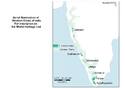
2012 | Western Ghats - Inscribed Property |
Disclaimer
The Nomination files produced by the States Parties are published by the World Heritage Centre at its website and/or in working documents in order to ensure transparency, access to information and to facilitate the preparations of comparative analysis by other nominating States Parties.
The sole responsibility for the content of each Nomination file lies with the State Party concerned. The publication of the Nomination file, including the maps and names, does not imply the expression of any opinion whatsoever of the World Heritage Committee or of the Secretariat of UNESCO concerning the history or legal status of any country, territory, city or area or of its boundaries.