Qal’at al-Bahrain – Ancient Harbour and Capital of Dilmun
Qal’at al-Bahrain – Ancient Harbour and Capital of Dilmun
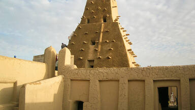
Qal’at al-Bahrain is a typical tell – an artificial mound created by many successive layers of human occupation. The strata of the 300 × 600 m tell testify to continuous human presence from about 2300 BC to the 16th century AD. About 25% of the site has been excavated, revealing structures of different types: residential, public, commercial, religious and military. They testify to the importance of the site, a trading port, over the centuries. On the top of the 12 m mound there is the impressive Portuguese fort, which gave the whole site its name, qal’a (fort). The site was the capital of the Dilmun, one of the most important ancient civilizations of the region. It contains the richest remains inventoried of this civilization, which was hitherto only known from written Sumerian references.
Description is available under license CC-BY-SA IGO 3.0
Qal’at al-Bahreïn – ancien port et capitale de Dilmun
Qal’at al-Bahreïn est un tell typique, c’est-à-dire une colline artificielle créée par plusieurs strates successives d’occupation humaine. La stratigraphie du tell de 300 m sur 600 atteste d’une présence humaine constante depuis environ 2300 av. J.-C. jusqu’au XVIe siècle de notre ère. Près d’un quart du site a déjà fait l’objet de fouilles, qui ont révélé des structures de types divers : résidentiel, public, commercial, religieux et militaire. Elles témoignent de l’importance du lieu, un port marchand, à travers les siècles. Au sommet de la colline de 12 m de hauteur se trouve un impressionnant fort portugais qui a donné son nom à l’ensemble du site (qal’a signifie fort). Le site est l’ancienne capitale de Dilmun, l’une des plus importantes civilisations antiques de la région. Il contient les plus riches vestiges répertoriés de cette civilisation, dont on n’avait auparavant connaissance qu’à travers les écrits sumériens.
Description is available under license CC-BY-SA IGO 3.0
قلعة البحرين- مرفأ قديم وعاصمة دلمون
إن قلعة البحرين تلّ نموذجي، أي أنه تلة مصنوعة نشأت بفضل طبقات متتالية من الأعمال البشرية. وتدلّ طبقات التلّ المتتالية من 300 متر حتى 600 متر على وجود بشري مستمرّ منذ حوالى 2300 سنة قبل الميلاد حتى القرن السادس عشر. لقد عرف حوالى ربع الموقع عمليات تنقيب أظهرت بنى متنوّعة : سكنية وعامة وتجارية ودينية وعسكرية. وهي تشهد على أهمية المكان الذي كان مرفاً تجارياً على مرور القرون. في قمة التلة التي ترتفع 12 متراً، توجد قلعة برتغالية رائعة أعطت اسمها لكل الموقع. والموقع هو عاصمة دلمون القديمة، وهي أحد أهمّ الحضارات القديمة في المنطقة. ويشمل الموقع أغنى الآثار المفهرسة (المسجلة) من هذه الحضارة التي لم نطّلع عليها في السابق إلا من خلال كتابات السومريين.
source: UNESCO/CPE
Description is available under license CC-BY-SA IGO 3.0
巴林贸易港考古遗址
位于巴林岛的卡拉特考古遗址是一个典型的台形土墩遗址,由连续许多层人类居住遗迹堆建而成的人工土墩。300×600米的土堆见证了从大约公元前2300年至公元16世纪人类一直在此居住的历史。遗址中已被挖掘的部分约占25%, 展示了不同类型的房屋结构: 包括住宅、公共设施、商业、宗教和军事设施。这些足以证明数世纪来这里作为通商口岸的重要性。在12米高的土墩之上是雄伟的葡萄牙堡垒,整个遗迹因此而得名“卡拉特”(qal'a),意即堡垒。该遗址是这一地区最重要的古代文明之一——迪尔蒙(Dilmun)文明的首都。这一文化至今只见于苏美尔文献记载中,但这一遗址却保存了其最丰富的遗迹。
source: UNESCO/CPE
Description is available under license CC-BY-SA IGO 3.0
Археологические памятники Калат-аль-Бахрейн
Калат-аль-Бахрейн – это типичный «телл», т.е. искусственный холм, образованный многими последовательными культурными наслоениями. Напластования данного «телла», имеющего размер 300 х 600 м свидетельствуют о непрерывном человеческом присутствии здесь приблизительно с 2300 г. до н.э. до ХVI в. н.э. Около 25% объекта уже раскопано, что открыло сооружения разного назначения: жилые, общественные, торговые, религиозные и военные. Эти находки подтвердили нахождение в данном месте в течение столетий важного торгового порта. На вершине 12-метрового холма находится внушительная португальская крепость, от которой произошло название всего объекта – «кала» (крепость). Именно здесь располагалась столица Дильмуна – государства, где сложилась одна из древних цивилизаций данного региона. Сохранилось богатейшее археологическое наследие, ярко характеризующее эту цивилизацию, которая ранее была известна только по письменным упоминаниям в шумерских источниках.
source: UNESCO/CPE
Description is available under license CC-BY-SA IGO 3.0
Qal’at Al Bahrein, antiguo puerto y capital de Dilmun
Qal’at al-Bahrein es un “tell” típico, esto es, una colina artificial con estratos formados por asentamientos humanos sucesivos. La estratigrafía de este altozano de 300 x 600 metros atestigua una presencia humana ininterrumpida desde 2.300 años a. C. hasta el siglo XVI de nuestra era. Se han efectuado excavaciones arqueológicas en un 25% de la superficie del sitio, lo que ha permitido descubrir estructuras de construcciones de diverso tipo: residenciales, públicas, comerciales, religiosas y militares. Todas ellas atestiguan la importancia de este puerto comercial a lo largo de los siglos. En lo alto de la colina de 12 metros de altura se yergue una impresionante fortaleza (“qal’a” en árabe) construida por los portugueses, que ha dado su nombre al sitio. En este “tell” estuvo asentada la capital de Dilmun, país donde floreció una de las civilizaciones antiguas más importantes de la región. En él se encuentran los vestigios más abundantes y valiosos de esta civilización descubiertos hasta la fecha, que hasta las excavaciones contemporáneas sólo era conocida por alusiones en fuentes escritas sumerias.
source: UNESCO/CPE
Description is available under license CC-BY-SA IGO 3.0
カルアト・アル-バフレーン -古代の港とディルムンの首都
source: NFUAJ
Qal'at al-Bahrein - de oude haven en hoofdstad van Dilmun
Source: unesco.nl

Outstanding Universal Value
Brief synthesis
Qal'at al-Bahrain: Ancient Harbour and Capital of Dilmun is an archaeological site comprising four main elements: an archaeological tell (an artificial hill formed over time by successive occupations) of over 16 hectares, immediately adjacent to the northern coast of Bahrain; a sea tower about 1600m North-West of the tell; a sea channel of just under 16 hectares through the reef near the sea tower, and palm-groves. The palm-groves and traditional agricultural gardens surround the site within the whole area of the land component of the buffer zone, being particularly noticeable on the Western and Northern sides, but also occurring on the Eastern and South-Eastern sides. The property is situated in the Northern Governorate, in Al Qalah village district on the northern coast about 5.5 km West of Manama, the present capital of Bahrain.
Qal'at al-Bahrain is an exceptional example of more or less unbroken continuity of occupation over a period of almost 4500 years, from about 2300 BC to the present, on the island of Bahrain. The archaeological tell, the largest known in Bahrain, is unique within the entire region of Eastern Arabia and the Persian Gulf as the most complete example currently known of a deep and intact stratigraphic sequence covering the majority of time periods in Bahrain and the Persian Gulf. It provides an outstanding example of the might of Dilmun, and its successors during the Tylos and Islamic periods, as expressed by their control of trade through the Persian Gulf. These qualities are manifested in the monumental and defensive architecture of the site, the wonderfully preserved urban fabric and the outstandingly significant finds made by archaeologists excavating the tell. The sea tower, probably an ancient lighthouse, is unique in the region as an example of ancient maritime architecture and the adjacent sea channel demonstrates the tremendous importance of this city in maritime trade routes throughout antiquity. Qal'at al-Bahrain, considered as the capital of the ancient Dilmun Empire and the original harbour of this long since disappeared civilisation, was the centre of commercial activities linking the traditional agriculture of the land (represented by the traditional palm-groves and gardens which date back to antiquity and still exist around the site) with maritime trade between such diverse areas as the Indus Valley and Mesopotamia in the early period (from the 3rd millennium BC to the 1st millennium BC) and China and the Mediterranean in the later period (from the 3rd to the 16th century AD). Acting as the hub for economic exchange, Qal'at al-Bahrain had a very active commercial and political presence throughout the entire region. The meeting of different cultures which resulted is expressed in the testimony of the successive monumental and defensive architecture of the site including an excavated coastal fortress dating from around the 3rd century AD and the large fortress on the tell itself dating from the 16th century which gives the site its name as Qal'at al-Bahrain, together with the wonderfully preserved urban fabric and the outstandingly significant and diverse finds demonstrating a mélange of languages, cultures and beliefs. For example, a madbasa (an architectural element used to produce date syrup) within the tell is one of the oldest in the world and reflects a link to the surrounding date palm-groves, demonstrating the continuity of traditional agricultural practices from the 1st millennium BC. The site, situated in a very strategic location, was an extremely significant part of the regional Gulf political network, playing a very active political role through many different time periods, which left traces throughout the different strata of the tell. Qal'at al-Bahrain is a unique example of a surviving ancient landscape with cultural and natural elements.
Criterion (ii): Being an important port city, where people and traditions from different parts of the then known world met, lived and practiced their commercial activities, makes the place a real meeting point of cultures - all reflected in its architecture and development. Being in addition, invaded and occupied for long periods, by most of the great powers and empires, leaved their cultural traces in different strata of the tell.
Criterion (iii): The site was the capital of one of the most important ancient civilizations of the region - the Dilmun civilization. As such this site is the best representative of this culture.
Criterion (iv): The palaces of Dilmun are unique examples of public architecture of this culture, which had an impact on architecture in general in the region. The different fortifications are the best examples of defence works from the 3rd century B.C to the 16th century AD, all on one site. The protected palm groves surrounding the site are an illustration of the typical landscape and agriculture of the region, since the 3rd century BC.
Integrity (2011)
With the extension of the site boundaries to include a second area to the World Heritage property comprising the ancient sea tower and the historic entrance channel (Decision 32 COM 8B.54), the known attributes that express Outstanding Universal Value are now within the property. The extension of the buffer zone by the same decision to include the visual corridor in the bay north of the site ensures that the relationship of the two parts of the property to each other and to the sea are maintained. The integration of this buffer zone into the National Planning and Development Strategies (2030) as a development exclusion zone endorsed by Royal Decree (November 2008) means that the exclusion corridor can only be crossed by a bridge at a minimal distance of 3 km to the shore (State Party's SoC report, 5 March 2009), thus ensuring that none of the attributes are threatended by development or neglect.
Apart from natural factors affecting the site through time, such as weathering, erosion, the harsh and windy climate, there have been no large impacts by either natural events or human actions. The many remaining structures as excavated are unaltered and have endured through 4 millennia, some walls still standing to a height of 4.5m. More than 85% of the tell is original and completely undisturbed. The surrounding adjacent landscape (both terrestrial and marine) is preserved and nearby developments, notably urban developments, have not compromised the visual or physical integrity of the property.
Authenticity (2005)
Authenticity is demonstrated by the long occupation sequence, expressed by the depth of the original stratigraphy, which is still in situ throughout the undisturbed part of the tell (less than 15% has been excavated). The original ensemble of structures, archaic urban fabric, tell, palm-groves and marine structures still exists and can be seen today to express the Outstanding Universal Value of the site in terms of form, materials and setting.
Protection and management requirements (2011)
The elements of Qal'at al-Bahrain are protected by laws (Law 11 of 1995, and Royal Decrees 21 of 1983, 26 of 2006 and 24 of 2008) in Bahrain. The tell is a National Monument (Ministerial Decree 1 of 1989). A zoning plan has been developed, in cooperation with other government departments, to control the height of surrounding buildings and the nature of future urban development, ensuring the maintenance of visual and physical integrity, including the visual corridor and marine elements added to the site by the World Heritage Committee in 2008 (32 COM 8B.54), and allowing for consultation with the managing bodies, the Directorate of Archaeology and Heritage and the Directorate of Museums in the Ministry of Culture, who monitor potential threats to the site and follow up conservation issues. The Directorate of Archaeology and Heritage needs to be consulted before any project is undertaken that threatens any archaeological site (Ministerial Order 1 of 1998). The site is fenced with on-site security. Visitor access is managed and monitored by the new on-site museum. The museum fulfils a very important role in the presentation/interpretation of the site and raises awareness of visitors, since it has been designed specifically to highlight the features of the Outstanding Universal Value of the property and surrounding buffer zone. No current excavation is allowed, but there are plans for the management of future excavations and a programme of underwater archaeology, including survey of the ancient channel. The village community situated on the southern boundary of the tell is being moved to a new location away from the site.


The Nomination files produced by the States Parties are published by the World Heritage Centre at its website and/or in working documents in order to ensure transparency, access to information and to facilitate the preparations of comparative analysis by other nominating States Parties.
The sole responsibility for the content of each Nomination file lies with the State Party concerned. The publication of the Nomination file, including the maps and names, does not imply the expression of any opinion whatsoever of the World Heritage Committee or of the Secretariat of UNESCO concerning the history or legal status of any country, territory, city or area or of its boundaries.