Soltaniyeh
Multiple Locations (14)
| ID | Name & Location | State Party | Coordinates | Property | Buffer Zone |
|---|---|---|---|---|---|
| 1188-001 | Soltaniyeh Dome | Iran (Islamic Republic of) |
N36 26 2.30 E48 47 45.70 |
14.8 ha | — |
| 1188-002 | Seh Tappeh | Iran (Islamic Republic of) |
N36 27 50.60 E48 47 10.50 |
0.35 ha | 3.48 ha |
| 1188-003 | Tappeh Qal'eh | Iran (Islamic Republic of) |
N36 27 13.10 E48 46 57.90 |
5.9 ha | 21.9 ha |
| 1188-004 | Karvangah | Iran (Islamic Republic of) |
N36 26 51.20 E48 49 49.20 |
1.2 ha | 21.6 ha |
| 1188-005 | Chelebi Oghlu | Iran (Islamic Republic of) |
N36 25 50.60 E48 47 10.70 |
0.28 ha | 7.04 ha |
| 1188-006 | Qush Khaneh | Iran (Islamic Republic of) |
N36 25 15.00 E48 47 19.30 |
1.47 ha | 3.5 ha |
| 1188-007 | Mollah Hassan Kashi Tomb | Iran (Islamic Republic of) |
N36 25 3.40 E48 47 40.90 |
0.05 ha | 2.5 ha |
| 1188-008 | Ruins and kilns | Iran (Islamic Republic of) |
N36 25 9.20 E48 47 55.60 |
1.23 ha | 31.42 ha |
| 1188-009 | Tappeh Dur | Iran (Islamic Republic of) |
N36 26 21.80 E48 46 57.30 |
0.3 ha | 258.28 ha |
| 1188-010 | Emamzadeh Dur | Iran (Islamic Republic of) |
N36 26 18.30 E48 46 59.00 |
0.006 ha | — |
| 1188-011 | Fenjanabad | Iran (Islamic Republic of) |
N36 26 14.90 E48 48 39.90 |
3.42 ha | — |
| 1188-012 | Tappeh Nur Kuchak (not marked but the only unmarked site is 303300 4033850) | Iran (Islamic Republic of) |
N36 25 47.00 E48 48 20.60 |
1.2 ha | — |
| 1188-013 | Tappeh Nur (TombTower) | Iran (Islamic Republic of) |
N36 25 37.30 E48 48 7.30 |
1.8 ha | — |
| 1188-014 | Soltaniyeh pasture including Mostafa Khan site | Iran (Islamic Republic of) |
N36 26 39.00 E48 49 1.30 |
758.14 ha | — |
Maps
| Date | Title | |
|---|---|---|
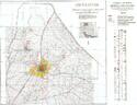
|
2005 | Soltaniyeh |
Disclaimer
The Nomination files produced by the States Parties are published by the World Heritage Centre at its website and/or in working documents in order to ensure transparency, access to information and to facilitate the preparations of comparative analysis by other nominating States Parties.
The sole responsibility for the content of each Nomination file lies with the State Party concerned. The publication of the Nomination file does not imply the expression of any opinion whatsoever of the World Heritage Committee or of the Secretariat of UNESCO concerning the history or legal status of any country, territory, city or area or of its boundaries.