Dorset and East Devon Coast
Multiple Locations (8)
| ID | Name & Location | State Party | Coordinates | Property | Buffer Zone |
|---|---|---|---|---|---|
| 1029-001 | Orcombe Rocks to Chit Rocks, Sidmouth | United Kingdom of Great Britain and Northern Ireland |
N50 39 37.00 W3 16 38.40 |
— | |
| 1029-002 | River Sid, Sidmouth to Seaton Hole | United Kingdom of Great Britain and Northern Ireland |
N50 41 13.40 W3 7 35.50 |
— | |
| 1029-003 | River Axe, Axmouth to The Cobb, Lyme Regis | United Kingdom of Great Britain and Northern Ireland |
N50 42 20.00 W2 59 23.60 |
— | |
| 1029-004 | Lyme Regis to West Bay | United Kingdom of Great Britain and Northern Ireland |
N50 43 20.10 W2 50 31.10 |
— | |
| 1029-005 | Chesil, the Fleet and Portland Coast | United Kingdom of Great Britain and Northern Ireland |
N50 37 52.90 W2 34 10.60 |
— | |
| 1029-006 | Portland Harbour Shore | United Kingdom of Great Britain and Northern Ireland |
N50 35 44.80 W2 27 29.60 |
— | |
| 1029-007 | Bowleaze Cove to Peveril Point | United Kingdom of Great Britain and Northern Ireland |
N50 36 54.20 W2 9 54.50 |
— | |
| 1029-008 | New Swanage to Studland Bay | United Kingdom of Great Britain and Northern Ireland |
N50 38 17.60 W1 55 37.60 |
— |
Maps
| Date | Title | |
|---|---|---|
|
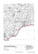
2000 | Dorset and East Devon Coast World Heritage Site: set of 8 maps |
Disclaimer
The Nomination files produced by the States Parties are published by the World Heritage Centre at its website and/or in working documents in order to ensure transparency, access to information and to facilitate the preparations of comparative analysis by other nominating States Parties.
The sole responsibility for the content of each Nomination file lies with the State Party concerned. The publication of the Nomination file, including the maps and names, does not imply the expression of any opinion whatsoever of the World Heritage Committee or of the Secretariat of UNESCO concerning the history or legal status of any country, territory, city or area or of its boundaries.