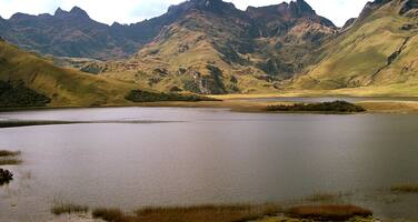
Sangay National Park
Factors affecting the property in 2007*
- Ground transport infrastructure
- Illegal activities
- Land conversion
- Livestock farming / grazing of domesticated animals
Factors* affecting the property identified in previous reports
a) Poaching,
b) Illegal livestock grazing,
c) Encroachment along the Park's perimeter,
d) Unplanned road construction.
UNESCO Extra-Budgetary Funds until 2007
Total amount provided to the property: USD 80,000
International Assistance: requests for the property until 2007
Total amount approved : 58,500 USD
| 1993 | Equipement for Sangay National Park (Approved) | 28,500 USD |
| 1985 | Public awareness programmes for local communities and ... (Approved) | 30,000 USD |
Missions to the property until 2007**
IUCN mission 1999; IUCN mission 2005
Conservation issues presented to the World Heritage Committee in 2007
The World Heritage Centre received a draft report from the State Party in Spanish in response to the World Heritage Committee Decision 30 COM 7B.30. No final version of this report has been received. The report focuses on advances in the implementation of the updated management plan for Sangay National Park, with particular attention on land tenure and economic development alternatives for communities in the property’s buffer zone.
Nine new park conservation officers have been hired by the management authority in the past year, with support from a project financed by Gordon and Betty Moore. This project will also provide financing in 2007 for the construction of five monitoring stations, the acquisition and maintenance costs of four vehicles along with basic conservation officer field equipment, and radio communication equipment, the latter provided following an in-depth analysis of communication needs. Upgrading of signage and existing monitoring stations has also been carried out, with the support of the Peruvian National Environment Fund.
An analysis of environmental changes in a 24,000 hectare quadrant along the Guamote-Macas road area (most of which is near, but outside of the property), from 1987-2003 was carried out with support from the United Nations Foundation financed Enhancing our Heritage project. (administered by the World Heritage Centre). Results using remote sensing, show that road construction has led to a 4% loss of forest cover in this zone (1,069 hectare loss), but also indicate forest regrowth along the road. Lands being used for agricultural and pastoral activities have increased by 10% in this zone, resulting from activities centered on two settlements in the area.
Economic development alternatives have been sought through the “Sangay Project” in both high and low altitude areas and with different ethnic groups (Quecha, Shuara and Mestizo). The project is focusing on training for local guides, grassland management, agroforestry development and support for the creation of local handcrafts. The report states that results are limited due to the relatively small scale of the project and the large expanse of the park.
Environmental education and institutional strengthening activities involving these communities, and local organizations are also being carried out. These included guided visits for locals, the broadcasting of films, traveling exhibits and the publication of leaflets. There has been a strong emphasis on reaching out to people within the Amazon zone of the park, with the development of a manual for environmental Education for school children, financed by Fundacion Natura.
In regards to land use tenure issues, the report states that there is very little human presence in the World Heritage property, with a total of 600 hectares, or approximately 0.2% of the property lands having been attributed to communities or families by way of historical grants. The Ministry of the Environment has focused attention on the Guamote-Macas road in relation to land tenure issues in an effort to ensure that further migration to this zone is halted. A cadastre was produced for lands bordering the road and the information so gathered was also used by the National Institute for Agricultural Development to resolve land use conflicts. Alternative land use regimes are now being promoted in this area, focusing on sustainable resource use and the control of deforestation. The report notes that 15,659 ha along the road have been formally removed from national park status following a negotiation process with local communities. As the road passes through both the World Heritage inscribed and non-inscribed portions of the park, it is not clear from the report how much of this is affecting the actual property. This requires clarification.
The Enhancing our Heritage project has also supported the design and implementation of a monitoring system for watersheds and lake systems in the property. This work will lead to the proposal for inscription of portions of the property under the Ramsar convention for wetlands.
Summary of the interventions
Decisions adopted by the Committee in 2007
31 COM 7B.40
Sangay National Park (Ecuador)
The World Heritage Committee,
1. Having examined Document WHC-07/31.COM/7B,
2. Having noted that the report submitted to the World Heritage Centre is labelled as a draft report, and regretting that the report submitted to the World Heritage Centre was not in one of the two working languages of the World Heritage Committee,
3. Commends the State Party for the progress made in some fields such as staffing, the development of economic alternatives and environmental education;
4. Requests the State Party to provide full details on the apparent proposed reduction of the area of the property, in accordance with Paragraphs 163-165 of the Operational Guidelines, along with an updated map illustrating clear boundaries, by 1 February 2008, for examination by the Committee at its 32nd session in 2008.
Draft Decision: 31 COM 7B.40
The World Heritage Committee,
1. Having examined Document WHC-07/31.COM/7B,
2. Having noted that the report submitted to the World Heritage Centre is labelled as a draft report,
3. Regrets that the report submitted to the World Heritage Centre was not in one of the two working languages of the World Heritage Committee,
4. Requests the State Party to provide full details on the apparent proposed reduction of the area of the property, in accordance with Paragraphs 163-165 of the Operational Guidelines, along with an updated map illustrating clear boundaries, by 1 February 2008, for examination by the Committee at its 32nd session in 2008.
 Ecuador
Exports
* :
The threats indicated are listed in alphabetical order; their order does not constitute a classification according to the importance of their impact on the property.
Furthermore, they are presented irrespective of the type of threat faced by the property, i.e. with specific and proven imminent danger (“ascertained danger”) or with threats which could have deleterious effects on the property’s Outstanding Universal Value (“potential danger”).
** : All mission reports are not always available electronically.

