Proposed for examination in 2022
Nominations to be examined
Cultural properties
Cultural Landscape of Old Tea Forests of the Jingmai Mountain in Pu’er
Located on Jingmai Mountain in southwestern China, this cultural landscape was developed over a thousand years by the Blang and Dai peoples following practices that began in the 10th century. The property is a tea production area comprised of traditional villages within old tea groves surrounded by forests and tea plantations. The traditional understorey cultivation of old tea trees is a method that responds to the specific conditions of the mountain’s ecosystem and subtropical monsoon climate, combined with a governance system maintained by the local Indigenous communities. Traditional ceremonies and festivities relate to the Tea Ancestor belief that spirits live in the tea plantations and in the local fauna and flora, a belief that is at the core of this cultural tradition.Deer Stone Monuments and Related Bronze Age Sites
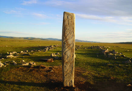
Located on the slopes of the Khangai Ridge in central Mongolia, these deer stones were used for ceremonial and funerary practices. Dating from about 1200 to 600 BCE, they stand up to four metres tall and are set directly in the ground as single standing stones or in groups, and are almost always located in complexes that include large burial mounds called khirgisüürs and sacrificial altars. Covered with highly stylized or representational engravings of stags, deer stones are the most important surviving structures belonging to the culture of Eurasian Bronze Age nomads that evolved and then slowly disappeared between the 2nd and 1st millennia BCE.Gaya Tumuli
This serial property includes archaeological cemetery sites with burial mounds attributed to the Gaya Confederacy, which developed in the southern part of the Korean Peninsula from the 1st to the 6th century CE. Through their geographical distribution and landscape characteristics, types of burials, and grave goods, the cemeteries attest to the distinctive Gaya political system in which polities existed as autonomous political equals while sharing cultural commonalities. The introduction of new forms of tombs and the intensification of the spatial hierarchy in the tumuli sites reflect the structural changes experienced by Gaya society during its history.Gordion
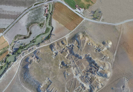
Located in an open rural landscape, the archaeological site of Gordion is a multi-layered ancient settlement, encompassing the remains of the ancient capital of Phrygia, an Iron Age independent kingdom. The key elements of this archaeological site include the Citadel Mound, the Lower Town, the Outer Town and Fortifications, and several burial mounds and tumuli with their surrounding landscape. Archaeological excavations and research have revealed a wealth of remains that document construction techniques, spatial arrangements, defensive structures, and inhumation practices that shed light on Phrygian culture and economy.Historic center of Gorokhovets
Jewish-Medieval Heritage of Erfurt
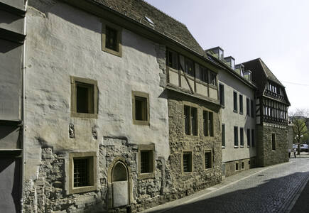
Located in the medieval historic centre of Erfurt, the capital city of Thuringia, the property comprises three monuments: the Old Synagogue, the Mikveh, and the Stone House. They illustrate the life of the local Jewish community and its coexistence with a Christian majority in Central Europe during the Middle Ages, between the end of the 11th and the mid-14th century.Koh Ker: Archaeological Site of Ancient Lingapura or Chok Gargyar
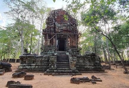
The archaeological site of Koh Ker is a sacred urban ensemble of numerous temples and sanctuaries including sculptures, inscriptions, wall paintings, and archaeological remains. Constructed over a twenty-three-year period, it was one of two rival Khmer Empire capitals – the other being Angkor – and was the sole capital from 928 to 944 CE. Established by King Jayavarman IV, his sacred city was believed to be laid out on the basis of ancient Indian religious concepts of the universe. The new city demonstrated unconventional city planning, artistic expression and construction technology, especially the use of very large monolithic stone blocks.Modernist Kaunas: Architecture of Optimism, 1919-1939
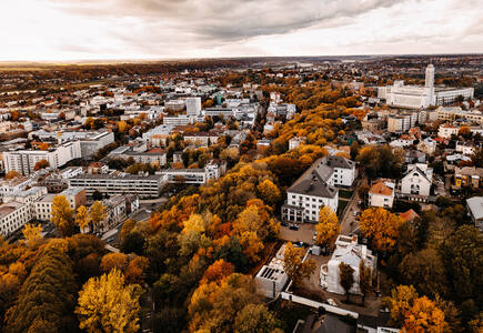
This property testifies to the rapid urbanization that transformed the provincial town of Kaunas into a modern city that became Lithuania’s provisional capital between the First and Second World Wars. Its community-driven transformation of an urban landscape was adapted from an earlier town layout. The quality of modern Kaunas was manifested through the spatial organization of the Naujamiestis (New Town) and Žaliakalnis (Green Hill) areas, and in public buildings, urban spaces and residences constructed during the interwar period that demonstrate a variety of styles in which the Modern Movement found architectural expression in the city.National Archaeological Park Tak’alik Ab’aj
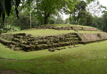
Tak’alik Ab’aj is an archaeological site located on the Pacific Coast of Guatemala. Its 1,700-year history spans a period that saw the transition from the Olmec civilization to the emergence of Early Mayan culture. Tak’alik Ab’aj had a primary role in this transition, in part because it was vital to the long-distance trade route that connected the Isthmus of Tehuantepec in today's Mexico to present-day El Salvador. Ideas and customs were shared extensively along this route. Sacred spaces and buildings were laid out according to cosmological principles, and innovative water management systems, ceramics, and lapidary art can be found. Today, Indigenous groups of different affiliations still consider the site a sacred place and visit it to perform rituals.Old town of Kuldīga
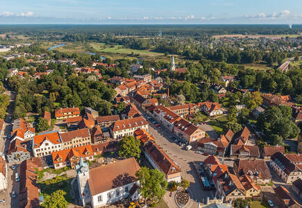
Located in the western part of Latvia, the town of Kuldīga is an exceptionally well-preserved example of a traditional urban settlement, which developed from a small medieval hamlet into an important administrative centre of the Duchy of Courland and Semigallia between the 16th and 18th centuries. The town structure of Kuldīga has largely retained the street layout of that period, and includes traditional log architecture as well as foreign-influenced styles that illustrate the rich exchange between local and travelling craftspeople from around the Baltic Sea. The architectural influences and craftsmanship traditions introduced during the period of the Duchy endured well into the 19th century.Santiniketan
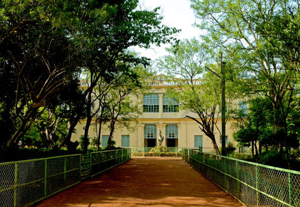
Established in rural West Bengal in 1901 by the renowned poet and philosopher Rabindranath Tagore, Santiniketan was a residential school and centre for art based on ancient Indian traditions and a vision of the unity of humanity transcending religious and cultural boundaries. A ‘world university’ was established at Santiniketan in 1921, recognizing the unity of humanity or “Visva Bharati”. Distinct from the prevailing British colonial architectural orientations of the early 20th century and of European modernism, Santiniketan represents approaches toward a pan-Asian modernity, drawing on ancient, medieval and folk traditions from across the region.Silk Roads: Zarafshan-Karakum Corridor
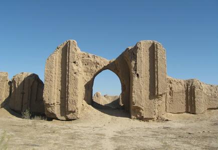
The Zarafshan-Karakum Corridor is a key section of the Silk Roads in Central Asia that connects other corridors from all directions. Located in rugged mountains, fertile river valleys, and uninhabitable desert, the 866-kilometre corridor runs from east to west along the Zarafshan River and further southwest following the ancient caravan roads crossing the Karakum Desert to the Merv Oasis. Channelling much of the east-west exchange along the Silk Roads from the 2nd century BCE to the 16th century CE, a large quantity of goods was traded along the corridor. People travelled, settled, conquered, or were defeated here, making it a melting pot of ethnicities, cultures, religions, sciences, and technologies.Talayotic Menorca
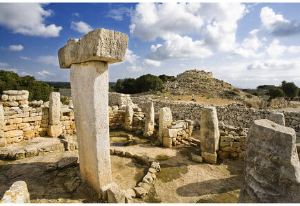
Located on the island of Menorca in the western Mediterranean Sea, these archaeological sites are situated in agro-pastoral landscapes. A testimony to the occupation of the island by prehistoric communities, these sites display a diversity of prehistoric settlements and burial places. The materials, forms and locations of structures dating from the Bronze Age (1600 BCE) to the Late Iron Age (123 BCE) show the evolution of a “cyclopean” architecture built with very large blocks of stone. Astronomical orientations and visual interconnections between prehistoric structures indicate networks with possible cosmological meanings.The Gedeo Cultural Landscape
The property lies along the eastern edge of the Main Ethiopian Rift, on the steep escarpments of the Ethiopian highlands. An area of agroforestry, it utilizes multilayer cultivation with large trees sheltering indigenous enset, the main food crop, under which grow coffee and other shrubs. The area is densely populated by the Gedeo people whose traditional knowledge support local forest management. Within the cultivated mountain slopes are sacred forests traditionally used by local communities for rituals associated with the Gedeo religion, and along the mountain ridges are dense clusters of megalithic monuments, which came to be revered by the Gedeo and cared for by their elders.The Persian Caravanserai
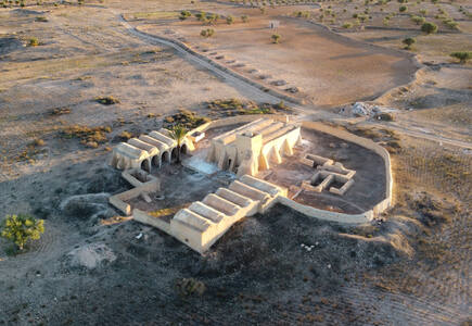
Caravanserais were roadside inns, providing shelter, food and water for caravans, pilgrims and other travellers. The routes and the locations of the caravanserais were determined by the presence of water, geographical conditions and security concerns. The fifty-four caravanserais of the property are only a small percentage of the numerous caravanserais built along the ancient roads of Iran. They are considered to be the most influential and valuable examples of the caravanserais of Iran, revealing a wide range of architectural styles, adaptation to climatic conditions, and construction materials, spread across thousands of kilometres and built over many centuries. Together, they showcase the evolution and network of caravanserais in Iran, in different historical stages.Tr’ondëk-Klondike
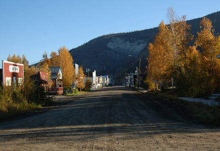
Located along the Yukon River in the sub-arctic region of Northwest Canada, Tr’ondëk-Klondike lies within the homeland of the Tr’ondëk Hwëch’in First Nation. It contains archaeological and historic sources that reflect Indigenous people’s adaptation to unprecedented changes caused by the Klondike Gold Rush at the end of the 19th century. The series illustrates different aspects of the colonization of this area, including sites of exchange between the Indigenous population and the colonists, and sites demonstrating the Tr’ondëk Hwëch’in’s adaptations to colonial presence.Viking-Age Ring Fortresses
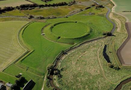
These five archaeological sites comprise a system of monumental ring-shaped Viking-Age fortresses sharing a uniform geometric design. Constructed between about 970 and 980 CE, the fortresses at Aggersborg, Fyrkat, Nonnebakken, Trelleborg and Borgring were positioned strategically near important land and sea routes, and each made use of the natural topography of their surrounding landscape for defensive purposes. They are an emblematic demonstration of the centralized power of the Jelling Dynasty, and a testimony to the socio-political transformations that the Danish realm underwent in the late 10th century.Žatec and the Landscape of Saaz Hops
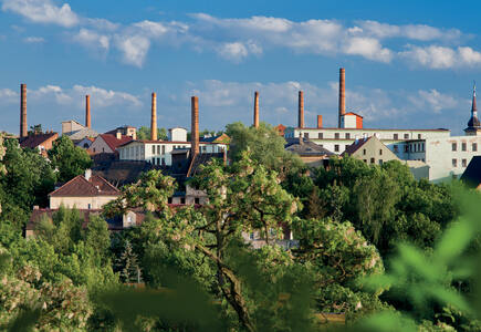
This cultural landscape has been shaped for centuries by the living tradition of cultivating and trading the world’s most renowned hop variety, used in beer production around the globe. The property includes particularly fertile hop fields near the river Ohře that have been farmed continuously for hundreds of years, as well as historic villages and buildings used for processing hops. The urban component of the property is represented by the medieval centre of Žatec with its southern extension, known as the “Prague Suburb” (Pražské předměstí) including numerous specific 19th to 20th-century industrial structures. Together, these illustrate the evolution of the agro-industrial processes and socio-economic system of growing, drying, certifying, and trading hops from the Late Middle Ages to the present.
Nominations to be examined
Natural properties
Forest Massif of Odzala-Kokoua
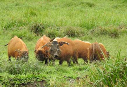
This property is an excellent example, at an exceptionally large-scale, of the process of post-glacial forest recolonization of savanna ecosystems. It is therefore ecologically significant as a convergence point of multiple ecosystem types (Congolese Forest, Lower Guinean Forest and Savanna). The broad range of age classifications across the forest succession spectrum contributes to the park’s highly distinct ecology, incorporating a broad range of remarkable ecological processes. It is one of the most important strongholds for forest elephants in Central Africa, and is recognized as the park with the richest primate diversity in the region.Volcanoes and Forests of Mount Pelée and the Pitons of Northern Martinique
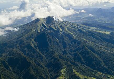
The global significance of Mount Pelée and Pitons du Carbet is based on its representation of volcanic processes and forest types. The 1902 eruption is considered the deadliest volcanic event of the 20th century, and a worldwide reference for the history of volcanology. All the forest types and the diversity of endemic plants of the Lesser Antilles are represented in the serial property, within forest continuums ranging from the seashore to the volcanic summits. The property is home to globally threatened species such as the Martinique Volcano Frog (Allobates chalcopis) and the Martinique Oriole (Icterus bonana), two strict endemics.
Significant modifications to the boundaries
Cultural properties
Koutammakou, the Land of the Batammariba
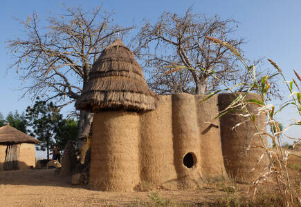
The Koutammakou landscape in north-eastern Togo and neighbouring Benin is home to the Batammariba, whose remarkable mud tower-houses are known as takienta (sikien in the plural). Nature is strongly associated with the rituals and beliefs of society here. The landscape is exceptional due to the architecture of the tower-houses which reflect the social structure; its farmland and forest; and the associations between people and landscape. The buildings are grouped in villages, which also include ceremonial spaces, springs, sacred rocks and sites reserved for initiation ceremonies.
Significant modifications to the boundaries
Natural properties
Andrefana Dry Forests
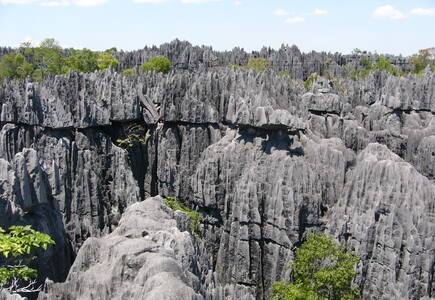
This serial property in western Madagascar comprises karstic landscapes and limestone uplands cut into impressive 'tsingy' peaks and a 'forest' of limestone needles, the spectacular canyon of the Manambolo river, rolling hills and high peaks. Undisturbed forests, lakes and mangrove swamps are the habitat for rare and endangered lemurs and birds. The component parts of the property cover almost the full range of ecological and evolutionary variation within the western forests of Madagascar, including western dry forests and southwestern spiny forest-thicket. These sites contain a spectacular array of endemic and threatened biodiversity, including baobabs, flame trees (Delonix), as well as unique evolutionary lineages such as the Mesitornithiformes, an order of birds which is 54 million years old.
Ha Long Bay - Cat Ba Archipelago
Covering an area of 65,650 ha and including 1,133 islands and islets, Ha Long Bay - Cat Ba Archipelago is located in the Northeast of Viet Nam, within Quang Ninh Province and Hai Phong City. Comprised of a multitude of limestone islands of islets rising from the sea, in a variety of sizes and shapes and presenting picturesque, unspoiled nature, Ha Long Bay - Cat Ba Archipelago is a spectacular seascape sculpted by nature. As the most extensive and best known example of marine - invaded tower karst, Ha Long Bay - Cat Ba Archipelago is one of the world’s mots important areas of fengcong (clusters of conical peaks) and fenglin (isolated tower features) karst. Additionally, the exceptionally beautiful landscape is also dominated by the typical ecosystems.
Hyrcanian Forests
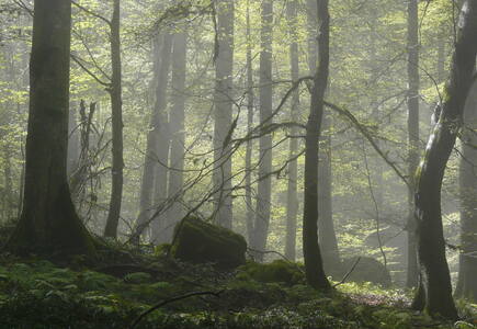
The Hyrcanian Forests form a unique forested massif that stretches along the Caspian Sea in Azerbaijan and Iran. The history of these broad-leaved forests dates back 25 to 50 million years, when they covered most of this Northern Temperate region. Their floristic biodiversity is remarkable with over 3,200 vascular plant species documented. To date, 180 species of birds typical of broad-leaved temperate forests and 58 mammal species have been recorded. Elements of the property comprise full ecosystems including top predators such as leopard, wolf and brown bear, and the forest has a high degree of rare and endemic tree species. The oldest trees seen here are 300-400 years old, with some possibly up to 500 years old.
Proposed for examination in 2023
Nominations to be examined
Cultural properties
Ancient Jericho/Tell es-Sultan
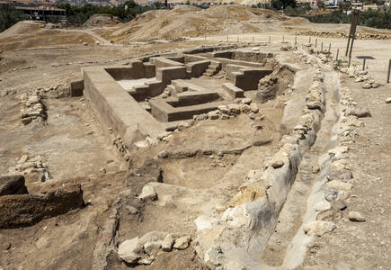
Ancient Jerico/Tell es-Sultan is located northwest of present-day Jericho in the Jordan Valley in Palestine, the property is an oval-shaped Tell, or mound, that contains the prehistorical deposits of human activity, and includes the adjacent perennial spring of ‘Ain es-Sultan. By the 9th to 8th millennium BC, Neolithic Ancient Jericho/Tell es-Sultan was already a sizeable permanent settlement, as expressed by surviving monumental architectural attributes such as a wall with a ditch and a tower. It reflects the developments of the period, which include the shifting of humanity to a sedentary communal lifestyle and the related transition to new subsistence economies, as well as changes in social organisation and the development of religious practices, testified by skulls and statues found. The Early Bronze Age archaeological material on the site provides insights into urban planning, while vestiges from the Middle Bronze Age reveal the presence of a large Canaanite city-state, equipped with an urban centre and technologically innovative rampart fortifications, occupied by a socially complex population.
Astronomical Observatories of Kazan Federal University
The property is comprised of two component parts: one in the historical centre of Kazan and the other in a forested suburban area west of the city. The Kazan City Astronomical Observatory, built in 1837, is located on the University campus and the building is characterized by a semi-circular façade and three towers with domes built to house astronomical instruments. The suburban Engelhardt Astronomical Observatory includes structures for sky observations and residential buildings, all located within a park. The observatories have been preserved complete with astronomical instruments and today perform mainly educational functions.Cultural Landscape of Khinalig People and “Köç Yolu” Transhumance Route
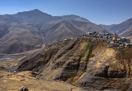
This cultural landscape is comprised of the high-mountain Khinalig village in northern Azerbaijan, high-altitude summer pastures and agricultural terraces in the Greater Caucasus Mountains, winter pastures in the lowland plains in central Azerbaijan, and the connecting 200-kilometre-long seasonal transhumance route called Köç Yolu (“Migration Route”). The village of Khinalig is home to the semi-nomadic Khinalig people, whose culture and lifestyle are defined by the seasonal migration between summer and winter pastures, and who retain the ancient way of long-distance vertical transhumance. The organically evolved network including ancient routes, temporary pastures and camping sites, mausoleums, and mosques illustrates a sustainable eco-social system adapted to extreme environmental conditions.Djerba: Testimony to a settlement pattern in an island territory
This serial property is a testimony to a settlement pattern that developed on the island of Djerba around the 9th century CE amidst the semi-dry and water-scarce environment. Low‑density was its key characteristic: it involved the division of the island into neighbourhoods, clustered together, that were economically self-sustainable, connected to each other and to the religious and trading places of the island, through a complex network of roads. Resulting from a mixture of environmental, socio-cultural and economic factors, the distinctive human settlement of Djerba demonstrates the way local people adapted their lifestyle to the conditions of their water-scarce natural environment.ESMA Museum and Site of Memory – Former Clandestine Centre of Detention, Torture and Extermination
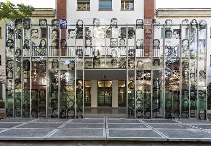
This property is located within the complex of the Former Navy School of Mechanics in Buenos Aires, in the former Officers’ Quarters. This was the Argentine Navy’s principal secret detention centre during the civil-military dictatorship of 1976-1983. As part of a national strategy to destroy armed and nonviolent opposition to the military regime, the Officers' Quarters building at ESMA (Escuela Superior de Mecánica de la Armada) was used for holding captive opponents who had been abducted in Buenos Aires and interrogating, torturing and eventually killing them.Eisinga Planetarium in Franeker
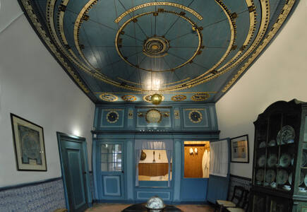
Built between 1774 and 1781, this property is a moving mechanical scale model of the solar system as it was known at the time. Conceived and built by an ordinary citizen – the wool manufacturer Eise Eisinga – the model is built into the ceiling and south wall of the former living room/bedroom of its creator. Powered by one single pendulum clock, it provides a realistic image of the positions of the Sun, the Moon, the Earth and five other planets (Mercury, Venus, Mars, Jupiter and Saturn). The planets revolve around the Sun in real time and the distance between the planets is at scale. The model fills the entire ceiling of the room, making it one of the earliest predecessors of the ceiling and projection planetariums of the 20th and 21st centuries.Funerary and memory sites of the First World War (Western Front)
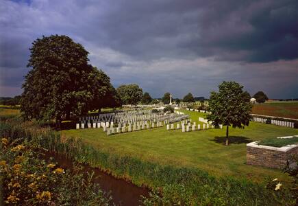
All along the Western Front of the First World War, which stretched for some 700 km from the North Sea to the Franco-Swiss border, a series of 139 funerary and memorial sites bear witness to the common desire of the various parties involved in the conflict to honour their children who fell in battle. This objective takes the form of individual graves and/or memorials listing the names of the missing. Places dedicated to meditation, remembrance and tributes are specially created. Beyond the diversity in size, location and design, there is a clear desire to create spaces that are worthy of the sacrifice made. This is reflected in the choice of noble materials, as well as in calls for renowned architects, botanists, landscape architects and artists to design sites of exceptional architectural, artistic and landscape quality. These sites are visited daily by pilgrims, individual visitors, official delegations, school groups, local community representatives and descendants. They bear witness to funerary and memorial practices that are still relevant today, as remains discovered by chance or during archaeological excavations are still buried there with all honours. These commemorative sites represent a heritage that almost literally belongs to the whole world, spreading a message of reconciliation that is still very topical.Hopewell Ceremonial Earthworks
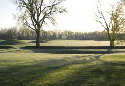
This property is a series of eight monumental earthen enclosure complexes built between 2,000 and 1,600 years ago along the central tributaries of the Ohio River. They are the most representative surviving expressions of the Indigenous tradition now referred to as the Hopewell culture. Their scale and complexity are evidenced in precise geometric figures as well as hilltops sculpted to enclose vast, level plazas. There are alignments with the cycles of the Sun and the far more complex cycles of the Moon. These earthworks served as ceremonial centres and the sites have yielded finely crafted ritual objects fashioned from exotic raw materials obtained from distant places.Jodensavanne Archaeological Site: Jodensavanne Settlement and Cassipora Creek Cemetery
Located on high ground on the densely forested banks of the Suriname River, the Jodensavanne Archaeological Site in northern Suriname is a serial property that illustrates early Jewish colonization attempts in the New World. The Jodensavanne Settlement, founded in the 1680s, includes the ruins of what is believed to be the earliest synagogue of architectural significance in the Americas, along with cemeteries, boat landing areas, and a military post. The Cassipora Creek Cemetery is the remnant of an older settlement founded in the 1650s. Located amidst Indigenous territory, the settlements were inhabited, owned, and governed by Jews who lived there together with free and enslaved persons of African and Indigenous descent. The settlements had the most extensive arrangement of privileges and immunities known in the early modern Jewish world.Memorial sites of the Genocide: Nyamata, Murambi, Gisozi and Bisesero
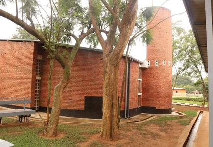
Between April and July 1994, an estimated one million people were killed across Rwanda by armed militias called Interahamwe that targeted Tutsi, but also executed moderate Hutu and Twa people. The victims of the genocide are commemorated in this serial property composed of four memorial sites. Two of the component parts were scenes of massacres: a Catholic church built in the hill of Nyamata in 1980, and a technical school built in the hill of Murambi in 1990. The hill of Gisozi in Kigali City hosts the Kigali Genocide Memorial built in 1999, where more than 250,000 victims have been buried, while the hill of Bisesero in the Western Province hosts a memorial built in 1998, to remember the fight of those who resisted their perpetrators for over two months before being exterminated.Sacred Ensembles of the Hoysalas
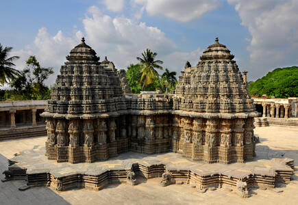
This serial property encompasses the three most representative examples of Hoysala-style temple complexes in southern India, dating from the 12th to 13th centuries. The Hoysala style was created through careful selection of contemporary temple features and those from the past to create a different identity from neighbouring kingdoms. The shrines are characterized by hyper-real sculptures and stone carvings that cover the entire architectural surface, a circumambulatory platform, a large-scale sculptural gallery, a multi-tiered frieze, and sculptures of the Sala legend. The excellence of the sculptural art underpins the artistic achievement of these temple complexes, which represent a significant stage in the historical development of Hindu temple architecture.The Ancient Town of Si Thep and its Associated Dvaravati Monuments
This is a serial property of three component parts: a distinctive twin-town site, featuring an Inner and Outer Town surrounded by moats; the massive Khao Klang Nok ancient monument; and the Khao Thamorrat Cave ancient monument. Together these sites represent the architecture, artistic traditions and religious diversity of the Dvaravati Empire that thrived in Central Thailand from the 6th to the 10th centuries, demonstrating the influences from India. The local adaptation of these traditions resulted in a distinctive artistic tradition known as the Si Thep School of Art which later influenced other civilizations in Southeast Asia.The Cosmological Axis of Yogyakarta and its Historic Landmarks
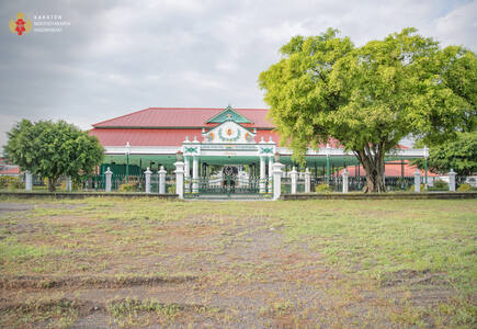
The central axis of Yogyakarta was established in the 18th century by Sultan Mangkubumi, and has continued from that time as a centre of government and Javanese cultural traditions. The six kilometre north-south axis is positioned to link Mount Merapi and the Indian Ocean, with the Kraton (palace) at its centre, and key cultural monuments lining the axis to the north and south that are connected through rituals. It embodies key beliefs about the cosmos in Javanese culture, including the marking of the cycles of life.The Cultural Landscape of Masouleh
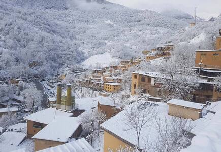
The Maison Carrée of Nîmes
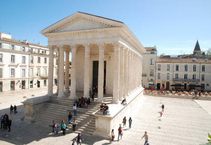
Built in the 1st century AD in the Roman colony of Nemausus – today’s city of Nîmes in the Occitanie region– the Maison Carrée is one of the earliest examples of a Roman temple which can be connected to the imperial worship in the provinces of Rome. Dedicated to the presumptive heirs of Augustus, the princes of Youth, prematurely deceased, this building confirmed the control of Rome on the conquered territory while expressing in a symbolic way the allegiance and attachment of the people from the city of Nemausus to Augustus’ dynasty. The architecture of the Maison Carrée and its sophisticated decoration took part, symbolically, in the dissemination of Augustus ideologic program which turned the Ancient Rome from republic to empire, thus opening a new golden age bearer of promises of peace, prosperity and stability known by the name of Pax Romana.
Wooden Hypostyle Mosques of Medieval Anatolia
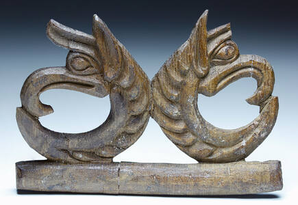
This serial property is comprised of five hypostyle mosques built in Anatolia between the late 13th and mid-14th centuries, each located in a different province of present-day Türkiye. The unusual structural system of the mosques combines an exterior building envelope built of masonry with multiple rows of wooden interior columns (“hypostyle”) that support a flat wooden ceiling and the roof. These mosques are known for the skilful woodcarving and handiwork used in their structures, architectural fittings, and furnishings.Zagori Cultural Landscape
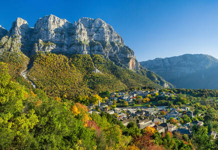
Located in a remote rural landscape in northwestern Greece, small stone villages known as Zagorochoria extend along the western slopes of the northern part of the Pindus mountain range. These traditional villages, typically organized around a central square containing a plane tree and surrounded by sacred forests maintained by local communities, showcase a traditional architecture adapted to the mountain topography. A network of stone-arched bridges, stone cobbled paths, and stone staircases linking the villages formed a system that served as a political and social unit connecting the communities of the Vikos and the Voïdomatis River basin.
Nominations to be examined
Natural properties
Anticosti
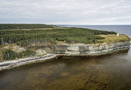
Situated on the island of Anticosti, the largest island in Quebec, this property is the most complete and best preserved palaeontological record of the first mass extinction of animal life, 447-437 million years ago. It contains the best preserved fossil record of marine life covering 10 million years of Earth history. The abundance, diversity, and exquisite preservation of the fossils are exceptional and allow for world-class scientific work. Thousands of large bedding surfaces allow the observation and study of shell and sometimes soft-bodied animals that lived on the shallow sea floor of an ancient tropical sea.Bale Mountains National Park
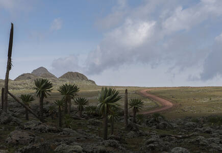
This property protects a landscape mosaic of extraordinary beauty that is shaped by the combined forces of ancient lava outpourings, glaciation and the dissection by the Great Rift Valley. It features volcanic peaks and ridges, dramatic escarpments, sweeping valleys, glacial lakes, lush forests, deep gorges and numerous waterfalls, creating exceptional natural beauty. The property harbours diverse and unique biodiversity at ecosystem, species and genetic levels, and five major rivers originate within the Park, estimated to supply water and support the livelihoods of millions of people in and beyond Ethiopia.Cold Winter Deserts of Turan
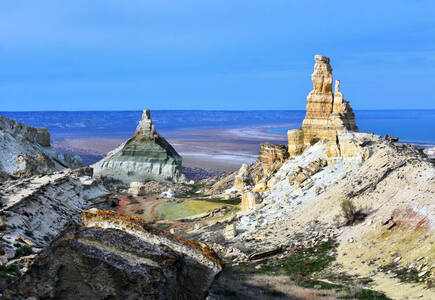
This transnational property comprises fourteen component parts found across arid areas of Central Asia’s temperate zone between the Caspian Sea and the Turanian high mountains. The area is subject to extreme climatic conditions with very cold winters and hot summers, and boasts an exceptionally diverse flora and fauna that has adapted to the harsh conditions. The property also represents a considerable diversity of desert ecosystems, spanning a distance of more than 1,500 kilometres from East to West. Each of the component parts complements the others in terms of biodiversity, desert types, and ongoing ecological processes.Evaporitic Karst and Caves of Northern Apennines
This serial property is an unusually well-preserved and extensive epigenic gypsum karst terrain. It includes a very high density of caves: over 900 caves in a relatively small area, with over 100 km of caves in total. It is the first and the best studied evaporitic karst in the world, with academic work beginning in the 16th century. It also includes some of the deepest gypsum caves in existence, reaching 265 meters below the surface.Nyungwe National Park
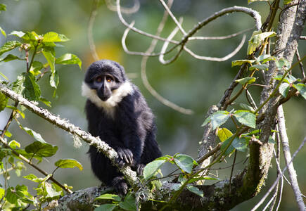
This serial property represents an important area for rainforest conservation in Central Africa. The property is home to intact forests and peat bogs, moors, thickets and grasslands, providing habitats to a highly diverse flora and fauna. The Park also contains the most significant natural habitats for a number of species found nowhere else in the world, including the globally threatened Eastern Chimpanzee (Pan troglodytes schweinfurthii), Golden Monkey (Cercopithecus mitis ssp. kandti) and the Critically Endangered Hills Horseshoe Bat (Rhinolophus hillorum). There are also 12 mammal and seven bird species that are globally threatened, and with 317 species of birds recorded, Nyungwe National Park is one of the most important sites for bird conservation in Africa.Tugay forests of the Tigrovaya Balka Nature Reserve
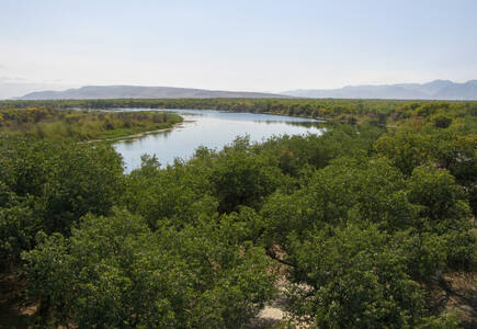
This property is located between the Vakhsh and Panj rivers in southwestern Tajikistan. The Reserve includes extensive riparian tugay ecosystems, the sandy Kashka-Kum desert, the Buritau peak, as well as the Hodja-Kaziyon mountains. The property is composed of a series of floodplain terraces covered by alluvial soils, comprising tugay riverine forests with very specific biodiversity in the valley. The tugay forests in the reserve represent the largest and most intact tugay forest of this type in Central Asia, and this is the only place in the world where the Asiatic poplar tugay ecosystem has been preserved in its original state over an area of this size.‘Uruq Bani Ma’arid
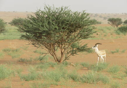
The property encompasses the western part of the greatest expanse of windblown sand on Earth, known as Ar Rub' al-KhaIi, and conserves a portion of one of the Earth’s most spectacular desert landscapes. The varied topography of the property creates a wide range of ecosystems. The site is globally notable due to the reintroduction of iconic desert animals, including the Arabian Oryx (Oryx leucoryx) and Arabian Sand Gazelle (Gazella marica). In the case of the oryx, this was after decades of extinction in the wild. The mobile dunes also provide an excellent and well-oxygenated habitat for sand-diving invertebrates and reptiles, while incised wadis in the limestone plateau harbor rare relict plants. The area has also been used for generations by pastoral, nomadic Bedu.
Nominations to be examined
Mixed properties
Highlands of the Mongolian Altai
Significant modifications to the boundaries
Cultural properties
Historic Centre of Guimarães and Couros Zone
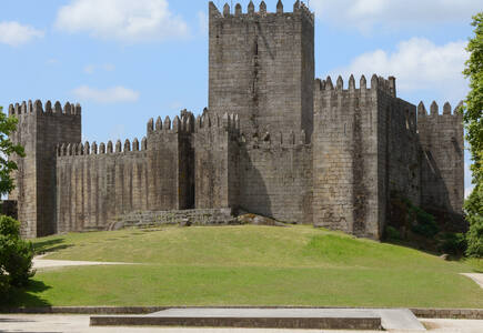
The historic town of Guimarães is associated with the emergence of the Portuguese national identity in the 12th century. An exceptionally well-preserved and authentic example of the evolution of a medieval settlement into a modern town, its rich building typology exemplifies the specific development of Portuguese architecture from the 15th to 19th century through the consistent use of traditional building materials and techniques. The property includes two monastic complexes and an industrial area, the Couros Zone, which, like the local river, was named after the traditional craft of leather tanning. Evidence of the craft, though no longer practiced, persists in the form of tanneries, workers' houses and urban spaces from the 19th and early 20th centuries. The property bears witness to a thousand years of Portuguese urban, architectural and societal developments.
By session
Views
World Heritage List statistics


