New Inscribed Properties
Cultural properties
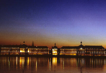
Bordeaux, Port of the Moon
The Port of the Moon, port city of Bordeaux in south-west France, is inscribed as an inhabited historic city, an outstanding urban and architectural ensemble, created in the age of the Enlightenment, whose values continued up to the first half of the 20th century, with more protected buildings than any other French city except Paris. It is also recognized for its historic role as a place of exchange of cultural values over more than 2,000 years, particularly since the 12th century due to commercial links with Britain and the Low Lands. Urban plans and architectural ensembles of the early 18th century onwards place the city as an outstanding example of innovative classical and neoclassical trends and give it an exceptional urban and architectural unity and coherence. Its urban form represents the success of philosophers who wanted to make towns into melting pots of humanism, universality and culture.
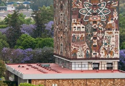
Central University City Campus of the Universidad Nacional Autónoma de México (UNAM)
The ensemble of buildings, sports facilities and open spaces of the Central University City Campus of the Universidad Nacional Autónoma de México (UNAM), was built from 1949 to 1952 by more than 60 architects, engineers and artists who were involved in the project. As a result, the campus constitutes a unique example of 20th-century modernism integrating urbanism, architecture, engineering, landscape design and fine arts with references to local traditions, especially to Mexico’s pre-Hispanic past. The ensemble embodies social and cultural values of universal significance and is one of the most significant icons of modernity in Latin America.
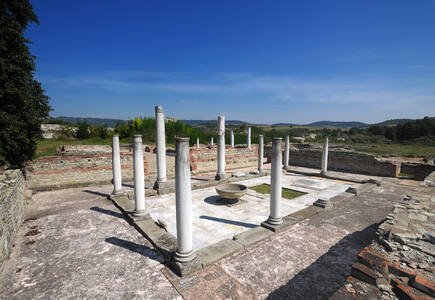
Gamzigrad-Romuliana, Palace of Galerius
The Late Roman fortified palace compound and memorial complex of Gamzigrad-Romuliana, Palace of Galerius, in the east of Serbia, was commissioned by Emperor Caius Valerius Galerius Maximianus, in the late 3rd and early 4th centuries. It was known as Felix Romuliana, named after the emperor’s mother. The site consists of fortifications, the palace in the north-western part of the complex, basilicas, temples, hot baths, memorial complex, and a tetrapylon. The group of buildings is also unique in its intertwining of ceremonial and memorial functions.
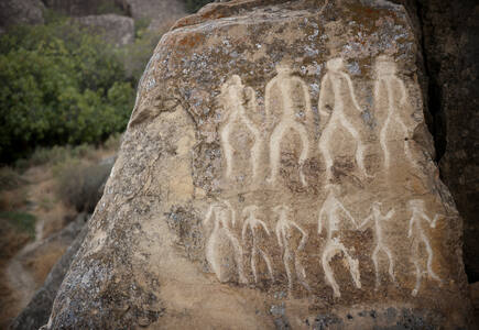
Gobustan Rock Art Cultural Landscape
Gobustan Rock Art Cultural Landscape covers three areas of a plateau of rocky boulders rising out of the semi-desert of central Azerbaijan, with an outstanding collection of more than 6,000 rock engravings bearing testimony to 40,000 years of rock art. The site also features the remains of inhabited caves, settlements and burials, all reflecting an intensive human use by the inhabitants of the area during the wet period that followed the last Ice Age, from the Upper Paleolithic to the Middle Ages. The site, which covers an area of 537 ha, is part of the larger protected Gobustan Reservation.
Kaiping Diaolou and Villages
Kaiping Diaolou and Villages feature the Diaolou, multi-storeyed defensive village houses in Kaiping, which display a complex and flamboyant fusion of Chinese and Western structural and decorative forms. They reflect the significant role of émigré Kaiping people in the development of several countries in South Asia, Australasia and North America, during the late 19th and early 20th centuries. There are four groups of Diaolou and twenty of the most symbolic ones are inscribed on the List. These buildings take three forms: communal towers built by several families and used as temporary refuge, residential towers built by individual rich families and used as fortified residences, and watch towers. Built of stone, pise , brick or concrete, these buildings represent a complex and confident fusion between Chinese and Western architectural styles. Retaining a harmonious relationship with the surrounding landscape, the Diaolou testify to the final flowering of local building traditions that started in the Ming period in response to local banditry.
Lavaux, Vineyard Terraces
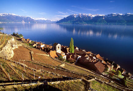
The Lavaux Vineyard Terraces, stretching for about 30 km along the south-facing northern shores of Lake Geneva from the Chateau de Chillon to the eastern outskirts of Lausanne in the Vaud region, cover the lower slopes of the mountainside between the villages and the lake. Although there is some evidence that vines were grown in the area in Roman times, the present vine terraces can be traced back to the 11th century, when Benedictine and Cistercian monasteries controlled the area. It is an outstanding example of a centuries-long interaction between people and their environment, developed to optimize local resources so as to produce a highly valued wine that has always been important to the economy.
Mehmed Paša Sokolović Bridge in Višegrad
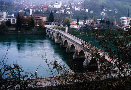
The Mehmed Paša Sokolović Bridge of Višegrad across the Drina River in the east of Bosnia and Herzegovina was built at the end of the 16th century by the court architect Mimar Koca Sinan on the orders of Grand Vizier Mehmed Paša Sokolović. Characteristic of the apogee of Ottoman monumental architecture and civil engineering, the bridge has 11 masonry arches with spans of 11 m to 15 m, and an access ramp at right angles with four arches on the left bank of the river. The 179.5 m long bridge is a representative masterpiece of Sinan, one of the greatest architects and engineers of the classical Ottoman period and a contemporary of the Italian Renaissance, with which his work may be compared. The unique elegance of proportion and monumental nobility of the whole site bear witness to the greatness of this style of architecture.
Old Town of Corfu
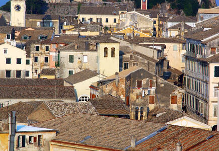
The Old Town of Corfu, on the Island of Corfu off the western coasts of Albania and Greece, is located in a strategic position at the entrance of the Adriatic Sea, and has its roots in the 8th century BC. The three forts of the town, designed by renowned Venetian engineers, were used for four centuries to defend the maritime trading interests of the Republic of Venice against the Ottoman Empire. In the course of time, the forts were repaired and partly rebuilt several times, more recently under British rule in the 19th century. The mainly neoclassical housing stock of the Old Town is partly from the Venetian period, partly of later construction, notably the 19th century. As a fortified Mediterranean port, Corfu’s urban and port ensemble is notable for its high level of integrity and authenticity.
Parthian Fortresses of Nisa
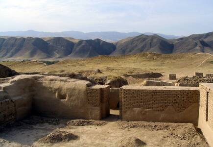
The Parthian Fortresses of Nisa consist of two tells of Old and New Nisa, indicating the site of one of the earliest and most important cities of the Parthian Empire, a major power from the mid 3rd century BC to the 3rd century AD. They conserve the unexcavated remains of an ancient civilization which skilfully combined its own traditional cultural elements with those of the Hellenistic and Roman west. Archaeological excavations in two parts of the site have revealed richly decorated architecture, illustrative of domestic, state and religious functions. Situated at the crossroads of important commercial and strategic axes, this powerful empire formed a barrier to Roman expansion while serving as an important communication and trading centre between east and west, north and south.
Red Fort Complex
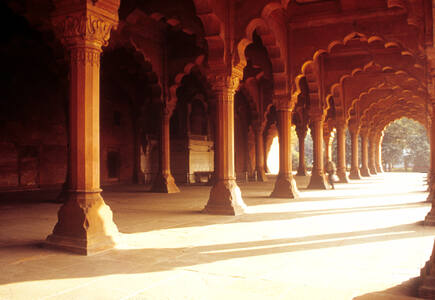
The Red Fort Complex was built as the palace fort of Shahjahanabad – the new capital of the fifth Mughal Emperor of India, Shah Jahan. Named for its massive enclosing walls of red sandstone, it is adjacent to an older fort, the Salimgarh, built by Islam Shah Suri in 1546, with which it forms the Red Fort Complex. The private apartments consist of a row of pavilions connected by a continuous water channel, known as the Nahr-i-Behisht (Stream of Paradise). The Red Fort is considered to represent the zenith of Mughal creativity which, under the Shah Jahan, was brought to a new level of refinement. The planning of the palace is based on Islamic prototypes, but each pavilion reveals architectural elements typical of Mughal building, reflecting a fusion of Persian, Timurid and Hindu traditions The Red Fort’s innovative planning and architectural style, including the garden design, strongly influenced later buildings and gardens in Rajasthan, Delhi, Agra and further afield.
Richtersveld Cultural and Botanical Landscape
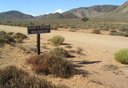
The 160,000 ha Richtersveld Cultural and Botanical Landscape of dramatic mountainous desert in north-western South Africa constitutes a cultural landscape communally owned and managed. This site sustains the semi-nomadic pastoral livelihood of the Nama people, reflecting seasonal patterns that may have persisted for as much as two millennia in southern Africa. It is the only area where the Nama still construct portable rush-mat houses (haru om ) and includes seasonal migrations and grazing grounds, together with stock posts. The pastoralists collect medicinal and other plants and have a strong oral tradition associated with different places and attributes of the landscape.
Rideau Canal
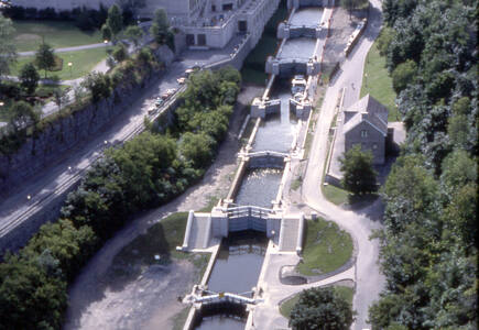
The Rideau Canal, a monumental early 19th-century construction covering 202 km of the Rideau and Cataraqui rivers from Ottawa south to Kingston Harbour on Lake Ontario, was built primarily for strategic military purposes at a time when Great Britain and the United States vied for control of the region. The site, one of the first canals to be designed specifically for steam-powered vessels, also features an ensemble of fortifications. It is the best-preserved example of a slackwater canal in North America, demonstrating the use of this European technology on a large scale. It is the only canal dating from the great North American canal-building era of the early 19th century to remain operational along its original line with most of its structures intact.
Samarra Archaeological City
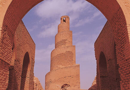
Samarra Archaeological City is the site of a powerful Islamic capital city that ruled over the provinces of the Abbasid Empire extending from Tunisia to Central Asia for a century. Located on both sides of the River Tigris 130 km north of Baghdad, the length of the site from north to south is 41.5 km; its width varying from 8 km to 4 km. It testifies to the architectural and artistic innovations that developed there and spread to the other regions of the Islamic world and beyond. The 9th-century Great Mosque and its spiral minaret are among the numerous remarkable architectural monuments of the site, 80% of which remain to be excavated.
Sydney Opera House
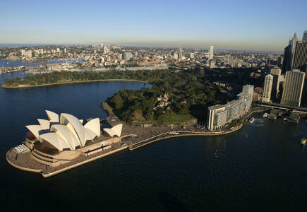
Inaugurated in 1973, the Sydney Opera House is a great architectural work of the 20th century that brings together multiple strands of creativity and innovation in both architectural form and structural design. A great urban sculpture set in a remarkable waterscape, at the tip of a peninsula projecting into Sydney Harbour, the building has had an enduring influence on architecture. The Sydney Opera House comprises three groups of interlocking vaulted ‘shells’ which roof two main performance halls and a restaurant. These shell-structures are set upon a vast platform and are surrounded by terrace areas that function as pedestrian concourses. In 1957, when the project of the Sydney Opera House was awarded by an international jury to Danish architect Jørn Utzon, it marked a radically new approach to construction.
Twyfelfontein or /Ui-//aes
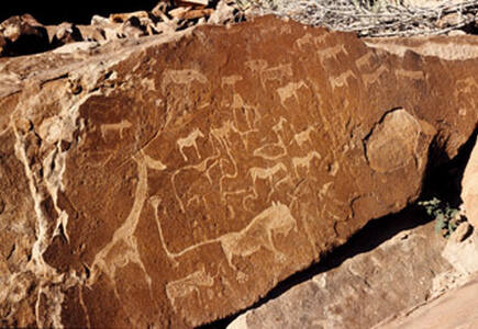
Twyfelfontein or /Ui-//aes has one of the largest concentrations of [...] petroglyphs, i.e. rock engravings in Africa. Most of these well-preserved engravings represent rhinoceros, . The site also includes six painteelephant, ostrich and giraffe, as well as drawings of human and animal footprintsd rock shelters with motifs of human figures in red ochre. The objects excavated from two sections, date from the Late Stone Age. The site forms a coherent, extensive and high-quality record of ritual practices relating to hunter-gatherer communities in this part of southern Africa over at least 2,000 years, and eloquently illustrates the links between the ritual and economic practices of hunter-gatherers.
New Inscribed Properties
Natural properties
Rainforests of the Atsinanana
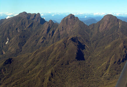
The Rainforests of the Atsinanana comprise six national parks distributed along the eastern part of the island. These relict forests are critically important for maintaining ongoing ecological processes necessary for the survival of Madagascar’s unique biodiversity, which reflects the island’s geological history. Having completed its separation from all other land masses more than 60 million years ago, Madagascar’s plant and animal life evolved in isolation. The rainforests are inscribed for their importance to both ecological and biological processes as well as their biodiversity and the threatened species they support. Many species are rare and threatened especially primates and lemurs.
Teide National Park
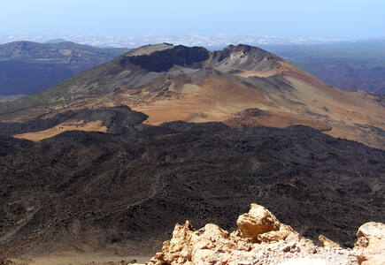
Situated on the island of Tenerife, Teide National Park features the Teide-Pico Viejo stratovolcano that, at 3,718 m, is the highest peak on Spanish soil. Rising 7,500 m above the ocean floor, it is regarded as the world’s third-tallest volcanic structure and stands in a spectacular environment. The visual impact of the site is all the greater due to atmospheric conditions that create constantly changing textures and tones in the landscape and a ‘sea of clouds’ that forms a visually impressive backdrop to the mountain. Teide is of global importance in providing evidence of the geological processes that underpin the evolution of oceanic islands.
New Inscribed Properties
Mixed properties
Ecosystem and Relict Cultural Landscape of Lopé-Okanda
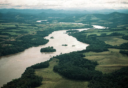
The Ecosystem and Relict Cultural Landscape of Lopé-Okanda demonstrates an unusual interface between dense and well-conserved tropical rainforest and relict savannah environments with a great diversity of species, including endangered large mammals, and habitats. The site illustrates ecological and biological processes in terms of species and habitat adaptation to post-glacial climatic changes. It contains evidence of the successive passages of different peoples who have left extensive and comparatively well-preserved remains of habitation around hilltops, caves and shelters, evidence of iron-working and a remarkable collection of some 1,800 petroglyphs (rock carvings). The property’s collection of Neolithic and Iron Age sites, together with the rock art found there, reflects a major migration route of Bantu and other peoples from West Africa along the River Ogooué valley to the north of the dense evergreen Congo forests and to central east and southern Africa, that has shaped the development of the whole of sub-Saharan Africa.
Significant modifications to the boundaries
Natural properties
Swiss Alps Jungfrau-Aletsch
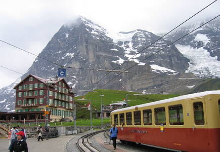
The extension of the natural World Heritage property of Jungfrau - Aletsch - Bietschhorn (first inscribed in 2001), expands the site to the east and west, bringing its surface area up to 82,400 ha., up from 53,900. The site provides an outstanding example of the formation of the High Alps, including the most glaciated part of the mountain range and the largest glacier in Eurasia. It features a wide diversity of ecosystems, including successional stages due particularly to the retreat of glaciers resulting from climate change. The site is of outstanding universal value both for its beauty and for the wealth of information it contains about the formation of mountains and glaciers, as well as ongoing climate change. It is also invaluable in terms of the ecological and biological processes it illustrates, notably through plan succession. Its impressive landscape has played an important role in European art, literature, mountaineering and alpine tourism.
By session
Views
World Heritage List statistics
