New Inscribed Properties
Cultural properties
Cambodian Memorial Sites: From centres of repression to places of peace and reflection
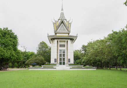
The property consists of three locations that reflect the human rights abuses of the Khmer Rouge regime in Cambodia from 1971 to 1979. The three component parts represent the widespread violence during this period: the former M-13 prison (early repression), the Tuol Sleng Genocide Museum (former S-21 prison), and the Choeung Ek Genocidal Center (former execution site of S-21). These places have been preserved and memorialized since the regime’s fall. The Tuol Sleng Museum maintains extensive archives and collections related to this period, mainly documented by the Extraordinary Chambers in the Courts of Cambodia (ECCC).
Cultural Heritage Sites of Ancient Khuttal
Ancient Khuttal was a medieval kingdom located between the Panj and Vakhsh Rivers and the Pamir piedmonts. The property includes ten sites and one monument reflecting its role from the 7th to 16th centuries in Silk Roads trade. Khuttal contributed valuable goods like salt, gold, silver, and horses, and served as a hub for cultural, religious, and technological exchanges. Its diverse archaeological remains—Buddhist temples, palaces, settlements, manufacturing centres, and caravanserais—illustrate its strategic importance and vibrant interactions with neighbouring empires.
Diy-Gid-Biy Cultural Landscape of the Mandara Mountains
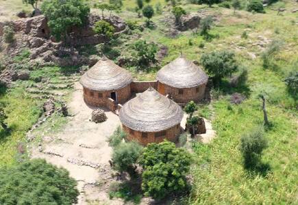
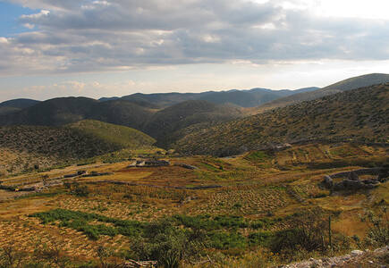
Located in the Far North Region of Cameroon, the property includes sixteen archaeological sites across seven villages. Known as Diy-Gid-Biy (meaning “Ruin of the Chief’s Residence” in the Mafa language), these dry-stone architectural structures were likely built between the 12th and 17th centuries. While their original builders remain unknown, the area has been inhabited by the Mafa people since the 15th century. The surrounding landscape features agricultural terraces, homes, tombs, places of worship, and artisan activities, reflecting a long-standing cultural and spiritual connection between the people and their environment.
Faya Palaeolandscape
Located between the Persian Gulf and Arabian Sea, the property preserves evidence of human occupation from the Middle Palaeolithic and Neolithic periods (210,000–6,000 years ago). Archaeological layers reveal how hunter-gatherers and pastoralists adapted to extreme climates, alternating between arid and rainy periods every 20,000 years. Beyond subsistence activities, early human groups utilized the site's geomorphological features for resource extraction. With diverse water sources and raw materials, Faya provides valuable insights into human resilience in hyper-arid environments.
Forest Research Institute Malaysia Forest Park Selangor
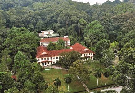
Located 16 km northwest of Kuala Lumpur, the property is a human-made tropical rainforest established on degraded tin-mining land from the 1920s. It includes scientific, residential, and service buildings, water bodies, and trails. The site represents a pioneering reforestation effort, successfully transforming barren land into a mature lowland tropical forest, showcasing early ecological restoration and sustainable land rehabilitation practices.
Funerary Tradition in the Prehistory of Sardinia – The domus de janas
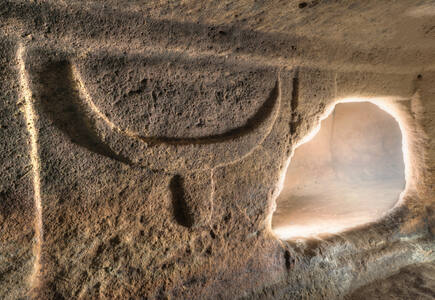
This serial property is an ensemble of hypogean burials and necropolises located in Sardinia, created between the 5th and 3rd millennia BCE. These sites reflect the daily life and funerary practices of prehistoric Sardinian communities. The domus de janas, locally known as “fairy houses,” are rock-cut tombs that reflect the funerary practices, spiritual beliefs, and social evolution of Sardinia’s prehistoric communities. These structures feature complex layouts, symbolic decorations, and figurative motifs that testify to the transformation of the relationship between the living and the dead in a society transitioning toward more complex forms of social organization. They represent the most extensive and rich manifestation of hypogean funerary architecture in the western Mediterranean, exemplifying a phenomenon attested by approximately 3,500 hypogea spread across the entire island.
Maratha Military Landscapes of India
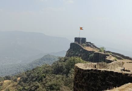
The property includes twelve major fortifications, mostly in Maharashtra State, with one in Tamil Nadu. These forts, such as Raigad, Shivneri, and Sindhudurg, were built, adapted, or expanded by the Marathas between the late 17th and early 19th centuries. Strategically located on coastal and mountainous terrain, they formed a complex defence system supporting Maratha military dominance, trade protection, and territorial control. This network played a key role in the Marathas’ rise as a major political and military force.
Megaliths of Carnac and of the shores of Morbihan
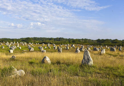
This serial property in Brittany, France, features a dense concentration of megalithic structures built during the Neolithic period (c. 5000–2300 BCE), carefully aligned with the area’s unique geomorphology. These monumental stone constructions—arranged in relation to one another and to natural features like terrain and waterways—reflect a sophisticated understanding of the environment. Rich engravings and associated artifacts further illustrate the cultural complexity of the societies that inhabited this part of the European Atlantic coast.
Minoan Palatial Centres
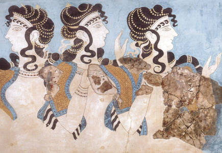
This serial property comprises six archaeological sites on Crete dating from 1900 to 1100 BCE. These sites represent the Minoan civilization, a major prehistoric Mediterranean culture. The palatial centres served as administrative, economic, and religious hubs, featuring advanced architecture, urban planning, and vibrant frescoes. They reveal early writing systems, maritime networks, and cultural exchanges. The property highlights the complexity of the Minoans’ social structure and their enduring influence on Mediterranean history.
Mount Mulanje Cultural Landscape
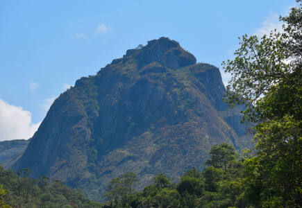
This property encompasses the mountain range located in southern Malawi, with the imposing Mount Mulanje—one of the world’s largest inselbergs—and its surrounding environment. Revered as a sacred place inhabited by gods, spirits, and ancestors, it holds deep cultural and spiritual significance. The mountain’s geological and hydrological features are connected with the belief systems and cultural practices of the Yao, Mang’anja, and Lhomwe peoples. These communities have sustained the mountain’s sacredness through rituals and traditions, making the site a sacred cultural landscape that reflects the spiritual and ecological harmony between people and nature.
Murujuga Cultural Landscape
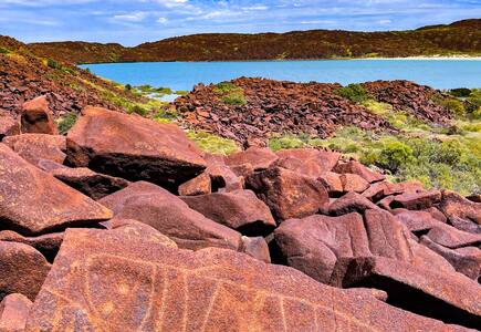
Murujuga is a landscape of ancient rocks located in northwest Australia, which encompasses the Burrup Peninsula, the Dampier Archipelago’s 42 islands, and nearby marine areas. It is shaped by the Lore—rules and narratives that were put in place to create the Country—and the enduring presence of the Ngarda-Ngarli, Traditional Owners and Custodians of the site. The property holds profound cultural and spiritual significance, reflecting over 50,000 years of continuous care and use. Murujuga is renowned for its dense concentration of petroglyphs, featuring unique motifs that display artistic and technical mastery.
Petroglyphs along the Bangucheon Stream
Prehistoric Sites of the Khorramabad Valley
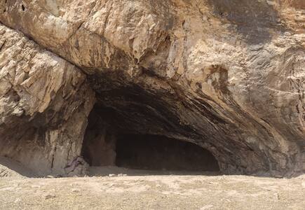
The prehistoric sites of the Khorramabad Valley include five caves and one rock shelter within a narrow ecological corridor rich in water, flora, and fauna. Human occupation dates back 63,000 years, with evidence from the Middle to Upper Palaeolithic periods. These sites reveal Mousterian and Baradostian cultures, offering insights into early human evolution and migration from Africa to Eurasia. Artifacts such as decorative objects and advanced stone tools highlight the cognitive and technological development of early humans in the Zagros Mountains. The area remains underexplored, holding significant potential for future archaeological discoveries.
Rock Paintings of Shulgan-Tash Cave
Located in the Southern Ural Mountains of Bashkortostan, the Shulgan-Tash Cave contains extensive Late Palaeolithic rock art. Set within a karst massif near the Belaya and Shulgan Rivers, it features large halls and deep chambers across two levels. The paintings depict steppe fauna—mammoths, woolly rhinoceroses, bison, horses, and a Bactrian camel—alongside anthropomorphic figures, abstract signs, and geometric motifs like the “Kapova trapezoids.” Archaeological finds offer insights into the artistic process and domestic life of its prehistoric inhabitants.
Sardis and the Lydian Tumuli of Bin Tepe
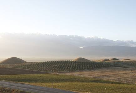
Sardis was the capital of the Lydians, a powerful Iron Age civilization (8th-6th centuries BCE) known for its wealth and early coinage production. The city had a unique urban structure with fortified walls, terraces, and distinct zones, including settlements, sanctuaries, and cemeteries. The cemetery of Bin Tepe features some of the largest tumulus tombs in the world. The Lydians developed a distinct language and religious system and were widely mentioned in Greek, Roman, and European texts. After their fall, Sardis remained significant under Persian, Greek, Roman, and Byzantine rule.
The Archaeological Ensemble of 17th Century Port Royal
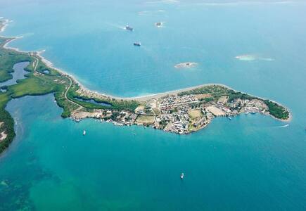
The town of Port Royal is located at the mouth of Kingston Harbour in southeastern Jamaica. It was a major 17th-century English port city. A devastating earthquake in 1692 submerged much of the town under water and sand. Today, its terrestrial and underwater remains offer rare insights into urban colonial life. Once a key hub for transatlantic trade—including the trade of enslaved Africans—Port Royal featured a deep-water port and six defensive forts, some now submerged. Archaeological evidence reveals a well-preserved layout of residential, religious, and administrative buildings, serving as a distinctive marker of British colonial presence in the Caribbean.
The Colonial Transisthmian Route of Panamá
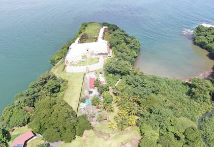
From the 16th century, the isthmus of Panama became a global strategic asset facilitating the transportation of goods and people between the Iberian Peninsula and the colonies of the Kingdom of Spain in America, the archipelago of the Philippines and the Canary Islands. The serial property bears testimony of the crossing of the isthmus including strategic fortified settlements, historic towns, archaeological sites and roads used to connect the Caribbean Sea and the Pacific Ocean until the mid-18th century.
The Palaces of King Ludwig II of Bavaria: Neuschwanstein, Linderhof, Schachen and Herrenchiemsee
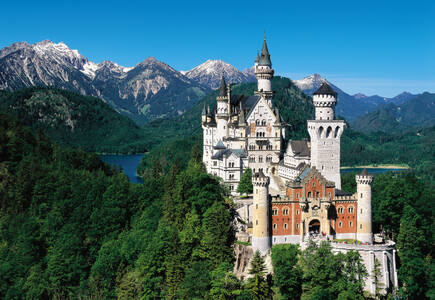
This serial property consists of four grand palace complexes in Bavaria’s alpine region, built under King Ludwig II between 1864 and 1886. Designed as personal retreats and imaginative escapes, they reflect the romantic and eclectic spirit of the era. Drawing inspiration from the Wartburg Castle, Versailles, German fairy tales, and Wagner’s operas, the palaces showcase historicist styles and advanced 19th-century techniques. Carefully integrated into stunning natural landscapes, they embody Ludwig’s artistic vision. Opened to the public shortly after his death in 1886, these sites are now preserved as museums and remain major cultural landmarks.
Wixárika Route through Sacred Sites to Wirikuta (Tatehuarí Huajuyé)
Xixia Imperial Tombs
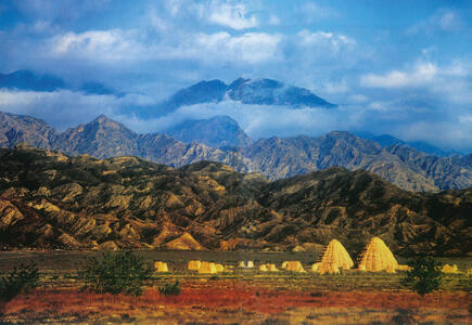
Located in the foothills of the southern Helan Mountains in Ningxia, this necropolis is the imperial cemetery of the Xixia Dynasty. It includes nine imperial mausoleums, 271 subordinate tombs, a northern architectural complex, and 32 flood control structures. Founded by the Tanguts in 1038, the Xixia Dynasty lasted until its destruction by Genghis Khan’s Mongol army in 1227. Positioned along the Silk Road, it became a multicultural civilization modelled on Chinese imperial traditions, with Buddhism at its core. The property reflects the dynasty’s religious and socio-political legacy.
Yen Tu-Vinh Nghiem-Con Son, Kiep Bac Complex of Monuments and Landscapes
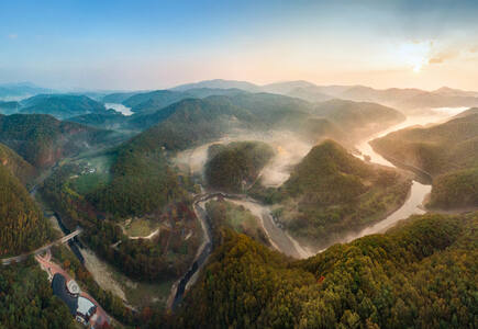
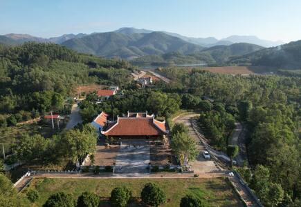
The property comprises 20 sites across forested mountains, lowlands, and river valleys. Centred on the Yen Tu Mountain Range, it was home to the Tran Dynasty during the 13th and 14th centuries and the birthplace of Truc Lam Buddhism, a uniquely Vietnamese Zen tradition that shaped the Dai Viet kingdom. The complex includes pagodas, temples, shrines, and archaeological remains tied to religious and historical figures. Strategically located in geologically favourable settings, it remains a vibrant pilgrimage destination.
New Inscribed Properties
Natural properties
Coastal and Marine Ecosystems of the Bijagós Archipelago – Omatí Minhô
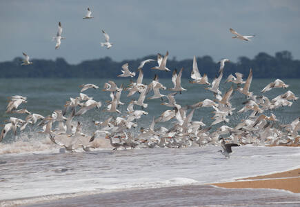
The property includes a continuous series of coastal and marine ecosystems, corresponding to the marine and intertidal environments of the best-preserved areas of the Bijagós Archipelago in Guinea-Bissau. The Archipelago is the only active deltaic archipelago on the African Atlantic coast and one of the few in the world. The site is home to a rich biodiversity, including endangered Green and Leatherback turtles, manatees, dolphins, and over 870,000 migratory shorebirds. It features mangroves, mudflats, and intertidal zones vital for marine life, and supports rare plant species, diverse fish populations, and bird colonies. Poilão Island is a globally important nesting site for turtles.
Gola-Tiwai Complex
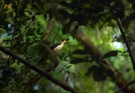
This serial property includes the Gola Rainforest National Park and the Tiwai Island Wildlife Sanctuary. Part of the Greater Gola Landscape, it lies within the Upper Guinean Forest, a biodiversity hotspot. The area hosts more than 1,000 plant species (113 endemic), 55 mammals (19 globally threatened), and key species like the African Forest Elephant and Pygmy Hippopotamus. It also supports up to 448 bird species, including the endangered White-necked Rockfowl. Rich in freshwater fish, butterflies, and dragonflies, the site provides vital habitats and ecosystem services, reflecting high conservation value and ecological integrity.
Møns Klint
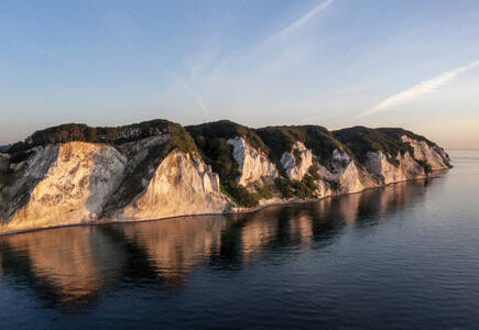
Featuring a dramatic glaciotectonic landscape shaped by Pleistocene glaciers, the property includes chalk cliffs, rolling hills, kame and kettle topography, and outwash plains. Visible cliff cross-sections reveal intense folding and faulting of Cretaceous chalk and Quaternary sediments. The area supports rare habitats like calcareous grasslands and beech forests, hosting diverse flora and fauna, including 18 species of orchid, and the almost-threatened Large Blue butterfly. Erosion continuously exposes fossils and reshapes the cliffs.
Peruaçu River Canyon
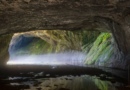
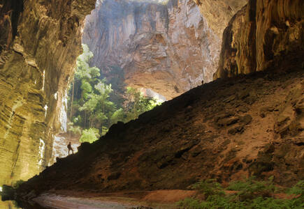
Located in northern Minas Gerais and featuring dramatic karst landscapes, vast caves, and rich biodiversity, the park’s horizontal cave systems, formed in carbonate rock, reveal striking speleothems, collapsed dolines, limestone arches, and underground rivers. Developed in the stable São Francisco craton, the landscape reflects major climatic and geological changes from the Plio-Pleistocene. The park lies at the intersection of the Cerrado, Caatinga, and Atlantic Forest biomes, supporting over 2,000 plant and animal species, including many threatened ones.
New Inscribed Properties
Mixed properties
Mount Kumgang – Diamond Mountain from the Sea
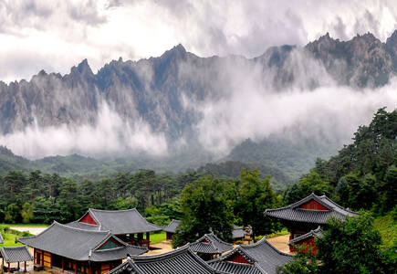
Mount Kumgang is a long-celebrated place of exceptional natural beauty, renowned for its near-white granite peaks, deep valleys, waterfalls, and pristine ecosystems, rising to nearly 1,600 metres. The mountain’s dramatic impact is enhanced through constantly changing weather patterns of mists, rain, sunshine and clouds. This sacred mountain is a key site of mountain Buddhism, with traditions dating back to the 5th century. This cultural landscape is home to ancient hermitages, temples, stupas, and stone carvings, many located in the Outer and Inner Kumgang Area. Three temples remain active today and bear exceptional testimony to centuries of Buddhist practice, with tangible and intangible heritage deeply intertwined with the landscape.
Significant modifications to the boundaries
Natural properties
Phong Nha-Ke Bang National Park and Hin Nam No National Park
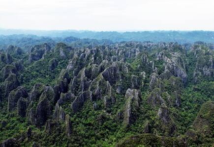
The Phong Nha-Ke Bang National Park and Hin Nam No National Park is a transboundary extension of Viet Nam’s Phong Nha-Ke Bang National Park, inscribed in 2003. Located in the Annamite mountains, it features rugged karst landscapes, deep caves—including the vast Xe Bang Fai Cave—as well as rich biodiversity and associated local traditional use. The park lies within the Indo-Burma biodiversity hotspot, home to over 1,500 plant and 536 vertebrate species, including many endemics and globally threatened species like the Red-Shanked Douc Langur and Sunda Pangolin. Unique species such as the Lao Rock Rat and Giant Huntsman Spider also inhabit the area. Its diverse ecosystems span lowland forests to high-altitude karst habitats.
iSimangaliso Wetland Park – Maputo National Park
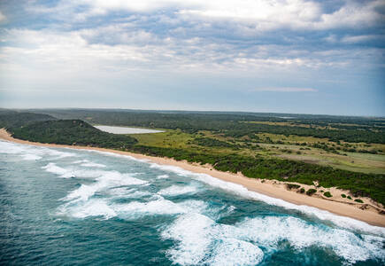
The iSimangaliso Wetland Park – Maputo National Park is a transboundary extension to South Africa’s iSimangaliso Wetland Park, inscribed in 1999. It includes terrestrial, coastal, and marine ecosystems, and is home to nearly 5,000 species. The site complements iSimangaliso’s conservation values, enhancing biodiversity protection across the Maputaland ecoregion. It features diverse habitats, including lakes, lagoons, mangroves, and coral reefs. The park lies within the Maputaland-Pondoland-Albany Hotspot, reflecting high endemism and ongoing natural processes, and underscores long-standing regional conservation cooperation.
By session
Views
World Heritage List statistics
