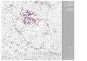
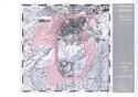
Mines of Rammelsberg, Historic Town of Goslar and Upper Harz Water Management System
Multiple Locations (2)
| ID | Name & Location | State Party | Coordinates | Property | Buffer Zone |
|---|---|---|---|---|---|
| 623ter-001 | Mines of Rammelsberg and Historic Town of Goslar | Germany |
N51 53 24 E10 25 14.02 |
363.3 ha | 376.1 ha |
| 623ter-002 | Upper Harz Water Management System | Germany |
N51 49 12.00 E10 20 24.00 |
1,009.89 ha | 5,654.69 ha |
Maps
| Date | Title | |
|---|---|---|
|
2008 | Upper Harz Water Management System 2010 |
|
2008 | Mines of Rammelsberg and the historic Town of Goslar |
Disclaimer
The Nomination files produced by the States Parties are published by the World Heritage Centre at its website and/or in working documents in order to ensure transparency, access to information and to facilitate the preparations of comparative analysis by other nominating States Parties.
The sole responsibility for the content of each Nomination file lies with the State Party concerned. The publication of the Nomination file does not imply the expression of any opinion whatsoever of the World Heritage Committee or of the Secretariat of UNESCO concerning the history or legal status of any country, territory, city or area or of its boundaries.