Palestine: Land of Olives and Vines – Cultural Landscape of Southern Jerusalem, Battir
Palestine: Land of Olives and Vines – Cultural Landscape of Southern Jerusalem, Battir
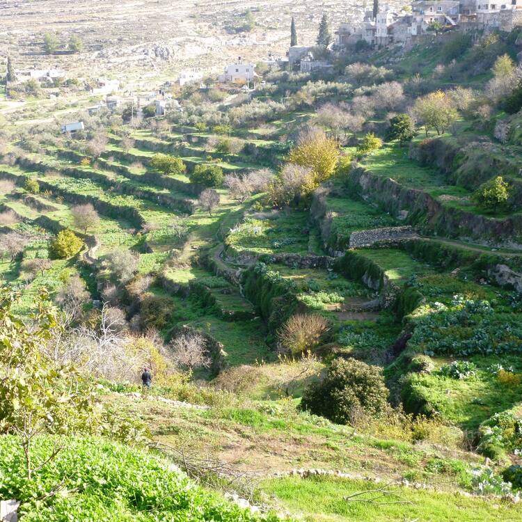
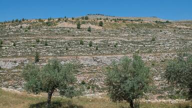
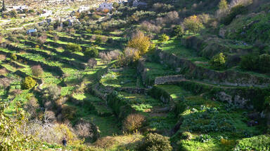
This site is located a few kilometres south-west of Jerusalem, in the Central Highlands between Nablus and Hebron. The Battir hill landscape comprises a series of farmed valleys, known as widian, with characteristic stone terraces, some of which are irrigated for market garden production, while others are dry and planted with grapevines and olive trees. The development of terrace farming in such a mountainous region is supported by a network of irrigation channels fed by underground sources. A traditional system of distribution is then used to share the water collected through this network between families from the nearby village of Battir.
Description is available under license CC-BY-SA IGO 3.0
Palestine : terre des oliviers et des vignes – Paysage culturel du sud de Jérusalem, Battir
Ce site est situé à quelques kilomètres au sud-ouest de Jérusalem, dans les hautes terres entre Naplouse et Hébron. Le paysage de collines de Battir comprend une série de vallées agricoles, widian, caractérisées par des terrasses de pierre, certaines irriguées pour la production maraîchère, d’autres sèches et plantées de vignes et d’oliviers. Le développement de ces terrasses cultivées, dans un environnement très montagneux, s’est appuyé sur un réseau de canaux d’irrigation alimenté par des sources souterraines. L’eau collectée grâce à ce réseau est attribuée selon un système traditionnel de répartition équitable entre les familles du village de Battir, situé à proximité de ce paysage culturel.
Description is available under license CC-BY-SA IGO 3.0
بلد الزيتون و الكرمة – منظر ثقافي في جنوب القدس, بتير
يتضمّن المنظر الطبيعي لتلال بتير الواقع على بعد بضع كيلومترات جنوب غرب القدس، في الأراضي الجبلية بين نابلس والخليل، سلسلة أودية زراعية تعرف باسم "وديان" وتتميّز بمدرّجات حجرية يُروى بعضها لإنتاج البقوليات، في حين يكون بعضها الآخر جافا ومزروعا كروما وأشجار زيتون. واستند تطوّر هذه المدرّجات المزروعة، في إطار بيئة جبلية للغاية، على شبكة من قنوات الريّ تغذيها مصادر المياه الجوفية. والمياه التي يتم جمعها بفضل هذه الشبكة تُوَزَّع بموجب نظام توزيع تقليدي منصف بين أسر قرية بتير الواقعة على مقربة من هذا المنظر الثقافي.
source: UNESCO/CPE
Description is available under license CC-BY-SA IGO 3.0
Палестина: земля олив и виноградников. Культурный ландшафт южной части Иерусалима, Батир (Палестина)
Объект, расположенный близ деревни Батир в нескольких километрах к юго-западу от Иерусалима, на холмистой возвышенности между городами Наблус и Хеврон, включает ряд сельскохозяйственных долин (widian), особенность которых составляют своеобразные каменные террасы. Часть долин орошается и используется для выращивания овощей, на неорошаемых участках располагаются виноградники и оливковые деревья. Обработка земель в условиях такой гористой местности опирается на сеть оросительных каналов, питаемых подземными источниками. Вода, собранная системой орошения, по традиции, поровну распределяется между семьями деревни Батир.
source: UNESCO/CPE
Description is available under license CC-BY-SA IGO 3.0
Palestina: tierra de olivares y viñas – Paisaje cultural del sur de Jerusalén, Battir (Palestina)
Situado a unos pocos kilómetros al sudoeste de Jerusalén, en las tierras altas que se extienden desde Naplusa hasta Hebrón, el paisaje del pueblo de Battir, asentado en este paisaje cultural, comprende una serie de valles (widian) con cultivos en terrazas escalonadas: en los bancales de secano crecen olivos y viñas, mientras que en los de regadío se cultivan frutas y hortalizas. La producción agrícola de estos bancales, situados en terreno muy montañoso, se sustenta gracias a una red de acequias alimentada por aguas de fuentes subterráneas. La distribución del agua captada por esa red se efectúa con arreglo a un sistema consuetudinario de reparto establecido entre las familias del pueblo de Battir.
source: UNESCO/CPE
Description is available under license CC-BY-SA IGO 3.0
パレスチナ:オリーブとワインの地-エルサレム南部バティールの文化的景観
source: NFUAJ
Palestina: land van olijfbomen en wijnranken. Het culturele landschap van zuid-Jeruzalem, Battir
Source: unesco.nl
Outstanding Universal Value
Brief synthesis
Battir is a major Palestinian cultural landscape, the adaptation of a deep valley system for agricultural purposes as a result of a good supply of water. The complex irrigation system of this water supply has led to the creation of dry walls terraces which may have been exploited since antiquity. The agricultural terraces, exploiting this irrigation system, were the basis for a strong presence of agriculture through the cultivation of olives and vegetables. The area still today has the same use.
The water distribution system used by the families of Battir is a testament to an ancient egalitarian distribution system that delivers water to the terraced agricultural land based on a simple mathematical calculation and a clear time-managed rotation scheme.
Criterion (iv): The dry-stone architecture represents outstanding example of a landscape that illustrates the development of human settlements near water sources and the adaptation of the land for agriculture. The village of Battir, which developed on the outskirts of this cultural landscape, and was inhabited by farmers who worked and still work the land, attests to the sustainability of this system and to its continuation over at least a millennia. The traditional system of irrigated terraces is an outstanding example of technological expertise, which constitutes an integral part of the cultural landscape.
Criterion (v): The strategic location of Battir and the availability of springs were two major factors that attracted people to settle in the area and adapt its steep landscape into arable land. The property is an outstanding example of traditional land-use, which is representative of many centuries of culture and human interaction with the environment. The agricultural practices that were used to create this living landscape reflect one of the oldest farming methods known to humankind and are an important source of livelihood for local communities.
Integrity
The Battir cultural landscape encompasses ancient terraces, archaeological sites, rock-cut tombs, agricultural towers, and most importantly an intact water system, represented by a collection pool, channels, etc. The integrity of this traditional water system is guaranteed by the families of Battir, who depend on it.
Authenticity
The irrigation system and the cultivation have hardly changed in time. There is a high level of authenticity in cultural landscape. This would be destroyed severely by the construction of a separation barrier, as it would destroy a large part of the landscape and the terrace system, visually as well as physically, due to the service road on both sides of the barrier.
Protection and management requirements
The cultural landscape is well protected by the Palestinian laws, among which the National charter for the Conservation of cultural heritage in Palestine, which was drafted with the contribution of UNESCO and ICCROM. A management plan is currently being finalized by the village council and actions are being taken to preserve the terraces, the pathways and the irrigation system. An Eco museum was created to ensure a sustainable system of management and protection. These efforts were carried out in full partnership with the main stakeholders and the local community.


