Note 2
What is the identification of sensitive areas and how could vulnerability assessments be used in the context of wind energy planning?
Depending on their nature, some attributes of World Heritage properties may be more sensitive to certain impacts, including impacts of wind energy projects, than others. The identification and mapping of attributes (➔ see Note 1) allows recognizing areas that would be unsuitable for wind energy developments, but at the same time identifying other areas where wind energy project would potentially have no adverse impact on the OUV of World Heritage properties.
A vulnerability assessment or a vulnerability study in this context is a process that is intended to identify threats and the risks that is generated by potential or proposed wind energy projects. It is a risk-based approach, which incorporate an assessment of sensitiveness and the possibilities to eliminate or minimize hazards. The identification of sensitive areas is ideally part of and the result of this more complex vulnerability assessment.
A vulnerability assessment and identification of sensitive areas could be applied for other types of projects or threats and hazards as well, that might be impactful for World Heritage properties. Vulnerability assessments could be prepared independently of any proposed projects, as an element of the management system for potential threats or hazards that a World Heritage property might be faced with.
What to consider for identifying sensitive areas related to a World Heritage property?
The basis of any vulnerability assessment is the list of identified attributes (features) that convey the OUV of the property (➔ see Note 1). When considering wind energy projects, this exercise is to be carried out considering the specificities of a World Heritage property on the one hand, and the relevant information on wind energy projects on the other hand (including general information based on the national or local wind energy policy of a country, or specific planned/proposed projects in or around the property).
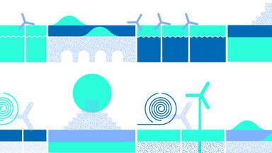
Mapping sensitive areas related to visual values
Over the years, visual impacts on World Heritage properties have increased in relevance and occurrence. They have heightened the need to identify and map specific vistas, panoramas, viewpoints, and silhouettes that need to be protected to maintain the visual distinctiveness of a property and to visually demonstrate the relationship between the World Heritage property with its surroundings (the buffer zone and the wider setting). ➔ See Note 5. This is especially relevant for cultural World Heritage properties and natural World Heritage properties inscribed under criteria (vii).
The vulnerability study should cover the property as well as the buffer zone and the wider setting of a World Heritage property (➔ see World Heritage essentials). Such mapping may focus on matters related to the exposure and vulnerability/sensitivity of the OUV of World Heritage properties to wind energy.
Wind energy related factors that may be relevant for the vulnerability assessment
- potential placement of wind farms / development potential indices for wind energy if available (DPIs – which is a land suitability index for wind energy installation)
- potential extension of the wind farms and location of the ancillary infrastructure
- technical parameters of the wind turbines considered suitable in that area, including information about their construction requirements
- technical information about the associated ancillary infrastructure and their construction requirements
- potential time of construction and its technical requirements
- upkeeping and maintenance requirements
- lifecycle of the windfarms
- deconstruction and its technical requirements
How to use the result of a vulnerability assessment?
The result of a vulnerability study is a complex dataset. The maps for sensitive or vulnerable areas are to be provided preferably with GIS based maps that could be included in databases and datasets with a clear explanation about the characteristic of the mapped area and its protection and management needs.
Other vulnerability data (if spatial data is less or not relevant for specific attributes) could be described in a format other than a map with clear links to the Outstanding Universal Value (OUV) of a World Heritage property and attributes that convey the OUV, including protection and management measures.
The datasets and maps are then to be included in the management system and management plan of the properties. The resulting maps could form part of the management system and plan of a property. It also allows this information to be included in other documents that form the basis of policy making and planning (like national/regional level development plans, spatial planning documents and zoning maps), moreover national databases for natural and cultural heritage. This process and the resulting dataset or maps allow tangible and intangible values and supporting elements, even abstract concepts to become perceptible with limitations that are possible to be incorporated into sectoral strategic plans and development maps.
How the result of identifying sensitive areas could assist wind energy projects?
The result of the vulnerability/sensitivity study or mapping has the high potential to indicate which World Heritage properties and which areas of these properties are vulnerable to wind energy projects and in which way. It allows recognizing potential areas that are suitable for wind energy projects from a World Heritage perspective, and also areas where certain or all type of wind energy facility might have a negative impact on the OUV of a World Heritage property.
The result of a vulnerability assessment for wind energy projects could already be available when a new project is proposed, but it could also be part of an impact assessment process (➔ See the elements of the impact assessment process in Impacts of wind energy projects and their assessment). Vulnerability studies may help to model and anticipate the impacts of projects and may serve as basis of dialogue between project proponents and the authorities or organizations entrusted with the protection and management of World heritage properties.
Case studies
See setting studies presented in World Heritage and wind energy planning, Protecting visual integrity in the context of the energy transition
See also the screening process of an impact assessment that was combined with mapping sensitive areas and finding suitable areas for offshore wind energy installation:
Planning offshore wind turbines along the coast of Normandy, France