The Ahwar of Southern Iraq: Refuge of Biodiversity and the Relict Landscape of the Mesopotamian Cities
Multiple Locations (7)
| ID | Name & Location | State Party | Coordinates | Property | Buffer Zone |
|---|---|---|---|---|---|
| 1481-001 | The Iraqi side of Huwaizah Marshes | Iraq |
N31 33 44 E47 39 28 |
48,131 ha | 42,561 ha |
| 1481-002 | The Central Marshes | Iraq |
N31 5 7 E47 03 15 |
62,435 ha | 83,958 ha |
| 1481-003 | The East Hammar Marshes | Iraq |
N30 44 21 E47 26 19 |
20,342 ha | 12,721 ha |
| 1481-004 | The West Hammar Marshes | Iraq |
N30 50 30 E46 41 03 |
79,991 ha | 68,403 ha |
| 1481-005 | Uruk Archaeological City | Iraq |
N31 19 27 E45 38 14 |
541 ha | 292 ha |
| 1481-006 | Ur Archaeological City | Iraq |
N30 57 47 E46 6 11 |
71 ha | 317 ha |
| 1481-007 | Tell Eridu Archaeological Site | Iraq |
N30 49 1 E45 59 45 |
33 ha | 1,069 ha |
Maps
| Date | Title | |
|---|---|---|
|
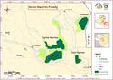
2016 | The Ahwar of Southern Iraq: Refuge of Biodiversity and the Relict Landscape of the Mesopotamian Cities - maps of the inscribed property |
Disclaimer
The Nomination files produced by the States Parties are published by the World Heritage Centre at its website and/or in working documents in order to ensure transparency, access to information and to facilitate the preparations of comparative analysis by other nominating States Parties.
The sole responsibility for the content of each Nomination file lies with the State Party concerned. The publication of the Nomination file does not imply the expression of any opinion whatsoever of the World Heritage Committee or of the Secretariat of UNESCO concerning the history or legal status of any country, territory, city or area or of its boundaries.