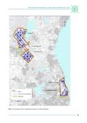
The par force hunting landscape in North Zealand
Multiple Locations (9)
| ID | Name & Location | State Party | Coordinates | Property | Buffer Zone |
|---|---|---|---|---|---|
| 1469-001 | Store Dyrehave | Denmark |
N55 54 49 E12 21 28 |
1,073.4 ha | 498 ha |
| 1469-002 | Gribskov | Denmark |
N55 58 24 E12 19 26 |
2,195.7 ha | 860.6 ha |
| 1469-003 | Jægersborg Dyrehave and Jægersborg Hegn | Denmark |
N55 48 13 E12 34 03 |
1,490.7 ha | 555.7 ha |
| 1469-004 | Path | Denmark |
N55 55 38 E12 20 24 |
0.06 ha | — |
| 1469-005 | Tolvkarlevej and Højager | Denmark |
N55 56 10 E12 20 44 |
0.29 ha | — |
| 1469-006 | Kulsviervej and Byskellet | Denmark |
N55 56 27 E12 21 19 |
0.81 ha | — |
| 1469-007 | Grønholtvangen south of Grønholt Vang | Denmark |
N55 56 58 E12 22 03 |
0.38 ha | — |
| 1469-008 | Ridestien in Grønholt Vang | Denmark |
N55 57 28 E12 22 16 |
0.23 ha | — |
| 1469-009 | Grønholtvangen north of Grønholt Vang | Denmark |
N55 57 46 E12 22 21 |
0.07 ha | — |
Maps
Disclaimer
The Nomination files produced by the States Parties are published by the World Heritage Centre at its website and/or in working documents in order to ensure transparency, access to information and to facilitate the preparations of comparative analysis by other nominating States Parties.
The sole responsibility for the content of each Nomination file lies with the State Party concerned. The publication of the Nomination file, including the maps and names, does not imply the expression of any opinion whatsoever of the World Heritage Committee or of the Secretariat of UNESCO concerning the history or legal status of any country, territory, city or area or of its boundaries.