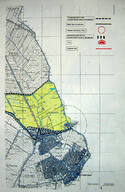
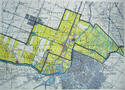
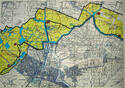
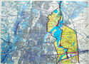
Dutch Water Defence Lines
Multiple Locations (20)
| ID | Name & Location | State Party | Coordinates | Property | Buffer Zone |
|---|---|---|---|---|---|
| 759bis-001 | Dutch Water Defence Lines, consisting of existing The Defence Line of Amsterdam and the extension New Dutch Waterline | Netherlands (Kingdom of the) |
N52 9 54 E5 4 58.8 |
55,368.92 ha | 149,705.95 ha |
| 759bis-002 | Coastal Fort near Ijmuiden | Netherlands (Kingdom of the) |
N52 27 53.73 E4 34 33.6 |
6.3 ha | 409.89 ha |
| 759bis-003 | Fort near Heemstede | Netherlands (Kingdom of the) |
N52 20 12.62 E4 37 56.36 |
1.52 ha | |
| 759bis-004 | Works along the IJ before Diemerdam | Netherlands (Kingdom of the) |
N52 20 34.6 E5 0 49.25 |
2.3 ha | |
| 759bis-005 | Fort along the Pampus | Netherlands (Kingdom of the) |
N52 21 53.24 E5 4 8.18 |
2.64 ha | 373.76 ha |
| 759bis-006 | Works along the IJ before Durgerdam (Vuurtoreneiland) | Netherlands (Kingdom of the) |
N52 22 20.58 E5 0 49.28 |
1.81 ha | 372.72 ha |
| 759bis-007 | Fort Werk IV | Netherlands (Kingdom of the) |
N52 16 17.03 E5 10 33.65 |
1.13 ha | |
| 759bis-008 | Tiel Inundation Canal | Netherlands (Kingdom of the) |
N51 52 35.2 E5 24 26.16 |
15.54 ha | |
| 759bis-009 | Fort Pannerden | Netherlands (Kingdom of the) |
N51 52 51.32 E6 1 36.15 |
1 ha | 88.28 ha |
| 759bis-010 | Group shelter type P | Netherlands (Kingdom of the) |
N52 5 6.62 E5 8 57.97 |
0.004 ha | |
| 759bis-011 | Group shelter type P | Netherlands (Kingdom of the) |
N52 5 4.47 E5 9 2.45 |
0.004 ha | |
| 759bis-012 | Zilveren schaats | Netherlands (Kingdom of the) |
N52 5 23.15 E5 8 44.79 |
3.44 ha | |
| 759bis-013 | Sluice | Netherlands (Kingdom of the) |
N52 5 16 E5 8 45.9 |
0.0006 ha | |
| 759bis-014 | Group shelter type P | Netherlands (Kingdom of the) |
N52 5 3.8 E5 9 3.67 |
0.004 ha | |
| 759bis-015 | Culvert near Offerhausweg | Netherlands (Kingdom of the) |
N52 5 38.15 E5 8 42.09 |
0.05 ha | |
| 759bis-016 | Culvert/Bridge near Minstroom | Netherlands (Kingdom of the) |
N52 5 9.24 E5 8 54.92 |
0.04 ha | |
| 759bis-017 | Culvert/Bridge Kromme Rijn | Netherlands (Kingdom of the) |
N52 4 38.07 E5 8 28.32 |
0.09 ha | |
| 759bis-018 | Bridge with the twelve holes | Netherlands (Kingdom of the) |
N52 4 56.07 E5 9 12.13 |
0.02 ha | |
| 759bis-019 | Watchtower at the reduit of Fort Vossegat | Netherlands (Kingdom of the) |
N52 4 56.05 E5 8 59.47 |
0.06 ha | |
| 759bis-020 | Shelter (Tamboershut) | Netherlands (Kingdom of the) |
N52 4 59.9 E5 9 10.95 |
0.005 ha |
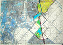
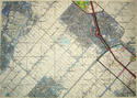
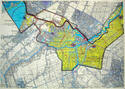
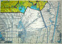
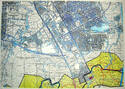
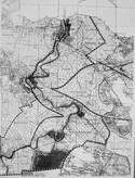
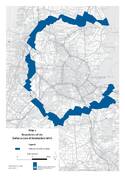
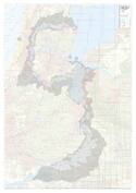
Maps


Disclaimer
The Nomination files produced by the States Parties are published by the World Heritage Centre at its website and/or in working documents in order to ensure transparency, access to information and to facilitate the preparations of comparative analysis by other nominating States Parties.
The sole responsibility for the content of each Nomination file lies with the State Party concerned. The publication of the Nomination file does not imply the expression of any opinion whatsoever of the World Heritage Committee or of the Secretariat of UNESCO concerning the history or legal status of any country, territory, city or area or of its boundaries.