Take advantage of the search to browse through the World Heritage Centre information.

Archaeological Ensemble of Mérida

Multiple Locations (22)
ID Name & Location State Party Coordinates Property Buffer Zone
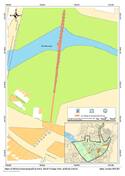
664-001 Los Milagros Aqueduct Spain N38 55 26.09
W6 20 52.41
0.1177 ha 20.9 ha
664-002 San Lázaro Aqueduct Spain N38 55 20.9
W6 20 7.29
1.0977 ha 20.87 ha
664-003 Alcantarilla Bridge Spain N38 55 40.64
W6 21 41.66
0.0038 ha
664-004 Guadiana River Dam, Roman Bridge over Guadiana River, Alcazaba Spain N38 54 53.83
W6 20 48.73
4.3975 ha 20.87 ha
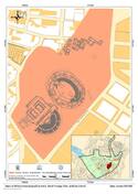
664-005 Roman Theatre, Amphitheatre, the Amphitheatre House Spain N38 54 59.18
W6 20 17.78
7.9637 ha 20.87 ha
664-006 Trajan's Arch, Concordia Temple Spain N38 55 4.47
W6 20 46.17
0.7827 ha 20.87 ha
664-007 Sta. Catalina Basilica Spain N38 55 15.93
W6 20 15.95
0.1549 ha 20.87 ha
664-008 Casa Herrera Basilica Spain N38 57 40.27
W6 17 40.21
2.3455 ha
664-009 Sta. Eulalia Basilica: Interpretation Centre, Temple of Mars Spain N38 55 14.49
W6 20 30.73
0.682 ha 20.87 ha
664-010 The Roman Circus Spain N38 55 12.05
W6 19 59.3
5.9935 ha 20.87 ha
664-011 The Mithraeum House - The Columbaria Funerary Area Spain N38 54 42.22
W6 20 23.49
3.5383 ha 20.87 ha
664-012 Church of Sta. Clara and Visigothic Art Collection Spain N38 55 1.7
W6 20 48.78
0.1532 ha 20.87 ha
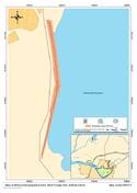
664-013 Cornalvo Dam Spain N38 59 19.22
W6 11 28.05
0.1881 ha
664-014 Proserpina Dam Spain N38 58 10.72
W6 21 59.27
0.5571 ha
664-015 Local Forum Spain N38 55 0.57
W6 20 35.09
0.7155 ha 20.87 ha
664-016 Roman Wall and Albarrana Islamic Tower Spain N38 55 10.03
W6 20 38.61
0.0251 ha 20.87 ha
664-017 National Museum of Roman Art Spain N38 55 2.23
W6 20 22.65
0.4447 ha 20.87 ha
664-018 Sta. Eulalia Obelisk Spain N38 55 9.5
W6 20 28.14
0.0596 ha 20.87 ha
664-019 Roman Bridge over Albarregas River Spain N38 55 25.54
W6 20 56.99
0.1094 ha 20.87 ha
664-020 Temple of Diana Spain N38 54 59.62
W6 20 39.61
1.0776 ha 20.87 ha
664-021 Thermal Baths at Reyes Huertas St. Spain N38 55 6.09
W6 20 22.18
0.0637 ha 20.87 ha
664-022 Thermal Baths at Alange Spain N38 47 5.04
W6 14 36.86
0.2977 ha
Maps
Date Title
2012 Map A. Map of the remain’s location in Spain and the Extremadura Autonomous Community Clarification / adopted
2012 Map B. Boundaries of the World Heritage Site of the Archaeological Ensemble of Mérida Clarification / adopted
2012 Map C. Boundaries of the World Heritage Site of the Archaeological Ensemble of Mérida, without the element 664-022 (Roman Thermal Baths at Alange) Clarification / adopted
2012 Map D. Boundaries of the World Heritage Site of the Archaeological Ensemble of Mérida, showing only the elements included inside the urban area Clarification / adopted
2012 Archaeological Ensemble of Mérida. Map showing component 664-001 Clarification / adopted
2012 Archaeological Ensemble of Mérida. Map showing component 664-002 Clarification / adopted
2012 Archaeological Ensemble of Mérida. Map showing component 664-003 Clarification / adopted
2012 Archaeological Ensemble of Mérida. Map showing component 664-004 Clarification / adopted
2012 Archaeological Ensemble of Mérida. Map showing component 664-005 Clarification / adopted
2012 Archaeological Ensemble of Mérida. Map showing component 664-006 Clarification / adopted
2012 Archaeological Ensemble of Mérida. Map showing component 664-007 Clarification / adopted
2012 Archaeological Ensemble of Mérida. Map showing component 664-008 Clarification / adopted
2012 Archaeological Ensemble of Mérida. Map showing component 664-009 Clarification / adopted
2012 Archaeological Ensemble of Mérida. Map showing component 664-010 Clarification / adopted
2012 Archaeological Ensemble of Mérida. Map showing component 664-011 Clarification / adopted
2012 Archaeological Ensemble of Mérida. Map showing component 664-012 Clarification / adopted
2012 Archaeological Ensemble of Mérida. Map showing component 664-013 Clarification / adopted
2012 Archaeological Ensemble of Mérida. Map showing component 664-014 Clarification / adopted
2012 Archaeological Ensemble of Mérida. Map showing component 664-015 Clarification / adopted
2012 Archaeological Ensemble of Mérida. Map showing component 664-016 Clarification / adopted
2012 Archaeological Ensemble of Mérida. Map showing component 664-017 Clarification / adopted
2012 Archaeological Ensemble of Mérida. Map showing component 664-018 Clarification / adopted
2012 Archaeological Ensemble of Mérida. Map showing component 664-019 Clarification / adopted
2012 Archaeological Ensemble of Mérida. Map showing component 664-020 Clarification / adopted
2012 Archaeological Ensemble of Mérida. Map showing component 664-021 Clarification / adopted
2012 Archaeological Ensemble of Mérida. Map showing component 664-022 Clarification / adopted
Disclaimer

The Nomination files produced by the States Parties are published by the World Heritage Centre at its website and/or in working documents in order to ensure transparency, access to information and to facilitate the preparations of comparative analysis by other nominating States Parties.

The sole responsibility for the content of each Nomination file lies with the State Party concerned. The publication of the Nomination file, including the maps and names, does not imply the expression of any opinion whatsoever of the World Heritage Committee or of the Secretariat of UNESCO concerning the history or legal status of any country, territory, city or area or of its boundaries.

top