Colchic Rainforests and Wetlands
Colchic Rainforests and Wetlands
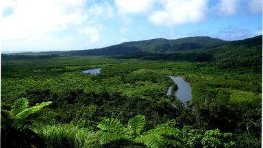
The property comprises seven component parts, within an 80km long corridor along the warm-temperate and extremely humid eastern coast of the Black Sea. They provide a series of the most typical Colchic ecosystems at altitudes ranging from sea level to more than 2,500 metres above it. The main ecosystems are ancient deciduous Colchic rainforests and wetlands, percolation bogs and other mire types of the distinct Colchic mire region. The extremely humid broad-leaved rainforests comprise a highly diverse flora and fauna, with very high densities of endemic and relict species, with significant numbers of globally threatened species and relict species, which survived the glacial cycles of the Tertiary. The site is home to approximately 1,100 species of vascular and non-vascular plants, including 44 threatened vascular plan species, and almost 500 species of vertebrates, and a high number of invertebrate species. The site also harbours 19 threatened animal species including sturgeon, notably the critically endangered Colchic Sturgeon. It is a key stopover for many globally threatened birds that migrate through the Batumi bottleneck.
Description is available under license CC-BY-SA IGO 3.0
Forêts pluviales et zones humides de Colchide
Le bien comprend sept éléments constitutifs dans un corridor de 80 km de long bordant le littoral oriental tempéré chaud et extrêmement humide de la mer Noire. Ces éléments constituent une série altitudinale quasi complète des écosystèmes les plus typiques de la Colchide, du niveau de la mer à plus de 2 500 m d’altitude. Les principaux écosystèmes sont des forêts pluviales anciennes et décidues de Colchide et des zones humides, des tourbières de percolation et autres types de milieux tourbeux de la région de Colchide. Les forêts pluviales de feuillus, très humides, abritent une flore et une faune extrêmement diverses et présentent de très fortes densités d’espèces endémiques et reliques, notamment un nombre important d’espèces menacées au plan mondial et d’espèces reliques ayant survécu aux cycles glaciaires du Tertiaire. Le bien abrite environ 1 100 espèces de plantes vasculaires et non vasculaires, dont 44 espèces de plantes non vasculaires menacées, ainsi que près de 500 espèces de vertébrés et un grand nombre d’espèces d’invertébrés. Le site constitue également l’habitat de 19 espèces animales menacées, notamment l’esturgeon, et en particulier l’esturgeon du Danube, en danger critique. Il s’agit d’un site d’étape clé pour de nombreux oiseaux menacés au plan mondial qui migrent à travers le goulot d’étranglement de Batumi.
Description is available under license CC-BY-SA IGO 3.0
غابات كولشان المطيرة وأراضيها الرطبة
يتألَّف الموقع من سبعة عناصر موزَّعة داخل ممرّ طوله 80 كم على امتداد الساحل الشرقي للبحر الأسود، الذي يمتاز بالحرارة الدافئة والرطوبة الشديدة. وتُعتبر هذه العناصر بمثابة سلسلة من نُظُم كولخيس البيئية المميّزة والموزّعة على ارتفاعات تبدأ من مستوى سطح البحر وتصل إلى أكثر من 2500 متر فوق مستوى سطح البحر. وتضم أبرز النظم البيئية في الموقع غابات كولخيس النفضية المطيرة وأراضيها الرطبة، وأراضي الخث الرشحيّة وغيرها من أنواع مستنقعات الخث في منطقة كولخيس المميّزة. وتأوي الغابات المطيرة الشديدة الرطوبة والعريضة الأوراق طيفاً واسعاً للغاية من الأصناف النباتية والحيوانية، وتشهد تواجداً مكثفاً للغاية للأنواع القديمة المتبقية والأنواع المستوطنة، وعدداً كبيراً من الأنواع المهددة بالانقراض على الصعيد العالمي والأنواع المستوطنة، التي نجت من الدورات الجليدية إبّان العصر الجليدي الثالث. ويعتبر الموقع موطناً لزهاء 1100 نوع من النباتات الوعائية وغير الوعائية، من بينها 44 نوعاً من النباتات الوعائية المهددة بالانقراض، وزهاء 500 نوع من الفقاريات، فضلاً عن عدد كبير من فصائل اللافقاريات. ويحتوي الموقع كذلك الأمر على 19 فصيلة من الحيوانات المهددة، من بينها الأسماك الحفشية، ولا سيما أسماك كولخيس الحفشية المهددة بالانقراض. ويندرج الموقع في عداد المحطات الرئيسية التي تتوقف فيها العديد من الطيور المهددة على الصعيد العالمي، والمهاجرة عبر باتومي.
source: UNESCO/CPE
Description is available under license CC-BY-SA IGO 3.0
科尔基斯雨林及湿地
该遗产地由7个部分组成,沿暖温带极其潮湿的黑海东海岸分布,纵向长度约80公里。这里有一系列最典型的科尔基斯生态系统,从海平面一直延伸到海拔2500多米以上。主体为古老的科尔基斯落叶雨林及湿地、渗透沼泽和其它科尔基斯沼泽地区独有的泥沼类型。极度潮湿的阔叶雨林由高度多样化的动植物群组成,具有非常高密度的孑遗特有种,以及大量在第三纪冰期中幸存下来的全球濒危物种和孑遗物种。该遗产地是大约1100种维管束植物和非维管束植物的家园,包括44种濒危维管植物,以及近500种脊椎动物和大量的无脊椎动物。该地区还栖息着19种濒危动物,包括鲟鱼,特别是极度濒危的科尔基斯鲟。此处还是许多通过巴统廊道迁徙的全球濒危鸟类的关键中继站。
source: UNESCO/CPE
Description is available under license CC-BY-SA IGO 3.0
Колхидские тропические леса и водно-болотные угодья
Объект состоит из семи составных частей в пределах 80-километрового коридора вдоль умеренно-теплого и очень влажного восточного побережья Черного моря. Объект представляет собой ряд наиболее типичных колхидских экосистем на высотах от уровня моря до более 2500 м над уровнем моря. Основными экосистемами являются древние колхидские лиственные тропические леса и водно-болотные угодья, перколяционные болота и другие виды болот, характерные для региона колхидских болот. Влажные широколиственные тропические леса являются местом обитания для разнообразной флоры и фауны с очень высокой плотностью эндемичных и реликтовых видов, со значительным количеством видов, находящихся в угрожаемом положении в глобальном масштабе, и реликтовых видов, которые пережили ледниковые циклы третичного периода. На территории объекта обитает около 1100 видов сосудистых и несосудистых растений, в том числе 44 вида сосудистых растений, находящихся в угрожаемом положении, а также почти 500 видов позвоночных и большое количество видов беспозвоночных. На территории объекта также обитают 19 видов животных, находящихся в угрожаемом положении, в том числе осетровые, в частности, находящийся на грани полного исчезновения колхидский осетр. Объект является ключевой остановкой для многих видов птиц, находящихся в угрожаемом положении в глобальном масштабе, которые мигрируют через узкие пути Батуми.
source: UNESCO/CPE
Description is available under license CC-BY-SA IGO 3.0
Bosques pluviales y zonas húmedas de la Cólquida
Este sitio consta de siete componentes situados en un amplio corredor de 80 kilómetros de longitud extendido a lo largo de la costa oriental del Mar Negro, cuyo clima es cálido templado y muy húmedo. Esos componentes albergan un conjunto de los ecosistemas más característicos de la región de la Cólquida, escalonados desde el nivel del mar hasta más de 2.500 metros de altura, entre los que destacan antiguos bosques pluviales caducifolios, humedales, turberas y otros tipos de zonas pantanosas específicas de la región. Los frondosos bosques pluviales de hoja ancha, extremadamente húmedos, albergan una flora y una fauna muy diversas que se caracterizan por la alta densidad de sus especies vivas endémicas y arcaicas, supervivientes de los ciclos glaciares del Periodo Terciario. El sitio cuenta con unas 1.100 especies de plantas de todas clases, entre las que figuran 44 plantas vasculares en peligro de extinción, y además es el hábitat de casi 500 especies de animales vertebrados y de poblaciones muy numerosas de invertebrados. De los 19 animales amenazados de desaparición que viven en la región, el esturión de la Cólquida es el que se halla en una situación más crítica. El sitio constituye, además, un área de escala esencial para muchas especies de aves migratorias en peligro de extinción a nivel mundial que transitan por la zona de Batumi, uno de los lugares del mundo con mayor concentración de paso de esta clase de aves.
source: UNESCO/CPE
Description is available under license CC-BY-SA IGO 3.0
Outstanding Universal Value
Brief synthesis
The property is situated in Georgia, within the Autonomous Republic of Adjara as well as the regions of Guria and Samegrelo-Zemo Svaneti. It comprises a series of seven component parts, which are located close to each other within an 80 km long corridor along the warm-temperate and extremely humid eastern coast of the Black Sea. They provide an almost complete altitudinal series of the most typical Colchic ecosystems running from sea level to more than 2,500 m above sea level. The main ecosystems are ancient deciduous Colchic rainforests and wetlands – particularly percolation bogs and other mire types of the Colchic mire region, a distinct mire region within Europe and Eurasia.
The Colchic Rainforests and Wetlands are relict forests, which have survived the glacial cycles of the ice age. The extremely humid nemoral broad-leaved rainforests comprise a highly diverse flora and fauna, with very high densities of endemic and relict species. This is the result of millions of years of uninterrupted evolution and speciation processes within the Colchic Pliocene refugium. The peatlands of the Colchis mire region, which are closely interlinked with lowland Colchic rainforests, also reflect the mild and extremely humid conditions there. These allow for the existence of percolation bogs, the simplest functional type of mires, only occurring in the Colchis mire region. In addition to percolation bogs, there is a complete series of other succession stages of mire development in the Colchic wetlands.
Criterion (ix): The property comprises ancient Colchic rainforests with their characteristic vertical zoning and ecological succession, and wetlands, particularly Colchic mires, with their supporting processes and succession. A unique combination of influences from three mountain ranges to the north, east and south, with the Black Sea to the west, plus high precipitation and a narrow range in seasonal temperature variations results in conditions that have created outstandingly complex and diverse forest structures, peatland accumulations, high levels of endemism and intra species diversity.
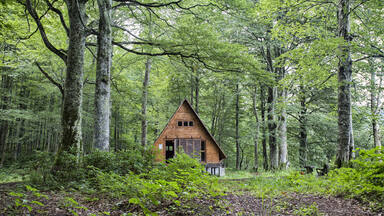
The Colchic rainforests are highly humid temperate deciduous rainforests, and among the oldest nemoral broad-leaved forests globally. While they are distinguished from other temperate forests by their rich evergreen understoreys, they also display a remarkably dense mosaic of forest types, with 23 forest associations co-existing within an area of only about 200 km2. Together with the Hyrcanian Forests, they are the most important relicts of Arcto-Tertiary forests in western Eurasia. This peculiar and diverse community, which has survived the Pleistocene glacial cycles, includes a multitude of relict and endemic species. It reflects exceptionally constant climatic conditions and is an invaluable example of the manifold long-term evolutionary processes of forest biota over at least 10-15 million years.
The extensive paludified areas along the Black Sea coast are a result of evolutionary and ecological processes related to climate variability in an ancient warm-temperate ecoregion continuously vegetated since the Tertiary period. The exceptional character of the mires has led to the recognition of a distinct Colchis mire region. Their percolation bogs are of particular global importance as they do not exist anywhere else in the world. They can be considered the simplest and hence ideal-typical mire, due to almost permanent water supplied exclusively by precipitation. Percolation bogs are essential for the functional understanding of all mires, and hence of terrestrial carbon storage in general.
Criterion (x): The property represents a distinctive area of outstanding biodiversity within the wider Caucasus Global Biodiversity Hotspot, where a rich flora and fauna adapted to warm-temperate and extremely humid climate is concentrated. It belongs to one of the two most important refuge areas of Arcto-Tertiary geoflora in western Eurasia. The property is characterized by a high level of floral and faunal diversity with significant numbers of globally threatened species and relict species, which survived the glacial cycles of the Tertiary.
The property is home to approximately 1,100 species of vascular and non-vascular plants, as well as almost 500 species of vertebrates, and a high number of invertebrate species. It hosts an extremely high proportion of endemic species for a non-tropical, non-island region. There are 149 species of plants with a restricted range and almost one third of mammals, amphibians and reptiles are endemic. The contribution of endemic species to amphibians, reptiles and mammals of the region is at 28%.
Forty-four globally threatened or near-threatened species of vascular plants, 50 of vertebrates, and 8 of invertebrates have been recorded in the Colchic Rainforests and Wetlands. The property also harbors sturgeon species, including the Colchic Sturgeon, and serves as a key stopover for many globally threatened birds that migrate through the Batumi bottleneck.
Integrity
The component parts of the Colchic Rainforests and Wetlands have been selected based on a careful regional analysis. The boundaries of component parts incorporate attributes necessary to convey the Outstanding Universal Value, mostly following natural features such as mountain ridges. The component parts cover most of the existing mires of the Colchis mire region, and the best preserved and most representative rainforests. The property includes more than 90% of the altitudinal range at which Colchic rainforests occur, and the great majority of typical forest associations. They also comprise a complete successional series of the mires characteristic of the Colchis mire region. The property as a whole holds the great majority of the Colchic flora and fauna, and an even greater proportion of the endemic plant species found in the wider region is concentrated here.
There were significant losses to the Colchic rainforests and mires across the Colchic region until the late 20th Century. In contrast, the forests and mires inside the property have remained fully intact both structurally and functionally, as shown by their community structure and ecological processes. While some of the Colchic mires were slightly degraded by nearby draining in the past, their current hydrological intactness and resilience is ensured by their dependence on atmospheric precipitation, high mire oscillation capacity, the stabilizing effect of the nearby sea, and extensive upstream buffer zones.
Protection and management requirements
The component parts of the property are effectively protected against local anthropogenic threats. Only small parts of some of the buffer zones are slightly affected by an acceptable level of traditional natural resource use. All the component parts of the property, and all but 208 ha of the buffer zone, are situated on state-owned land within legally designated protected areas. These are either strictly protected areas (IUCN Protected Area category Ia), or those zones of National Parks (IUCN Protected Area category II) that afford the highest levels of protection. Only a very small part of the property belongs to a protected landscape (IUCN Protected Area category V). The boundaries of these protected areas are known and accepted by the local population.
The protected areas that cover the property are managed by the Agency of Protected Areas of the Ministry of Environmental Protection and Agriculture of Georgia, through its local Protected Area Administration. Sustainably funded integrated management of the entire property is required in addition to the implementation of comprehensive management plans for all four protected areas. Coordination of component areas is enabled as all are managed by the Agency of Protected Areas. An integrated management framework of the property has been developed and requires finalization.
There is scope for the protected areas to be expanded further, based on strategic conservation planning using Key Biodiversity Areas, which may provide an additional layer of protection to the property, and possibly allow for future extensions to both the property and buffer zones to be considered. This is particularly important in view of existing and potential developments in proximity of the property and along the Black Sea coast. Any development projects need to be subject to rigorous Environmental Impact Assessment procedures, and should not go ahead in case of potential negative impacts on the property’s Outstanding Universal Value.


