Print
Share on social media
Facebook TwitterUNESCO social media
Facebook Youtube Twitter RSS World Heritage Terms / Policies SyndicationStećci Medieval Tombstone Graveyards
Multiple Locations (28)
| ID | Name & Location | State Party | Coordinates | Property | Buffer Zone |
|---|---|---|---|---|---|
| 1504-001 | Radimlja, Stolac | Bosnia and Herzegovina |
N43 5 31.97 E17 55 26.59 |
1.48 ha | 51.22 ha |
| 1504-002 | Grčka glavica in the village of Biskup, Konjic | Bosnia and Herzegovina |
N43 29 48 E18 7 18 |
0.26 ha | 2.34 ha |
| 1504-003 | Kalufi in Krekovi, Nevesinje | Bosnia and Herzegovina |
N43 18 47.5 E18 11 47.3 |
1.99 ha | 9.98 ha |
| 1504-004 | Borak in the village of Burati, Rogatica | Bosnia and Herzegovina |
N43 50 13 E18 53 4.05 |
3 ha | 4.6 ha |
| 1504-005 | Maculje, Novi Travnik | Bosnia and Herzegovina |
N44 3 2 E17 40 30 |
0.6 ha | 17.23 ha |
| 1504-006 | Dugo polje at Blidinje, Jablanica | Bosnia and Herzegovina |
N43 39 47.6 E17 32 35 |
0.65 ha | 35.02 ha |
| 1504-007 | Gvozno, Kalinovik | Bosnia and Herzegovina |
N43 33 27.6 E18 26 18 |
0.27 ha | 7.1 ha |
| 1504-008 | Grebnice, Radmilovića Dubrava, Baljci, Bileća | Bosnia and Herzegovina |
N42 54 16.5 E18 27 52 |
1.18 ha | 2.5 ha |
| 1504-009 | Bijača, Ljubuški | Bosnia and Herzegovina |
N43 7 44.9 E17 35 37 |
0.22 ha | 4.7 ha |
| 1504-010 | Olovci, Kladanj | Bosnia and Herzegovina |
N44 17 16 E18 38 52 |
0.06 ha | 4.32 ha |
| 1504-011 | Mramor in Musići, Olovo | Bosnia and Herzegovina |
N44 6 26 E18 31 15 |
0.51 ha | 5.45 ha |
| 1504-012 | Kučarin in Hrančići, Goražde | Bosnia and Herzegovina |
N43 40 57.3 E18 45 34 |
2.38 ha | 11.86 ha |
| 1504-013 | Boljuni, Stolac | Bosnia and Herzegovina |
N43 1 40.38 E17 52 29.36 |
1.06 ha | 1.35 ha |
| 1504-014 | Dolovi in the village of Umoljani, Trnovo | Bosnia and Herzegovina |
N43 39 18.5 E18 14 13.24 |
22.38 ha | 31.56 ha |
| 1504-015 | Luburića polje, Sokolac | Bosnia and Herzegovina |
N43 57 28.34 E18 50 34.45 |
3 ha | 4.6 ha |
| 1504-016 | Potkuk in Bitunja, Berkovići | Bosnia and Herzegovina |
N43 6 35.86 E18 7 44.24 |
1.06 ha | 5.1 ha |
| 1504-017 | Bečani, Šekovići | Bosnia and Herzegovina |
N44 19 40.09 E18 50 41.78 |
0.39 ha | 2.1 ha |
| 1504-018 | Mramor in Vrbica, Foča | Bosnia and Herzegovina |
N43 23 24.99 E18 56 34.99 |
2.22 ha | 2.79 ha |
| 1504-019 | Čengića Bara, Kalinovik | Bosnia and Herzegovina |
N43 25 14.83 E18 24 7.24 |
0.38 ha | 1.9 ha |
| 1504-020 | Ravanjska vrata, Kupres | Bosnia and Herzegovina |
N43 51 47.91 E17 18 45.57 |
1.51 ha | 21 ha |
| 1504-021 | Velika and Mala Crljivica, Cista Velika | Croatia |
N43 30 55.28 E16 55 37.9 |
2.06 ha | 8.02 ha |
| 1504-022 | St. Barbara, Dubravka, Konavle | Croatia |
N42 32 30.42 E18 25 20.57 |
0.17 ha | 9.63 ha |
| 1504-023 | Grčko groblje, Žabljak | Montenegro |
N43 5 41.34 E19 8 57.06 |
0.1 ha | 7.49 ha |
| 1504-024 | Bare Žugića, Žabljak | Montenegro |
N43 6 27.36 E19 10 5.22 |
0.42 ha | 3.01 ha |
| 1504-025 | Grčko groblje, Plužine | Montenegro |
N43 20 30.18 E18 51 26.22 |
0.05 ha | 0.77 ha |
| 1504-026 | Mramorje, Perućac, Bajina Bašta | Serbia |
N43 57 28 E19 25 49 |
0.55 ha | 17.85 ha |
| 1504-027 | Mramorje, Rastište, Bajina Bašta | Serbia |
N43 56 45 E19 21 13 |
0.33 ha | 23 ha |
| 1504-028 | Grčko groblje, Hrta, Prijepolje | Serbia |
N43 17 56 E19 37 28 |
0.87 ha | 24.75 ha |
Maps
| Date | Title | |
|---|---|---|

|
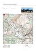
2016 | Stećci – Medieval Tombstone - maps of the inscribed property |
Disclaimer
The Nomination files produced by the States Parties are published by the World Heritage Centre at its website and/or in working documents in order to ensure transparency, access to information and to facilitate the preparations of comparative analysis by other nominating States Parties.
The sole responsibility for the content of each Nomination file lies with the State Party concerned. The publication of the Nomination file, including the maps and names, does not imply the expression of any opinion whatsoever of the World Heritage Committee or of the Secretariat of UNESCO concerning the history or legal status of any country, territory, city or area or of its boundaries.