Print
Share on social media
Facebook TwitterUNESCO social media
Facebook Youtube Twitter RSS World Heritage Terms / Policies SyndicationSites of Japan’s Meiji Industrial Revolution: Iron and Steel, Shipbuilding and Coal Mining
Multiple Locations (23)
| ID | Name & Location | State Party | Coordinates | Property | Buffer Zone |
|---|---|---|---|---|---|
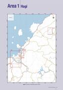
| 1484-001 | Hagi Proto-industrial Heritage/ Hagi Reverbatory Furnace | Japan |
N34 25 41 E131 25 06 |
0.38 ha | 119.72 ha |
| 1484-002 | Hagi Proto-industrial Heritage/ Ebisugahana Shipyard | Japan |
N34 25 50 E131 24 44 |
0.79 ha | — |
| 1484-003 | Hagi Proto-industrial Heritage/ Ohitayama Tatara Iron Works | Japan |
N34 30 20 E131 32 18 |
0.63 ha | 234.56 ha |
| 1484-004 | Hagi Proto-industrial Heritage/ Hagi Castle Town | Japan |
N34 24 52 E131 23 14 |
96.9 ha | 712.31 ha |
| 1484-005 | Hagi Proto-industrial Heritage/ Shokasonjuku Academy | Japan |
N34 24 44 E131 25 03 |
0.13 ha | 1.73 ha |
| 1484-006 | Shuseikan | Japan |
N31 37 04 E130 34 41 |
9.98 ha | 61.09 ha |
| 1484-007 | Shuseikan/ Terayama Charcoal Kiln | Japan |
N31 39 43 E130 36 01 |
0.64 ha | 2.01 ha |
| 1484-008 | Shuseikan / Sekiyoshi Sluice gate of Yoshino leat | Japan |
N31 38 50 E130 33 09 |
0.11 ha | 1.93 ha |
| 1484-009 | Nirayama Reverbatory Furnaces | Japan |
N35 02 22 E138 57 45 |
0.5 ha | 33.86 ha |
| 1484-010 | Hashino Iron Mining and Smelting Site | Japan |
N39 19 58 E141 40 47 |
39.55 ha | 523.73 ha |
| 1484-011 | Mietsu Naval Dock | Japan |
N33 12 28 E130 20 25 |
3.14 ha | 33.43 ha |
| 1484-012 | Nagasaki Shipyard/ Kosuge Slip Dock | Japan |
N32 43 39 E129 51 40 |
2.36 ha | 16.45 ha |
| 1484-013 | Nagasaki Shipyard/ Mitsubishi No.3 Dry Dock | Japan |
N32 44 15 E129 51 23 |
2.28 ha | 5.82 ha |
| 1484-014 | Nagasaki Shipyard/ Mitsubishi Senshokaku Guest House | Japan |
N32 44 18 E129 51 25 |
0.41 ha | — |
| 1484-015 | Nagasaki Shipyard/ Mitsubishi Giant Cantilever Crane | Japan |
N32 44 32 E129 51 33 |
0.03 ha | 13.19 ha |
| 1484-016 | Nagasaki Shipyard/ Mitsubishi Former Pattern Shop | Japan |
N32 44 35 E129 51 22 |
0.36 ha | — |
| 1484-017 | Takashima Coal Mine/ Takashima Coal Mine | Japan |
N32 39 51 E129 45 04 |
0.17 ha | 5.75 ha |
| 1484-018 | Takashima Coal Mine/ Hashima Coal Mine | Japan |
N32 37 42 E129 44 18 |
6.51 ha | 36.04 ha |
| 1484-019 | Glover House and Office | Japan |
N32 44 03 E129 52 09 |
0.31 ha | 61.95 ha |
| 1484-020 | Miike Coal Mine and Miike Port | Japan |
N33 00 33 E130 25 31 |
119.78 ha | 371.61 ha |
| 1484-021 | Misumi West Port | Japan |
N32 37 20 E130 27 20 |
18.61 ha | 83.45 ha |
| 1484-022 | The Imperial Steel Works, Japan | Japan |
N33 52 25 E130 48 21 |
1.71 ha | 33.81 ha |
| 1484-023 | Onga river Pumping Station | Japan |
N33 48 40 E130 42 25 |
1.38 ha | 55.89 ha |
Maps
| Date | Title | |
|---|---|---|

|
2015 | Sites of Japan’s Meiji Industrial Revolution: Iron and Steel, Shipbuilding and Coal Mining - maps of inscribed property |
Disclaimer
The Nomination files produced by the States Parties are published by the World Heritage Centre at its website and/or in working documents in order to ensure transparency, access to information and to facilitate the preparations of comparative analysis by other nominating States Parties.
The sole responsibility for the content of each Nomination file lies with the State Party concerned. The publication of the Nomination file, including the maps and names, does not imply the expression of any opinion whatsoever of the World Heritage Committee or of the Secretariat of UNESCO concerning the history or legal status of any country, territory, city or area or of its boundaries.