Print
Share on social media
Facebook TwitterUNESCO social media
Facebook Youtube Twitter RSS World Heritage Terms / Policies SyndicationFujisan, sacred place and source of artistic inspiration
Multiple Locations (25)
| ID | Name & Location | State Party | Coordinates | Property | Buffer Zone |
|---|---|---|---|---|---|
| 1418-001 | Fujisan Moutain Area | Japan |
N35 21 38.99 E138 43 38.99 |
19,311.9 ha | 49,375.7 ha |
| 1418-002 | Fujisan Hongu Sengen Taisha Shrine | Japan |
N35 13 39 E138 36 36 |
4.8 ha | |
| 1418-003 | Yamamiya Sengen-jinja Shrine | Japan |
N35 16 15.99 E138 38 12.99 |
0.5 ha | |
| 1418-004 | Murayama Sengen-jinja Shrine | Japan |
N35 15 41 E138 39 59 |
3.6 ha | |
| 1418-005 | Suyama Sengen-jinja Shrine | Japan |
N35 15 15.99 E138 50 56 |
0.9 ha | |
| 1418-006 | Fuji Sengen-jinja Shrine (Subashiri Sengen-jinja Shrine) | Japan |
N35 21 45 E138 51 47.99 |
1.8 ha | |
| 1418-007 | Kawaguchi Asama-jinja Shrine | Japan |
N35 31 51.99 E138 46 28.99 |
1.6 ha | |
| 1418-008 | Fuji Omuro Segen-jinja Shrine | Japan |
N35 30 38 E138 44 44.99 |
2.6 ha | |
| 1418-009 | “Oshi” Lodging House (Former House of the Togawa Family) | Japan |
N35 28 47.99 E138 47 44.99 |
0.1 ha | |
| 1418-010 | “Oshi” Lodging House (House of the Osano Family) | Japan |
N35 28 33.99 E138 47 38 |
0.1 ha | |
| 1418-011 | Lake Yamanakako | Japan |
N35 25 15.99 E138 52 32 |
698.1 ha | |
| 1418-012 | Lake Kawaguchiko | Japan |
N35 30 47 E138 44 48 |
592.8 ha | |
| 1418-013 | Oshino Hakkai springs (Deguchiike Pond) | Japan |
N35 27 12.99 E138 50 12 |
0.048 ha | |
| 1418-014 | Oshino Hakkai (Okamaike Pond) | Japan |
N35 27 33.99 E138 49 50 |
0.002 ha | |
| 1418-015 | Oshino Hakkai (Sokonashiike Pond) | Japan |
N35 27 33.99 E138 49 53 |
0.006 ha | |
| 1418-016 | Oshino Hakkai (Choshiike Pond) | Japan |
N35 27 35.99 E138 49 54 |
0.005 ha | |
| 1418-017 | Oshino Hakkai (Wakuike Pond) | Japan |
N35 27 35.99 E138 49 58 |
0.078 ha | |
| 1418-018 | Oshino Hakkai (Nigoriike Pond) | Japan |
N35 27 37 E138 49 57 |
0.031 ha | |
| 1418-019 | Oshino Hakkai (Kagamikke Pond) | Japan |
N35 27 38.99 E138 49 59 |
0.014 ha | |
| 1418-020 | Oshino Hakkai (Shobuike Pond) | Japan |
N35 27 41 E138 50 3 |
0.042 ha | |
| 1418-021 | Funatsu lava tree molds | Japan |
N35 27 10 E138 45 15 |
8.2 ha | |
| 1418-022 | Yoshida lava tree molds | Japan |
N35 26 49.99 E138 45 33.99 |
5.8 ha | |
| 1418-023 | Hitoana Fuji-ko Iseki | Japan |
N35 21 42 E138 35 29 |
2.8 ha | |
| 1418-024 | Shiraito no Taki waterfalls | Japan |
N35 18 47 E138 35 13.99 |
1.8 ha | |
| 1418-025 | Mihonomatsubara pine tree grove | Japan |
N34 59 36.99 E138 31 22 |
64.4 ha | 252 ha |
Maps
| Date | Title | |
|---|---|---|

|
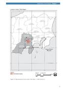
2013 | Fujisan, sacred place and source of artistic inspiration - map of inscribed property |
Disclaimer
The Nomination files produced by the States Parties are published by the World Heritage Centre at its website and/or in working documents in order to ensure transparency, access to information and to facilitate the preparations of comparative analysis by other nominating States Parties.
The sole responsibility for the content of each Nomination file lies with the State Party concerned. The publication of the Nomination file, including the maps and names, does not imply the expression of any opinion whatsoever of the World Heritage Committee or of the Secretariat of UNESCO concerning the history or legal status of any country, territory, city or area or of its boundaries.