The Dolomites
Multiple Locations (9)
| ID | Name & Location | State Party | Coordinates | Property | Buffer Zone |
|---|---|---|---|---|---|
| 1237rev-001 | Pelmo-Croda da Lago | Italy |
N46 26 52.00 E12 6 49.00 |
4,343.57 ha | 2,427.252 ha |
| 1237rev-002 | Marmolada | Italy |
N46 25 54.00 E11 51 23.00 |
2,207.53 ha | 577.953 ha |
| 1237rev-003 | Pale di San Martino San Lucano – Dolomiti Bellunesi – Vette Feltrine | Italy |
N46 14 51.00 E11 59 39.00 |
31,665.7 ha | 23,668.939 ha |
| 1237rev-004 | Dolomiti Friulane e d`Oltre Piave | Italy |
N46 20 48.00 E12 30 13.00 |
21,460.63 ha | 25,027.641 ha |
| 1237rev-005 | Dolomiti Settentrionali Cadorine, Sett Sass | Italy |
N46 36 47.00 E12 9 47.00 |
53,585.968 ha | 25,182.289 ha |
| 1237rev-006 | Puez-Odle / Puez-Geisler / Pöz-Odles | Italy |
N46 36 13.00 E11 48 24.00 |
7,930.337 ha | 2,863.546 ha |
| 1237rev-007 | Sciliar-Catinaccio | Italy |
N46 27 16.00 E11 36 10.00 |
9,302.098 ha | 4,770.689 ha |
| 1237rev-008 | Rio delle Foglie | Italy |
N46 21 37.00 E11 25 14.00 |
271.6 ha | 547.408 ha |
| 1237rev-009 | Dolomiti di Brenta | Italy |
N46 9 51.00 E10 54 9.00 |
11,135.442 ha | 4,201.045 ha |
Maps
| Date | Title | |
|---|---|---|
|
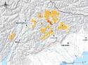
2009 | The Dolomites - inscribed zones |
Disclaimer
The Nomination files produced by the States Parties are published by the World Heritage Centre at its website and/or in working documents in order to ensure transparency, access to information and to facilitate the preparations of comparative analysis by other nominating States Parties.
The sole responsibility for the content of each Nomination file lies with the State Party concerned. The publication of the Nomination file, including the maps and names, does not imply the expression of any opinion whatsoever of the World Heritage Committee or of the Secretariat of UNESCO concerning the history or legal status of any country, territory, city or area or of its boundaries.