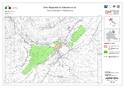
Rock Drawings in Valcamonica
Multiple Locations (6)
| ID | Name & Location | State Party | Coordinates | Property | Buffer Zone |
|---|---|---|---|---|---|
| 94-001 | Parco Comunale di Luine di Darfo-Boario Terme | Italy |
N45 53 18.611 E10 10 49.688 |
10.1 ha | 405.87 ha |
| 94-002 | Parco Archeologico Nazionale dei Massi di Cemmo | Italy |
N46 1 51.6 E10 20 20.4 |
2.98 ha | 161.93 ha |
| 94-003 | Parco Archeologico Comunale di Seradina-Bedolina, in Capo di Ponte | Italy |
N46 2 5.647 E10 20 34.822 |
8.62 ha | 152.9 ha |
| 94-004 | Parco Comunale di Sellero | Italy |
N46 3 30.373 E10 20 13.733 |
83.02 ha | 74.6 ha |
| 94-005 | Parco Pluritematico | Italy |
N46 9 34.409 E10 21 38.282 |
83.21 ha | 95.59 ha |
| 94-006 | Parco Nazionale delle Incisioni Rupestri di Capo di Ponte/ Riserva Naturale delle Incisioni Rupestri di Ceto, Cimbergo e Paspardo | Italy |
N46 1 36.595 E10 21 12.91 |
244.37 ha | 127.34 ha |
Maps


Disclaimer
The Nomination files produced by the States Parties are published by the World Heritage Centre at its website and/or in working documents in order to ensure transparency, access to information and to facilitate the preparations of comparative analysis by other nominating States Parties.
The sole responsibility for the content of each Nomination file lies with the State Party concerned. The publication of the Nomination file, including the maps and names, does not imply the expression of any opinion whatsoever of the World Heritage Committee or of the Secretariat of UNESCO concerning the history or legal status of any country, territory, city or area or of its boundaries.