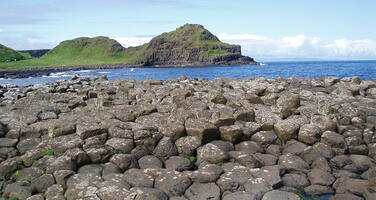
Giant's Causeway and Causeway Coast
Factors affecting the property in 2002*
- Commercial development
- Interpretative and visitation facilities
- Management systems/ management plan
Factors* affecting the property identified in previous reports
- Commercial development in the area surrounding the site
- Redevelopment of a complex for visitor facilities
- Need for an integrated management plan
International Assistance: requests for the property until 2002
Total amount approved : 0 USD
Missions to the property until 2002**
Information presented to the Bureau of the World Heritage Committee in 2002
Previous deliberations:
25th session of the Committee – Chapter VIII.97 / Annex IX, page 123.
Main issues:
Piecemeal development adjacent to site; lack of buffer zone; visitor centre re-development; management plan preparation.
New information:
A detailed report on the site has been provided via letter and electronic mail from the Department for Culture, Media and Sports dated 11 February 2002. IUCN states that the report notes that the management plan for the Area of Outstanding Natural Beauty (AONB) which has the World Heritage site as its core, is now under preparation. An issues paper is being prepared for public consultation by March 2002, which will be followed by a draft plan in June 2002. A final version of the plan is then to be lodged with the Department of Environment of Northern Ireland (DOENI) in November 2002. DOENI intends to publish the agreed AONB management plan in January 2003. Through the United Kingdom Observer, DOENI undertakes to keep the Bureau informed on progress on the plan.
An advisory group has been established to oversee the preparation of the AONB management plan and representation on this group has been sought from IUCN and agreed from the State Party. The first working meeting of the advisory group is scheduled for15 February 2002.
The report notes the decision of Moyle District Council, taken 21 January 2002, to again consider selling its property within the World Heritage Site (the United Kingdom Observer in Helsinki had informed the Bureau that the Council had taken a decision on the 4th December 2001 not to sell those lands). Two parties who had previously submitted bids for the property (the National Trust and a private developer) have been asked to re-affirm their respective bids, and the Council was to make a decision on the matter on the 6 February 2002.
The property in question is 3.6 ha of land within the site that is owned by the Council and houses the current visitors centre and car park. The visitor centre was partly destroyed by fire in 2000. The National Trust, the owner of the rest of the World Heritage Site, leases part of the visitors centre from the Council. In early 2001 the Council had offered the site for development. The State Party report notes that a number of planning applications have recently been lodged relating to the area immediately adjacent to the World Heritage site. These applications will be determined under the Northern Ireland planning process.
DOENI reiterates its determination to protect the setting of this World Heritage site from inappropriate development. It notes that the main body of the WHS is a designated National Nature Reserve, which is not, itself, under threat. This National Nature Reserve is directly protected by separate Northern Ireland legislation (the Nature Conservation and Amenity Lands Order (Northern Ireland) 1985).
IUCN received some reports expressing concern with threats to the integrity of the site, and more specifically on the following issues:
- Ongoing piecemeal development/applications and poor controls on development;
- Absence of an integrated management plan;
- Lack of a statutory development plan which recognises the unique nature of the World Heritage site;
- Concern that the current planning system only considers each application on its own merit, but does not consider cumulative impacts.
One of these reports notes that the tenderer for the visitor centre is the same developer who is already undertaking development in the land adjacent to the site (conversion of a listed building to a public house), and has three other applications in train (Arts, Crafts and Cultural Centre; 60 room hotel and separate tea room).
IUCN has received reports, including the State Party letter of 11 February, that the decision to sell the land was again reversed by the Moyle District Council on 6 February 2002, and the Council intends to take the lead in redeveloping the visitor facilities.
The “Planning” issue of 15 February 2002 includes an article and editorial on the Giant’s Causeway site, which cover the concerns raised by the National Trust and the financial difficulties faced by the Moyle District Council in building a visitor’s centre. The Trust is lobbying the government to ensure all councils adopt management plans as supplementary planning guidance, that World Heritage status be recognised in planning policy, and for sites to be protected by buffer zones. The editorial questions the worth, authority and influence of World Heritage status and suggests it acts as a magnet for development.
Action Required
The Bureau reiterates its concerns with piecemeal development and the absence of a clear buffer zone with special planning provisions which would prevent such development taking place. There is potential for cumulative impacts which could cause irreversible damage to the setting and environmental context of the site. The Bureau notes that the State Party report in December mentioned that the DOENI “has commenced preparation of the Northern Area Plan which will provide the statutory planning framework for development in the area up to 2016. The plan will formulate local planning policies accordingly. As an interim measure, and in advance of the planned adoption of this plan in 2003, the current policy provides for a 4 kilometre radius around the World Heritage site within which all development proposals will be subject to particular scrutiny.” The Bureau expresses its concern that knowledge of the two planning processes underway may be intensifying development proposals around the site, and requests information from the State Party as to whether the AONB and normal planning processes provide sufficient protection of the area adjacent to the site. The Bureau encourages the State Party to delineate a buffer zone as part of the Northern Area Plan and AONB management plan processes. Finally, the Bureau urges the State Party to implement the 4 km special zone during the drafting period of the Northern Area Plan, and to consider a moratorium on commercial development until such time as both the AONB management plan and the Northern Area Plan are further progressed.
Summary of the interventions
Decisions adopted by the Committee in 2002
26 COM 21B.24
Giant’s Causeway and Causeway Coast (United Kingdom)
The World Heritage Committee,1. Notes the state of conservation report and the decision by the Bureau contained in document WHC-02/CONF.202/2, paragraphs XII. 36- 40;
2. Notes the new information that a mission has been invited to the site.
26 BUR XII.36-40
Giant’s Causeway and Causeway Coast (United Kingdom)
XII.36 A detailed report on the site has been provided via letter and electronic mail from the Department for Culture, Media and Sports dated 11 February 2002. IUCN stated that the report noted that the management plan for the Area of Outstanding Natural Beauty (AONB) which has the World Heritage site as its core, is now under preparation. An issue paper was prepared for public consultation by March 2002, which will be followed by a draft plan in June 2002. A final version of the plan is then to be lodged with the Department of Environment of Northern Ireland (DOENI) in November 2002. DOENI intends to publish the agreed AONB management plan in January 2003. Through the United Kingdom Observer, DOENI undertakes to keep the Bureau informed on progress on the plan.
XII.37 In early 2001, the Moyle Distric Council had offered the site for development. The State Party report noted that a number of planning applications had recently been lodged relating to the area immediately adjacent to the World Heritage site. These applications will be determined under the Northern Ireland planning process. IUCN received some reports expressing concern with threats to the integrity of the site, and more specifically on the following issues: ongoing piecemeal development/applications and poor control on development; absence of an integrated management plan; lack of a statutory development plan which recognises the unique nature of the World Heritage site; concern that the current planning system only considers each application on its own merit, but does not consider cumulative impacts.
XII.38 One of these reports noted that the bid for tender for the visitor centre is the same developer who is already undertaking development in the land adjacent to the site (conversion of a listed building to a public house), and has three other applications pending (Arts, Crafts and Cultural Centre; 60-room hotel and separate tea room). The Bureau noted that the State Party letter of 11 February stated that the decision to sell the land was again reversed by the Moyle District Council on 6 February 2002, and that the Council intended to take the lead in redeveloping the visitor facilities.
XII.39 The Bureau reiterated its concerns about piecemeal development and the absence of a clear buffer zone with special planning provisions that would prevent such development occurring. There is potential for cumulative impacts which could cause irreversible damage to the setting and environmental context of the site. The Bureau noted that the State Party report in December mentioned that the DOENI “has commenced preparation of the Northern Area Plan which will provide the statutory planning framework for development in the area up to 2016. The plan will formulate local planning policies accordingly. As an interim measure, and in advance of the planned adoption of this plan in 2003, the current policy provides for a 4-km radius around the World Heritage site within which all development proposals will be subject to particular scrutiny.”
XII.40 The Bureau expressed its concern that knowledge of the two planning processes underway may be intensifying development proposals around the site, and requested information from the State Party as to whether the AONB and normal planning processes provide sufficient protection of the area adjacent to the site. The Bureau encouraged the State Party to delineate a buffer zone as part of the Northern Area Plan and AONB management plan processes. Finally, the Bureau urged the State Party to implement the 4-km special zone during the drafting period of the Northern Area Plan, and to consider a moratorium on commercial development until such time as both the AONB management plan and the Northern Area Plan are further advanced".
The Committee is requested to note the decision by the Bureau (please refer to document WHC-02/CONF.202/2, paragraphs XII. 36- 40)
 United Kingdom of Great Britain and Northern Ireland
Documents examined by the Committee
26COM (2002)Exports
* :
The threats indicated are listed in alphabetical order; their order does not constitute a classification according to the importance of their impact on the property.
Furthermore, they are presented irrespective of the type of threat faced by the property, i.e. with specific and proven imminent danger (“ascertained danger”) or with threats which could have deleterious effects on the property’s Outstanding Universal Value (“potential danger”).
** : All mission reports are not always available electronically.

