Mount Kenya National Park/Natural Forest
Factors affecting the property in 2002*
- Avalanche/ landslide
- Fire (widlfires)
- Illegal activities
- Land conversion
- Legal framework
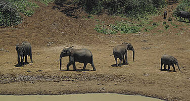
- Livestock farming / grazing of domesticated animals
- Management systems/ management plan
- Other Threats:
Uncontrolled forest land excisions, in the Mount Hombe and Ragat blocks
Factors* affecting the property identified in previous reports
- Illegal activities leading to serious destruction of canopy and a decrease of the overall forest area
- Livestock grazing in the site
- Fire
- Landslides
- Cannabis cultivation
- Lack of implementation of the Management Plan
International Assistance: requests for the property until 2002
Total amount approved : 25,000 USD
| 2000 | Management Planning Proposal for " Mount Kenya National ... (Approved) | 25,000 USD |
Missions to the property until 2002**
Conservation issues presented to the World Heritage Committee in 2002
In response to the Centre’s letter dated 20 December 2001 informing the State Party of the decision of the Committee to request a mission to enable an independent assessment of the state of the conservation of the World Heritage site, an e-mail response dated 22 April 2002 was received from the State Party agreeing to the mission and suggesting that it be undertaken during the second half of 2002.
The State Party has also completed and submitted to the Centre a comprehensive Management Plan for the site prepared under the support of an International Assistance amounting to US$25,000 approved under Technical Cooperation by the 24th ordinary session of the Bureau. The Plan is under review by the Centre.
IUCN reports that in November 2001, it was informed that the Government of Kenya had announced the authorization of de-gazetting of State forests amounting to more than 170,000 acres of its remaining forests. Forest cover is estimated at between 2 and 10% of Kenya’s land area, with closed forest (canopy covering at least 40 percent), calculated by UNEP using satellite imagery, amounting to 1.7%. The excisions were authorized for, amongst others sites, the Eastern Mau, Western Mau, Nakuru, Nabkoi, Mount Kenya, Marmanet, North Tinderet, Mount Londiani, South Nandi, Molo, and Kapsaret Forests.
UNEP informed IUCN that the forest excision planned for Mt. Kenya (the Sirimon excision) is outside but adjacent to the World Heritage site. The objective of the excision is to provide land for settlement.
The State Party report of 14 February 2002 provided an update on achievements in preparation of the Management Plan for the site:
· Modalities for management transition from the Forest Department to the Kenya Wildlife Service (KWS) is at an advanced stage;
· The first consultative workshop was held involving potential donors and organisations active in the Mount Kenya area in July 2001;
· In August and September 2001, Forest Stations, Forest Guard Posts, tourist facilities and KWS ranger posts were visited to collect information on their general state, equipment, personnel, the plantations, cultivation by non-residents of the area;
· These ground surveys were complemented by an aerial survey to check the preliminary boundaries, which were mapped against the background of a vegetation survey conducted by the Conservation of Indigenous Forest Programme (COMIFOR)in 1998 and compared with the map produced by the Kenya Indigenous Forests Conservation Programme in 1992;
· Community meetings in all five Districts of Mount Kenya were conducted with the assistance of the Kenya Forests Working Group. The aim was to solicit views and comments concerning past, present and future management of the National Reserve;
· District level meetings were held in November, and the final Draft Management Plan was submitted to the KWS in the first week of December 2001. This was then submitted to various stakeholders for review, and subsequently in January 2002, presented to a donor/partner forum;
· The final Management Plan was to be produced by the end of February 2002.
IUCN has been informed by UNEP that the Kenya Forest Working Group was requested by the KWS to co-ordinate a monitoring exercise to assess the impact of the new management practices put in place by the KWS since its take-over of responsibilities for the site in July 2000. UNEP also informs that, based on satellite images from February 2002, there appears to have been substantial regeneration of vegetation cover in large areas within the Mt Kenya National Park and National Reserve that were encroached upon up to 2000. The full UNEP report using sampled aerial survey, satellite images and ground surveys is anticipated to be complete in June or July 2002.
IUCN was provided with a report on the state of conservation of the site, in particular the actions undertaken since 2000 and the results achieved, from the Senior Warden of Mt Kenya National Park and National Reserve, and the Laikipia Research Programme.
The report notes that various enforcement measures have been implemented, including:
· On-going aerial monitoring to identify targeted areas by loggers and deploy enforcement teams on the ground;
· Approximately 1,000 cases of illegal extraction of forest resources have been prosecuted;
· KWS snaring patrols have removed several hundred snares since 2000;
· KWS is the first institution to address the illegal dumping of waste by the Meru County Council in the forest of Mt. Kenya;
· 35 additional rangers were deployed to Mt. Kenya in January 2002 to improve security and law enforcement.
With respect to community-oriented projects, it is reported that human-wildlife conflicts are being addressed by erecting electric fencing with support from the Billy Woodley Mount Kenya Trust. Community projects are also being undertaken as part of the UNDP/GEF/SGP Compact project (Mt. Kenya is one of six World Heritage sites selected under the Compact Programme for funding). Further, International Fund for Agricultural Development (IFAD) is launching a water catchment management pilot project on the south-east side of the mountain, and USAID is in the preliminary stage of planning a community development project. It is reported that the recently drafted Management Plan will redefine the World Heritage site boundaries according to various zones. The proposed IUCN mission (which is officially called for in the draft Management Plan) will be most useful if it can review the Plan on site. The report notes that the results of the above-outlined new practices include an increase in tourism revenues by 80% since 2000, and a reduction in forest encroachment from 20,265ha in 2000 to 7,941 hectares in 2002. The report also notes that as a result of improved forest plantation management by the Forest Department, the establishment of forest plantation in the Mt. Kenya National Reserve (outside the World Heritage site) increased from 539 hectares in the period 1995-2000 to 2,352 hectares in 2000-2002. KWS is undertaking a monitoring exercise to assess the effectiveness of its new management practices, through the commissioning of independent organizations, including the Kenya Forests Working Group (KFWG) and the Laikipia Research Programme.
Summary of the interventions
Decisions adopted by the Committee in 2002
26 COM 21B.14
Mount Kenya National Park/Natural Forest (Kenya)
The World Heritage Committee,
1. Commends the efforts of the State Party to address conservation problems at this site, particularly in relation to encroachment control and implementation of community projects;
2. Requests the State Party to provide for review by the Centre and IUCN: a final copy of the Kenya Forests Working Group (KFWG)/Laikipia et al. Report; a map of the proposed Sirimon Forest excision, clearly showing its relationship to the World Heritage site, as well as the location of the increase in plantation forest, and an update on the proposed excision including information on any Environmental Impact Assessment (EIA) undertaken for the excision and the consideration of the impacts on the World Heritage site, including measures to be employed to mitigate these impacts;
3. Welcomes the invitation from the State Party for a mission to the site in the second half of 2002.The Committee may wish to adopt the following decision:
"The Committee commends the efforts of the State Party to address conservation problems at this site, particularly in relation to control encroachment and implementation of community projects. The Committee further requests the State Party to provide for review by the Centre and IUCN: a final copy of the KFWG/Laikipia et al. report; a map of the proposed Sirimon Forest excision, clearly showing its relationship to the World Heritage site, as well as the location of the increase in plantation forest; and an update on the proposed excision including information on any EIA undertaken for the excision and the consideration of the impacts on the World Heritage site, including measures to be employed to mitigate these impacts. Further, the Committee welcomes the invitation from the State Party for a mission to the site in the second half of 2002."
 Kenya
Kenya
* :
The threats indicated are listed in alphabetical order; their order does not constitute a classification according to the importance of their impact on the property.
Furthermore, they are presented irrespective of the type of threat faced by the property, i.e. with specific and proven imminent danger (“ascertained danger”) or with threats which could have deleterious effects on the property’s Outstanding Universal Value (“potential danger”).
** : All mission reports are not always available electronically.

