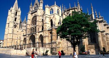
Routes of Santiago de Compostela: Camino Francés and Routes of Northern Spain
Factors affecting the property in 2004*
- Water infrastructure
International Assistance: requests for the property until 2004
Total amount approved : 0 USD
Missions to the property until 2004**
Conservation issues presented to the World Heritage Committee in 2004
The World Heritage Centre received information about the enlargement of the barrage of Yesa, which will flood a stretch of the World Heritage property. On 1 February 2004, the State Party submitted a report on the importance to supply irrigation water to the region, and remarks that permission has been given by the State Administration to relocate the affected protected buildings, which is allowed, according to article 18 of the Law on Spanish Historical Heritage, in cases of “major force or social interest”. The report also stressed that the current route is not the original one travelled by pilgrims, and that the World Heritage declaration “only affects landmarks, or locations on the route rather than a specific route in itself.”
This argument questions the original nomination. In the 1993 identification of the site, the whole length of the route, and a 30-metre strip on either side of the Route, is protected. Moreover, the nomination file not only includes an inventory of protected monuments along the Route, but also a list of areas of special natural value and villages of particular interest, such as Artieda.
ICOMOS stressed that a continuous linear cultural landscape from the Pyrenees to Santiago de Compostela was nominated by the Spanish Government and inscribed by the World Heritage Committee. This included both the “landmarks” referred to in the January 2004 document and clearly defined linking routes, the latter being defined on a series of maps, along with a buffer zone on either side. In the opinion of ICOMOS the State Party should reconsider its case. If it can cite overwhelming socio-economic reasons for the extension of the Yesa reservoir these should be advanced in a request to the World Heritage Committee for the removal of this stretch of the Route on these grounds alone. Should the Committee consent to this proposal, the suggested rerouted stretch should not be included within the World Heritage property.
Summary of the interventions
Decisions adopted by the Committee in 2004
28 COM 15B.79
The World Heritage Committee,
1. Acknowledges with appreciation the extensive information received from the State Party;
2. Recalls that in the nomination file, the World Heritage boundaries of the property are identified as the lands occupied by the Route itself and a stretch of 30 metres at each side, which is enlarged in towns and villages;
3. Further recalls that the nomination file included an inventory of protected monuments, areas of special natural value and villages, which will be flooded if the barrage is enlarged;
4. Takes note that the original enlargement of the barrage would have affected the authenticity of the World Heritage property, as it would physically destroy part of it as it was identified at the time of its inscription;
5. Also notes that provisions had been taken to preserve, by re-location, specific monuments listed in the inventory;
6. Further recalls Article 11 of the World Heritage Convention and paragraphs 81-82 of the Operational Guidelines (2002);
7. Congratulates the State Party for having reconsidered the enlargement of the barrage, reducing the flooded part of the route from 7,1 km to 3,4 km for the Southern part and from 2,3 km to 800m for the Northern part, as a result saving the main heritage elements associated with the route;
8. Requests a report on the situation, including a request for a change of boundaries, to be submitted to the World Heritage Centre by 1 February 2005 in order that the World Heritage Committee can examine the state of conservation of the property at its 29th session in 2005.
Draft Decision: 28 COM 15B.79
The World Heritage Committee,
1. Acknowledges with appreciation the extensive information received from the State Party;
2. Recalls that in the nomination file, the World Heritage boundaries of the property are identified as the lands occupied by the Route itself and a stretch of 30 metres at each side, which is enlarged in towns and villages;
3. Further recalls that the nomination file included an inventory of protected monuments, areas of special natural value and villages, such as Artieda, which will be flooded if the barrage is enlarged;
4. Expresses its concern about the way the enlargement of the barrage will affect the authenticity of the World Heritage property, as it would physically destroy part of it as it was identified at the time of its inscription;
5. Notes that provisions have been taken to preserve, by re-location, specific monuments listed in the inventory;
6. Further recalls Article 11 of the Convention and paragraphs 81-82 of the Operational Guidelines;
7. Urges the State Party to reconsider the enlargement of the barrage, and that if it decides that there are overwhelming socio-economic reasons for its enlargement, to submit a request for a change of boundaries to the Committee for removal of this stretch of the Route for this reason only and recalls that if the State Party decides to propose a change of the boundaries of the World Heritage property, an evaluation of the proposal has to be carried out;
8. Requests a report on the situation to be submitted to the World Heritage Centre by 1 February 2005 in order that the World Heritage Committee can examine the state of conservation of the property at its 29th session in 2005.
 Spain
Spain
* :
The threats indicated are listed in alphabetical order; their order does not constitute a classification according to the importance of their impact on the property.
Furthermore, they are presented irrespective of the type of threat faced by the property, i.e. with specific and proven imminent danger (“ascertained danger”) or with threats which could have deleterious effects on the property’s Outstanding Universal Value (“potential danger”).
** : All mission reports are not always available electronically.

